Short coastal hike to Hermigua
Map
Probably a long walk – but the small coastal hike from Agulo to Hermigua and back is part of the GR-132 hiking trail from Hermigua to Vallehermoso. Since the small tour takes you between the two places and over the romantic hamlet Lepe directly along the coast, the rough Atlantic is of course never far away.
coastal hike above the bay of Hermigua
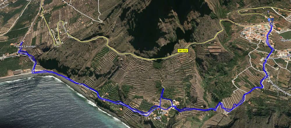
I already described most of the hike from Vallehermoso to Hermigua in other articles. On the picture you can see the other hikes that can be combined with this short coastal hike to Hermigua. One part is: La Gomera – round hike over Vallehermoso through the Tamargada gorge. Another part is: La Gomera – a varied circular walk in the north of the small Canary Island. And the third part is La Gomera – through the steep wall to Mirador Abrante. These three hikes can be wonderfully complemented and combined with today’s small tour. 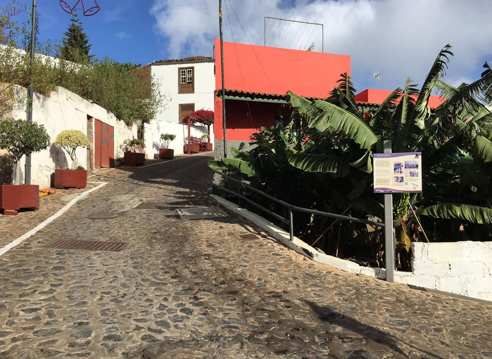
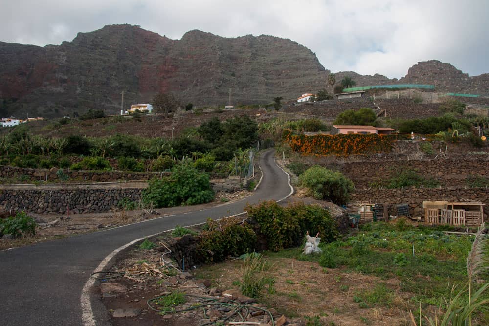
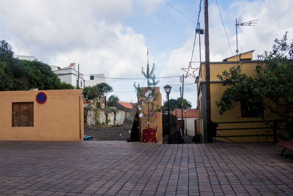
pretty alleys in the small village Agulo
Hermigua
The small municipality of Hermigua itself consists of several districts. In this area of La Gomera the native inhabitants of the Canary Islands (the Guanches) are said to have already been resident. Today the inhabitants of Hermigua live from tourism in addition to agriculture. Many people come for hiking and to visit the nearby Garajonay National Park. And with the Playa de La Caleta near Hermigua they find the only real beach in the north of the island.
wll postsigned hiking paths in Hermigua
Through the River Cedro, which carries water all year round, the area around Hermigua is one of the richest in water on the entire island of La Gomera. It is possible to intensively cultivate bananas and other fruits and agricultural products. During my last stay unfortunately also not very much water from above came to it J. Hermigua itself stretches as a place from the height up to the Atlantic Ocean. The landscape with the elevations around the place Hermigua and the Bosque del Cedro is wonderful and offers itself for hikes almost.
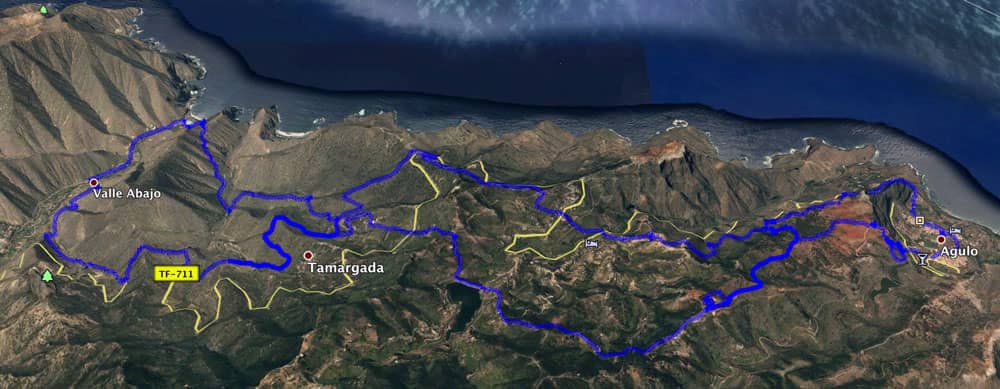
Track of the hike Agulo-Hermigua-Agulo
General information about the coastal hike from Agulo to Hermigua
Starting point and approach
Bus stop at the main road of Agulo GM 1 (TF-711)
Arrival by car
GM1 (TF-711) from Hermigua or Vallehermoso. There is ample parking at the roadside of Agulo.
Article summary and large selection of GPS hiking tracks
Sign up for my newsletter now and get exclusive access to my collected GPS tracks as well as all the brief information about my articles.
Sign up nowArrival by bus
In Agulo the line 2 stops, which runs between the small capital San Sebastian and Vallehermoso. More information about the bus lines on La Gomera can be found here. Time
I don’t like to give general time information for hiking tours, as the times are very individual. For this little walk I needed 1 hour and 45 minutes (return journey) (with a short stay in Hermigua).
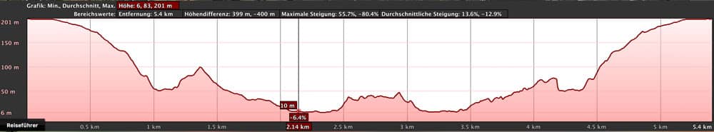
elevation profile hike Agulo - Hermigua - Agulo
Difference in altitude and distance
The difference in altitude is only 290 meters. The distance is approx. 5.5 kilometers long.
Requirement
A simple and easy coastal hike for everyone, which is actually more of a walk. Who is sporty on the way and would like more, that should connect it absolutely with the suggested other hiking routes.
Refreshment
There are restaurants, bars and shops in Agulo and Hermigua.
Track of the three hikes from Agulo, they can fine combined with this short track
Variants
This tour can be easily combined with various other walks and circular walks on the nearby GR-132 (see first paragraph above).
For those who only like a bigger coastal walk, the route is right. It is advisable to combine this tour with an extensive visit to Hermigua and/or Agulo. More information about tours around Agulo can be found here. 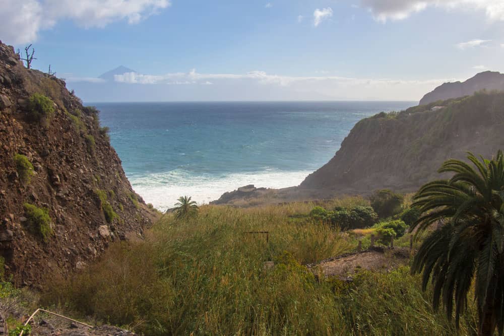
view over the Barranco of Tenerife
Coastal hike from Agulo to Hermigua
Article summary and large selection of GPS hiking tracks
Sign up for my newsletter now and get exclusive access to my collected GPS tracks as well as all the brief information about my articles.
Sign up nowSection Agulo to the end of Agulo
You start your hike in Agulo at the Carretera Central. Just opposite the bus stop at the end of the village towards Vallehermoso, before a left turn, a road leads you into the village. Continue straight ahead on Calle Alameda. This road leads straight into Calle Pintor Aguiar. This way you will get a small impression of the pretty little village Agulo. Nevertheless, it is a good idea to have a closer look around in the small alleys afterwards or before the hike.
hiking trail at the street to Agulo
When the Calle Pintor Aguiar forks, you turn right with the hiking trail GR-132 direction Hermigua. You are now on the Carretera el Transportador. After a short time you will come to a fork again. Calle el Transportador continues to the left. But you follow the path on a narrow road to the right. First you continue on a wide path that winds slightly downhill in some curves. Now you have left the last houses of Agulo behind you and walk between high stone walls and terraced fields.
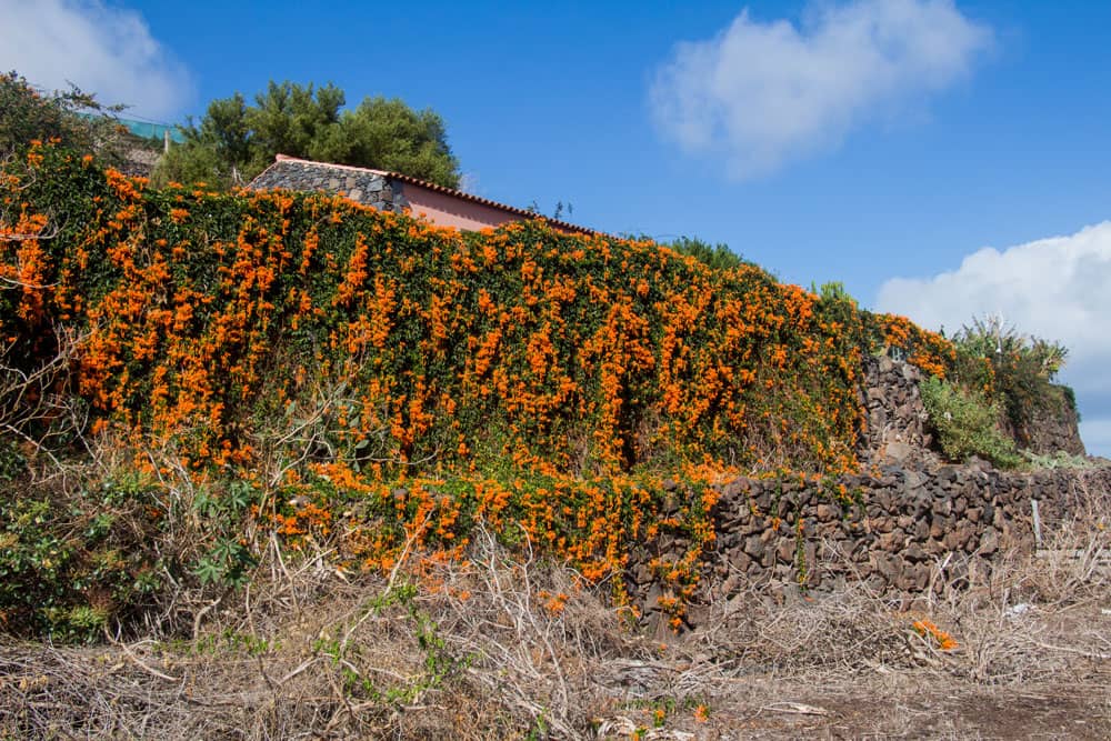
flowers at the hiking trail at the exit of Agulo
Section from the end of Agulo to the hamlet of Lepe
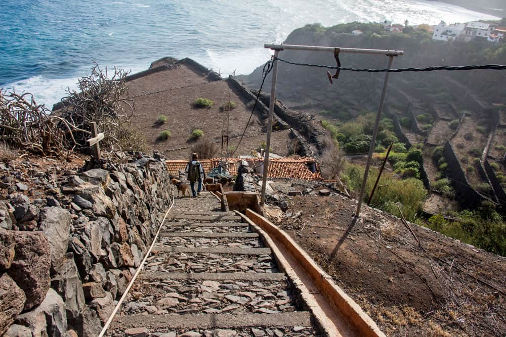
Suddenly the path changes into a short and very steep descent. On the steps with a view of the Atlantic in front of you, you walk steeply downhill between terraced fields. At this point the way back up is of course a bit strenuous. After the steep descent you stand on a terraced field. There a crossway leads you to the other side of the field. At the end you descend on narrow steps into the Barranco. There runs a small stream, which you cross on stones. You cross Barranco down there.
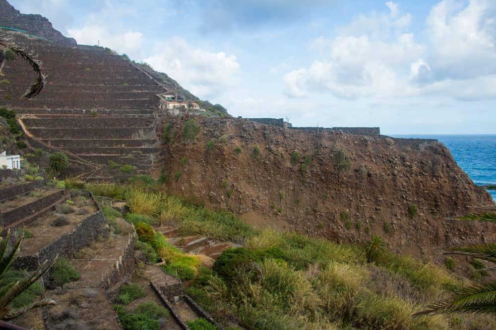
view from Lepe over the Barranco direction Agulo over the terrace fields
The narrow path now leads you straight along a wall towards Lepe. On steep steps you go up to the very quiet little hamlet. If you feel like it, you can look around a bit. As you can see on the track, I have also allowed myself a walk around the small village and a small ascent at the edge. I wanted to enjoy the view of the village and the wild Atlantic.
the little village Lepe between Hermigua and Agulo
Section Weiler Lepe to Hermigua
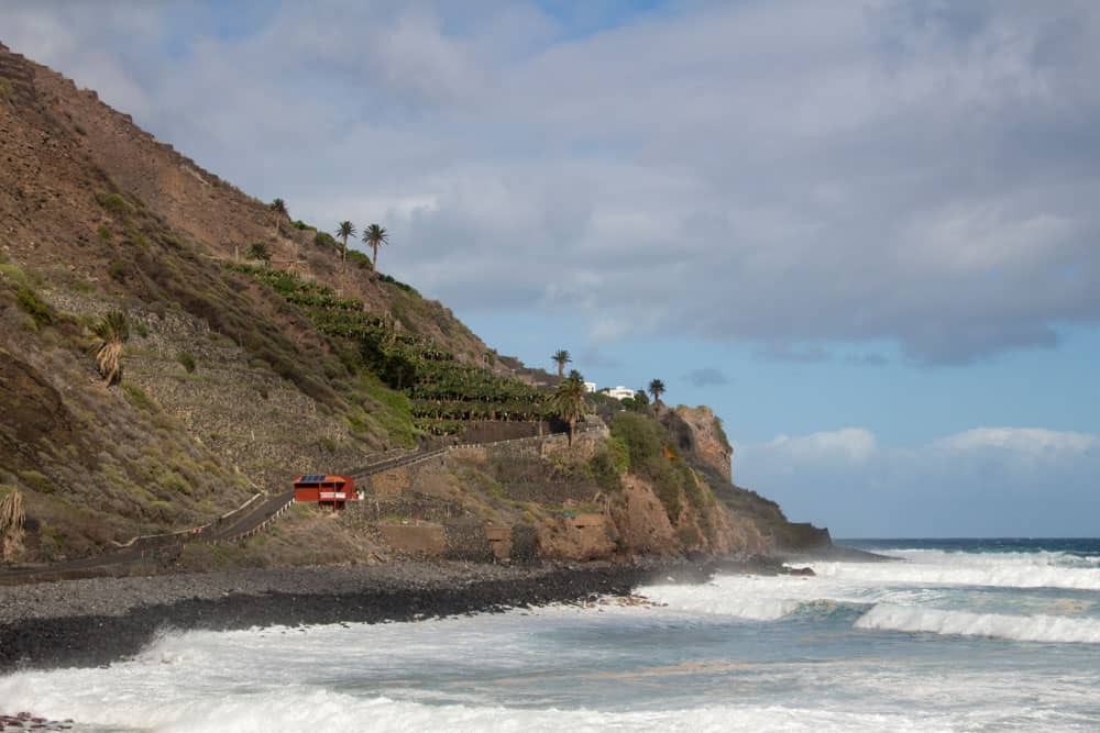
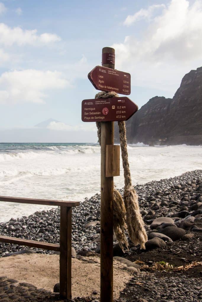
Already in Lepe you reach a small „main road“, which you follow further and further signposted with the GR-132 direction Hermigua. The road will take you parallel to the coast above. From here you can see the Atlantic Ocean with the neighbouring island of Tenerife and the Teide. On Calle Lepe, after a bend, you go down to Playa de Santa Catalina, the beach of Hermigua.
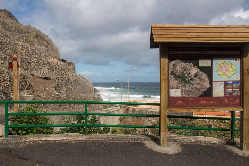
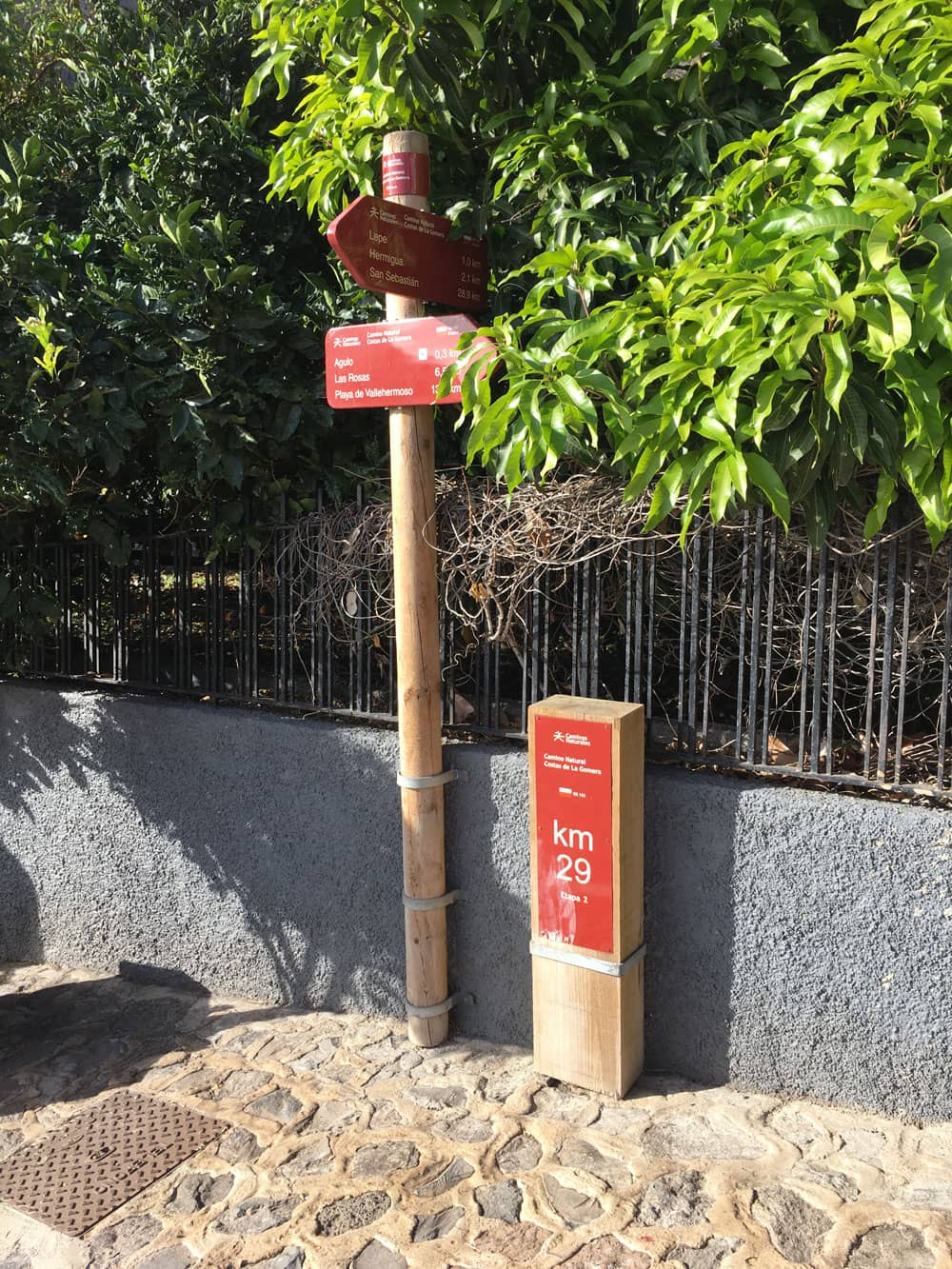
Information Board in Hermigua
Maybe you want to have a picnic on the beach or visit the local beach bar Piloto. If you want to go further, Calle de Lepe takes you straight inland to Hermigua. My track ends here a short time behind the beach because I wanted to go back and spend the rest of the time visiting Agulo. The way back, which leads mostly uphill, is of course a little more exhausting than the easy way back, which runs mainly downhill.
Hermigua beach
And finally
I hope you enjoyed this little hike. Even if it is quite small, it can be combined wonderfully with the other hiking tours in the vicinity. I wish you a lot of fun and joy while hiking,
Dagmar von SiebenInseln