In addition to this high-level hike on the small Canary Island of La Gomera, you will find several hiking suggestions in the Vallehermoso and Hermigua region on SevenIslands. This is because I spent a considerable amount of time there a few years ago and have hiked quite frequently. Furthermore, during my island circumnavigation on the long-distance trail GR-132 in December 2023, I hiked the section between Hermigua and Vallehermoso and presented it on SiebenInseln. Here, I am now describing a shorter but quite interesting and diverse high-level hike in the reverse direction from Vallehermoso to Hermigua.
Map
This hike is not only much shorter than the hike on the GR-132 long-distance trail but also has significantly fewer elevation meters. Therefore, it is suitable for people who want to shorten the long curved section on the GR-132 at this stage. However, even without this intention, the hike over the heights of La Gomera is simply diverse, offering many excellent viewpoints and becoming very adventurous due to the steep descent at the end.
General Information about the High-Level Hike Vallehermoso – Hermigua
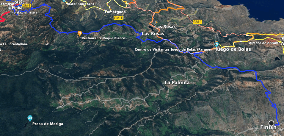
Track of the High-Level hike Vallehermoso - Hermigua (blue)
Starting Point and Access
The hike starts in the center of Vallehermoso on the GM-1 road at the roundabout on the central square in front of the large parking lot.
Access by Car
By car, you can drive to Vallehermoso on the island road GM-1. There, you simply head towards the town center and find a parking space for your vehicle either on the street or in front of the Supermercado.
Access by bus
Bus lines 2 and 4 stop in Vallehermoso. This hike is a „one-way hike.“ If you want to take the bus back to Vallehermoso from Hermigua or vice versa, you need to use bus line 2. For more information and exact timetables, visit Gomera bus.
Time
I prefer not to give general time estimates, as times are always individual. We took almost 6 hours for this hike with many breaks
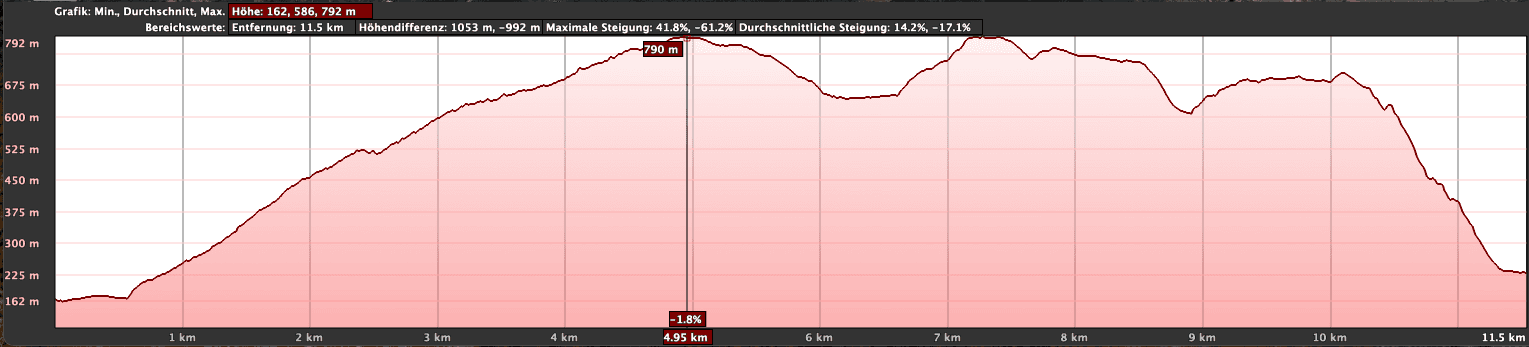
Profile of the High-Level hike Vallehermoso - Hermigua
Elevation Difference and Distance
The route is just under 14 kilometers long, and the elevation difference to overcome is 890 meters.
Requirements
Article summary and large selection of GPS hiking tracks
Sign up for my newsletter now and get exclusive access to my collected GPS tracks as well as all the brief information about my articles.
You hike the entire time on well-maintained trails. Only the descent to Hermigua is quite steep. Good footing and freedom from vertigo are necessary there. Due to the length of the tour and the elevation meters, good physical condition is a prerequisite.
Rest Stops
There are opportunities for refreshments at the beginning and end of the tour in Vallehermoso and Hermigua. In between, only the Juego de Bolas restaurant might be open. Therefore, be sure to bring enough water and, if necessary, provisions.
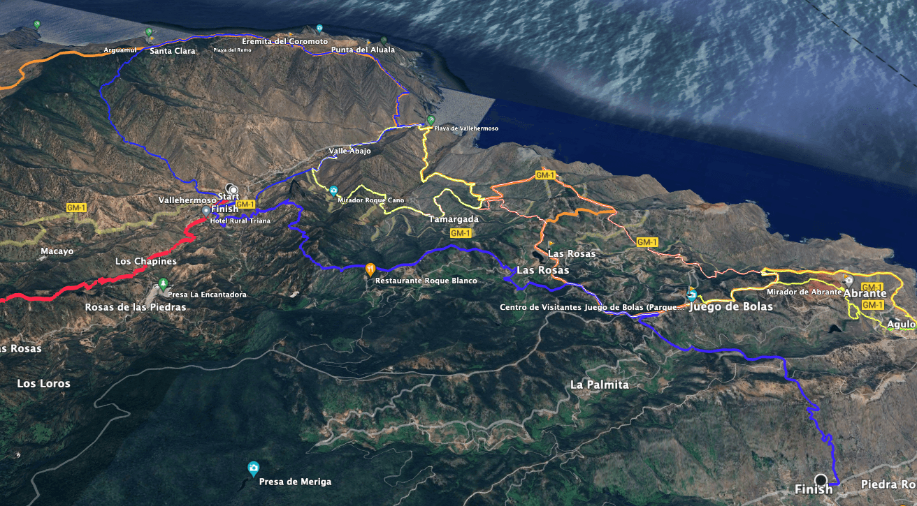
Track of the Vallehermoso - Hermigua High-Level hike (blue) and neighbouring hiking tracks
Variants
As it is a one-way hike, you can also walk it in both directions.
View from the High-Level Hike on Tenerife - GR 132 hiking trail, 2nd stage - Hermigua - Vallehermoso
High-Level Hike Vallehermoso – Hermigua
Section Vallehermoso to Roque Cano Ridge
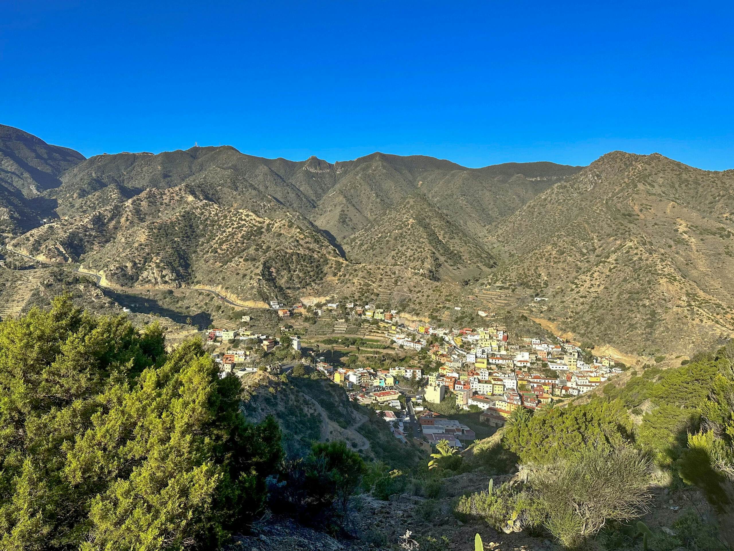
You start your high-level hike in Vallehermoso on the GM-1 at the roundabout in front of the central square. You walk along the GM-1 for about 50 meters and then turn right, crossing the small Barranco on the road. On the other side of the Barranco, a road winds up in switchbacks towards Roque Cano (Calle Amador). Here, you hike on stairs cutting across the road and then along the road itself.
Vallehermoso from the ascent path to Roque Cano
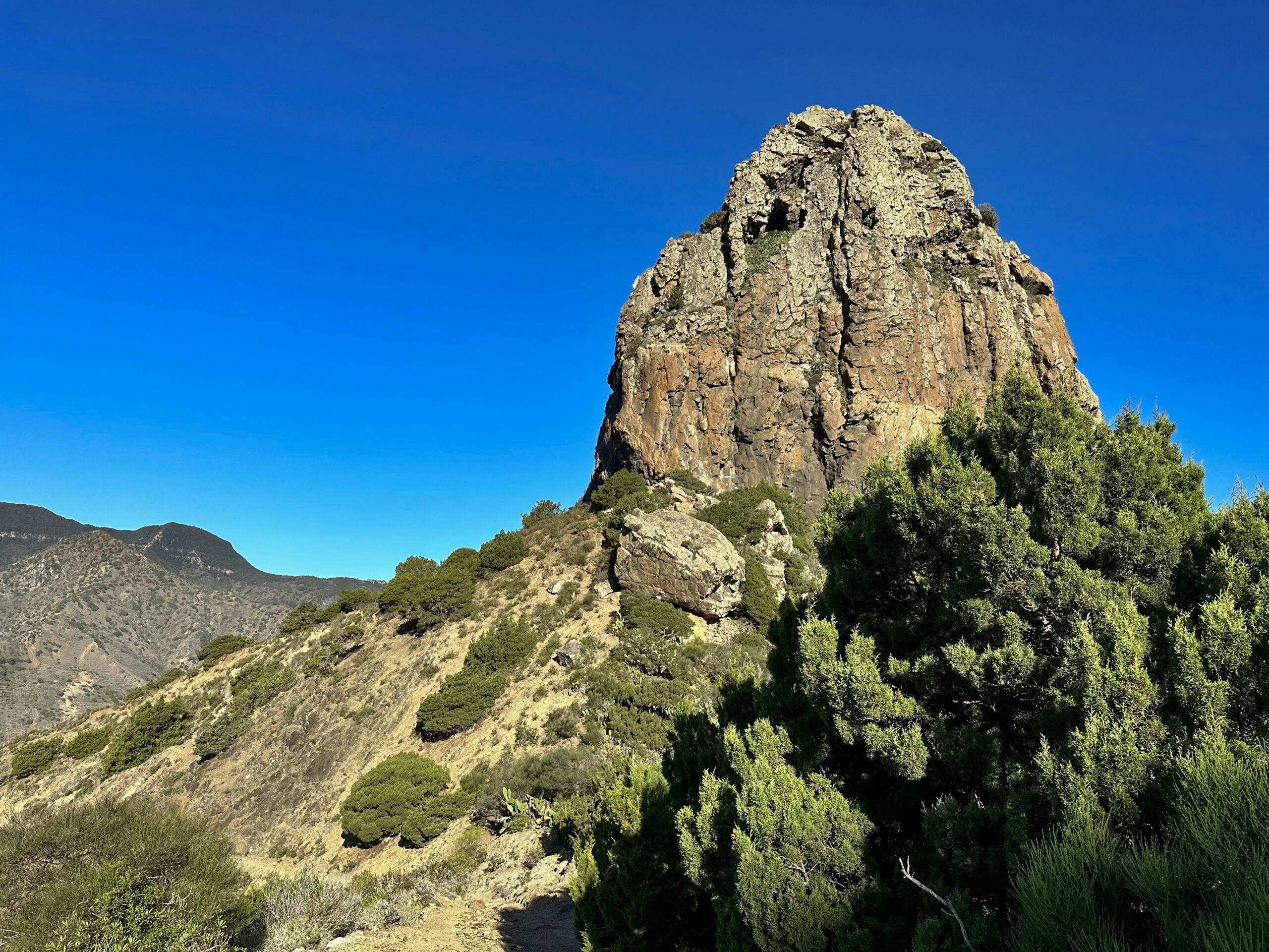
Finally, the hiking trail follows the right side of the road at the end. The well-maintained and partly paved path takes you steeply up the slope to a ridge. Once at the top, you have a great view of Vallehermoso behind you. In front of you lies the impressive Roque Cano. You walk directly to the base of the rock giant. From there, the hiking trail follows the ridge. On this high-level hiking trail, you can enjoy fantastic views in all directions.
Vallehermoso - Hermigua hiking trail along the Roque Cano
Section Roque Cano Ridge to End of Calle Teón
Slowly, the high-level hiking trail turns to the right side of the slope. From there, you hike through wooded areas on the next ridge. The trail continues uphill on the right side of this ridge. You hike through the forest mostly uphill and occasionally downhill for short stretches when crossing small cuts. Gradually, the trail ascends further along the slope and eventually reaches a ridge. From here, you can look down into the Tamargada Valley. But the long ascent continues. Now the trail turns to the left side of the slope.
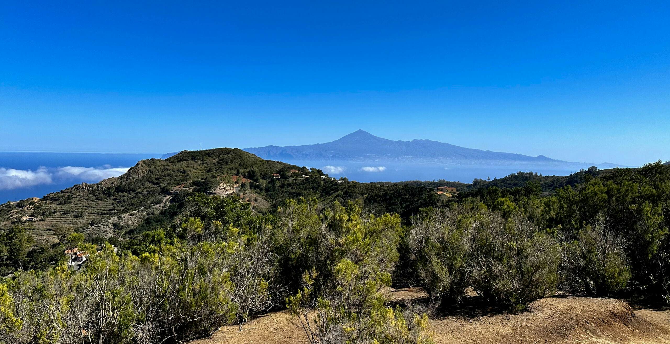
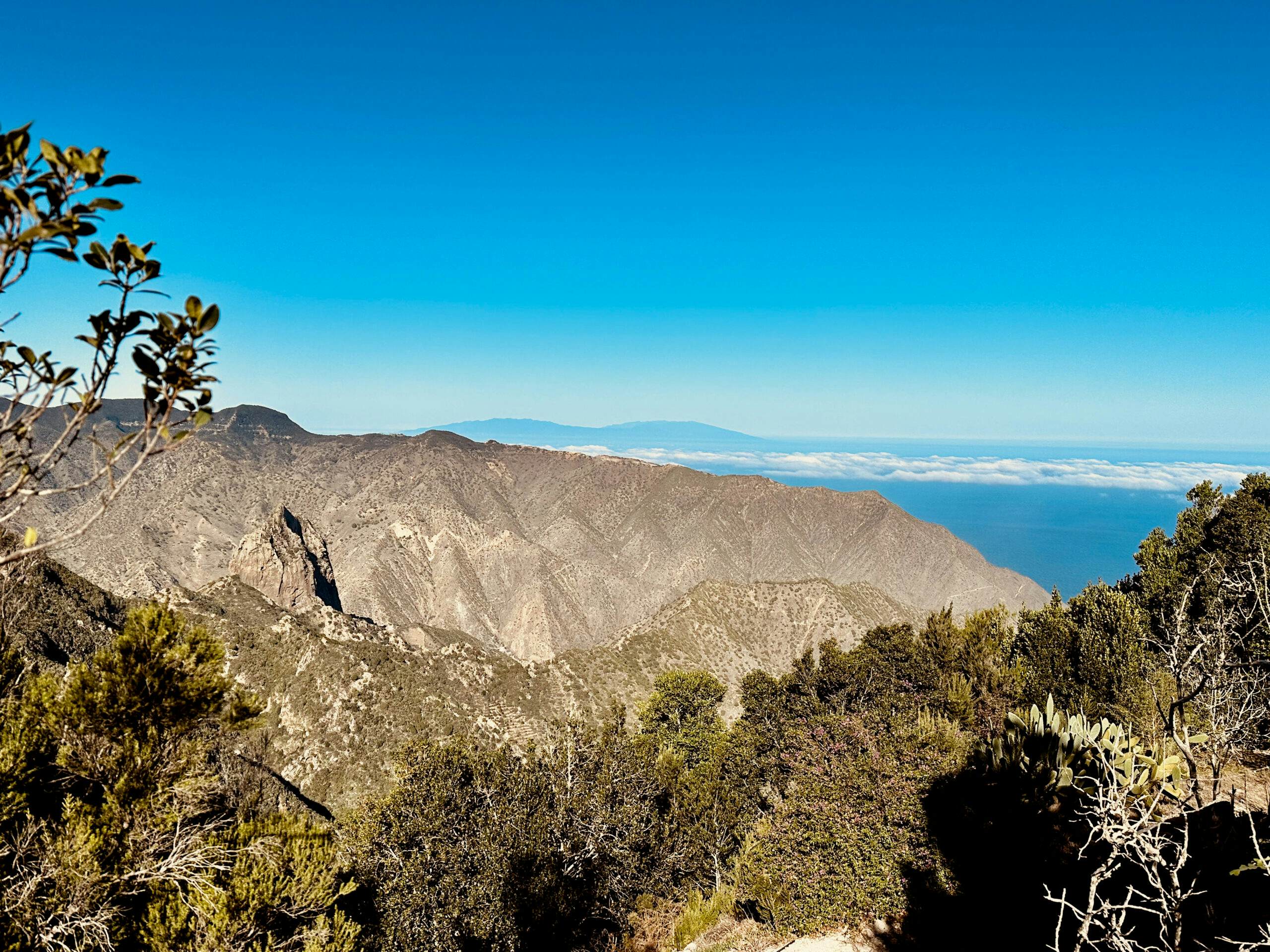
View back from the hiking trail to the neighbouring island of La Palma and Roque Cano
At the end of this ascent, you reach a ridge with a road (Calle de Teón). Follow this small road to the left and ignore all paths and lanes branching off to the right. You hike past isolated farms with magnificent views of the neighboring islands and Mount Teide. At the end of the ridge, the road turns to the right side of the slope. At the first sharp right turn, leave the road for a hiking trail straight ahead.
Article summary and large selection of GPS hiking tracks
Sign up for my newsletter now and get exclusive access to my collected GPS tracks as well as all the brief information about my articles.
Section End of Calle Teón to Carretera Laguna Grande
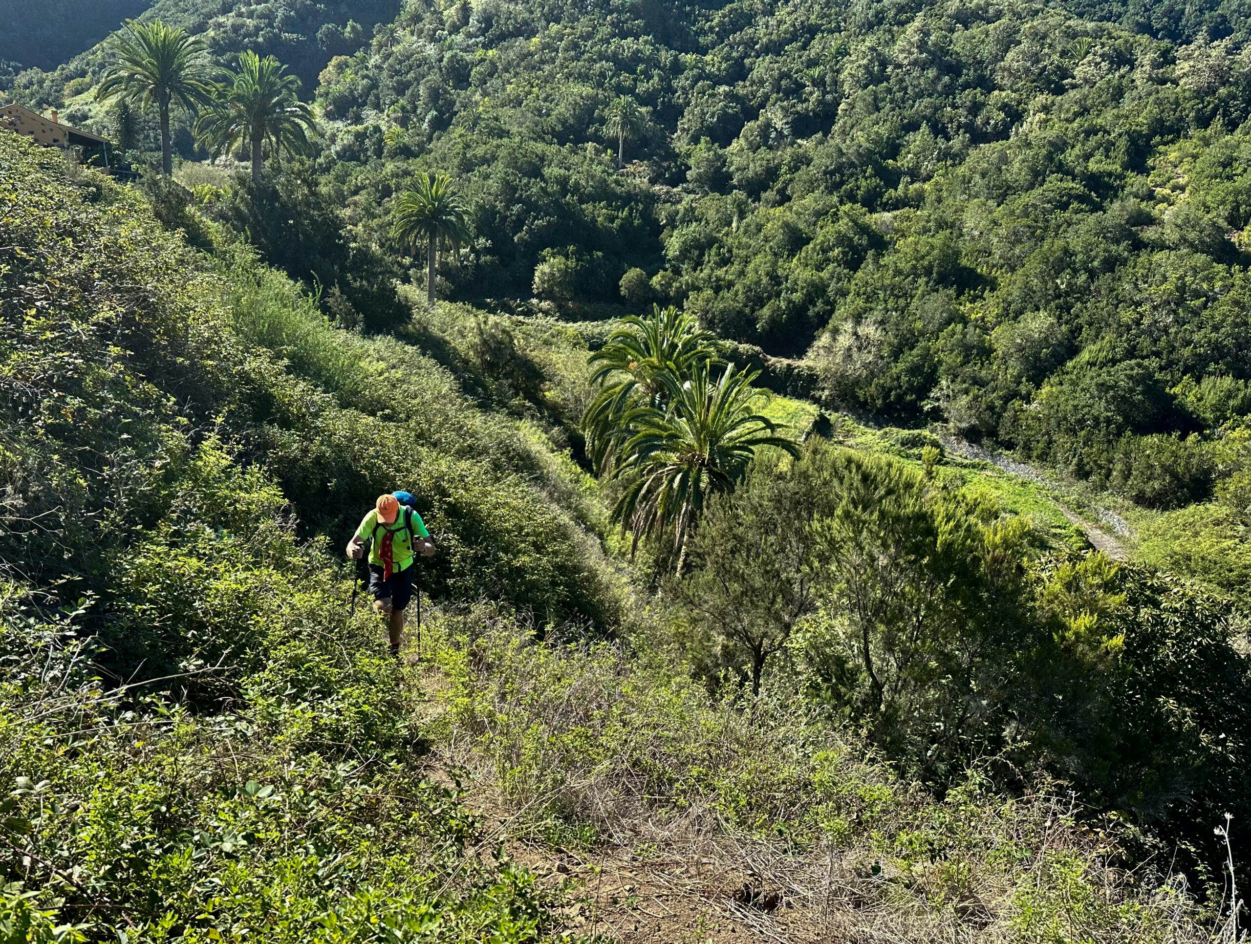
The hiking trail leads you slowly downhill on the side of the slope into a wide green valley near the Las Rosas reservoir in Barranco de Las Rosas. Eventually, you reach a road that you cut across multiple times on the hiking trail. Once at the bottom, the trail takes you around to the right side of Barranco de Las Rosas. You hike down into the valley on a dirt road. At the bottom, you cross the Barranco and hike steeply up on the right side to the road.
Hiker on the hiking trail from Vallehermoso to Hermigua near Las Rosas
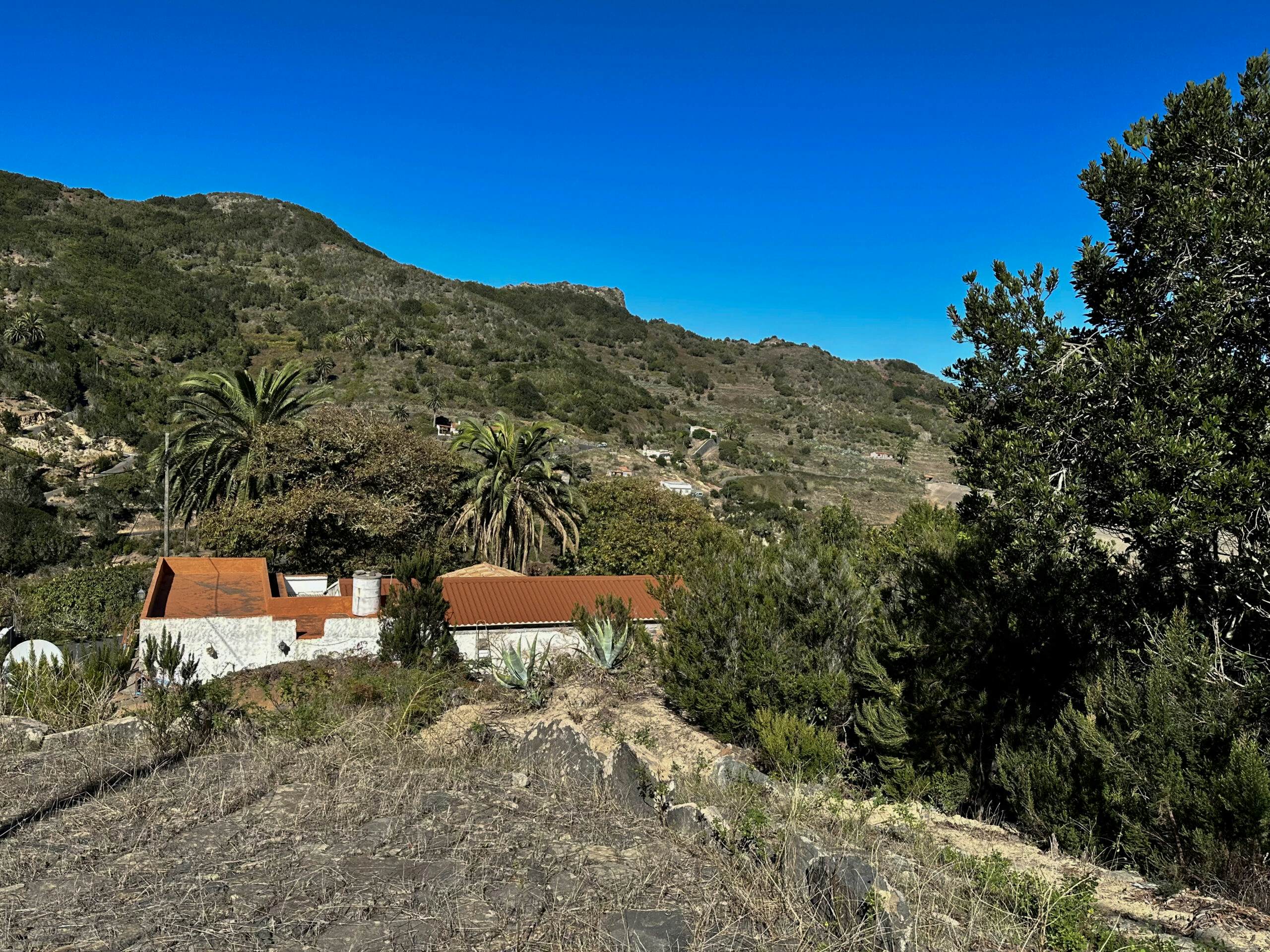
From the road, the hiking trail takes you steeply up into the forest, passing a farmhouse. Another ascent through the forest follows as you cross the slope to the left. Finally, you reach the main hiking trail, where the GR-132 from Hermigua to Vallehermoso also runs. Here, you also encounter the large circular hike from Pie de la Cuesta. Follow both hiking trails to the right, uphill to the ridge, and then downhill through a green valley and uphill again to Carretera Laguna Grande.
Hiking trail via Las Rosas from Vallehermoso to Hermigua
Section Carretera Laguna Grande to High-Level Hiking Trail above Hermigua
You walk left along Carretera Laguna Grande towards Centro de Visitantes Juego de Bolas. However, while the GR-132 and the other hiking trail continue straight ahead to Juego de Bolas, you leave the road to the right at the Juego de Bolas restaurant. Initially, follow the road below the restaurant for a while. Then, take a small hiking trail through bushes and fields downhill into the valley. At the bottom, you reach Calle las Eras, which you follow a little to the left.
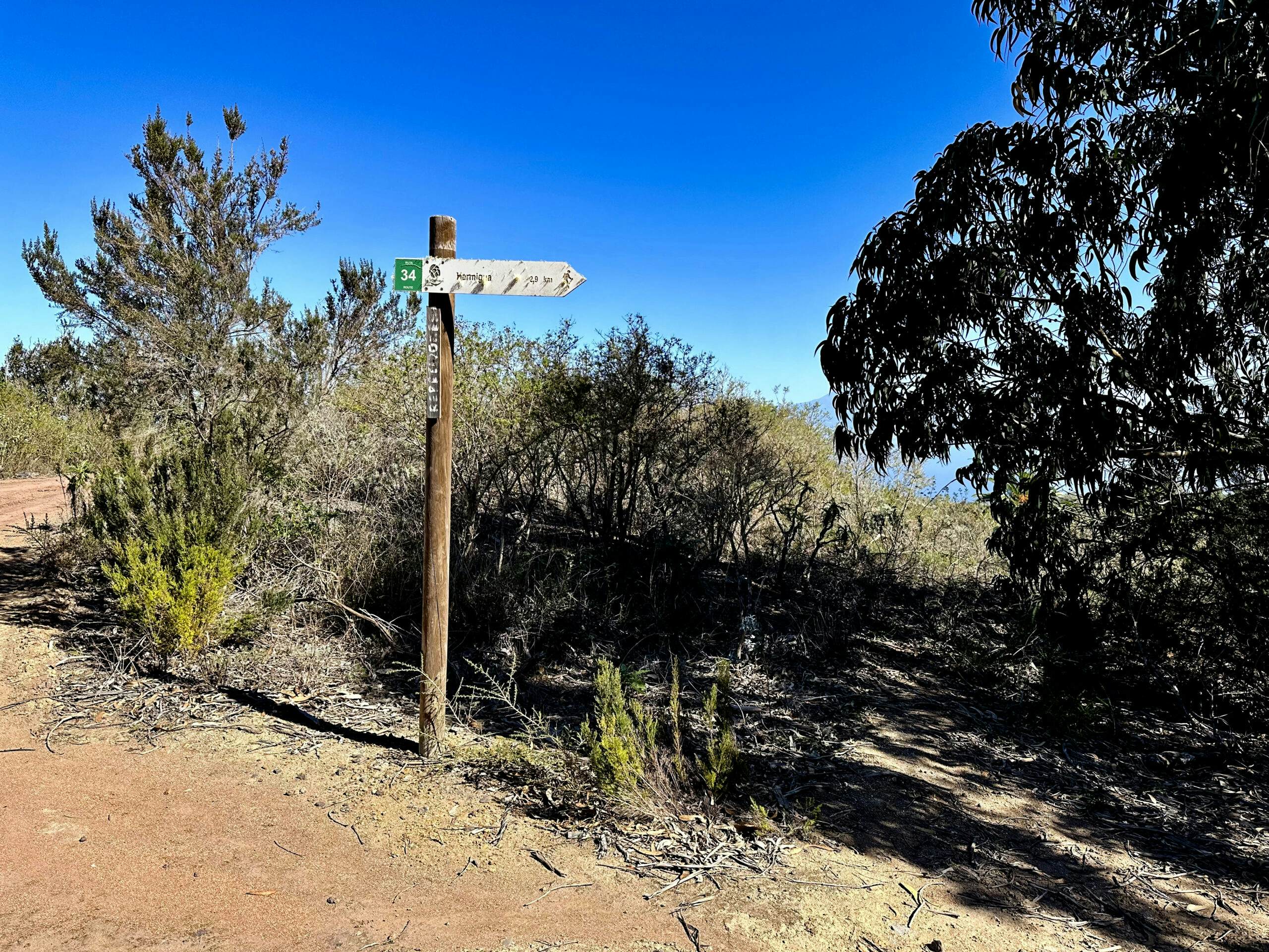
Hiking signposts on the high-altitude hiking trail towards Hermigua (Ruta 34)
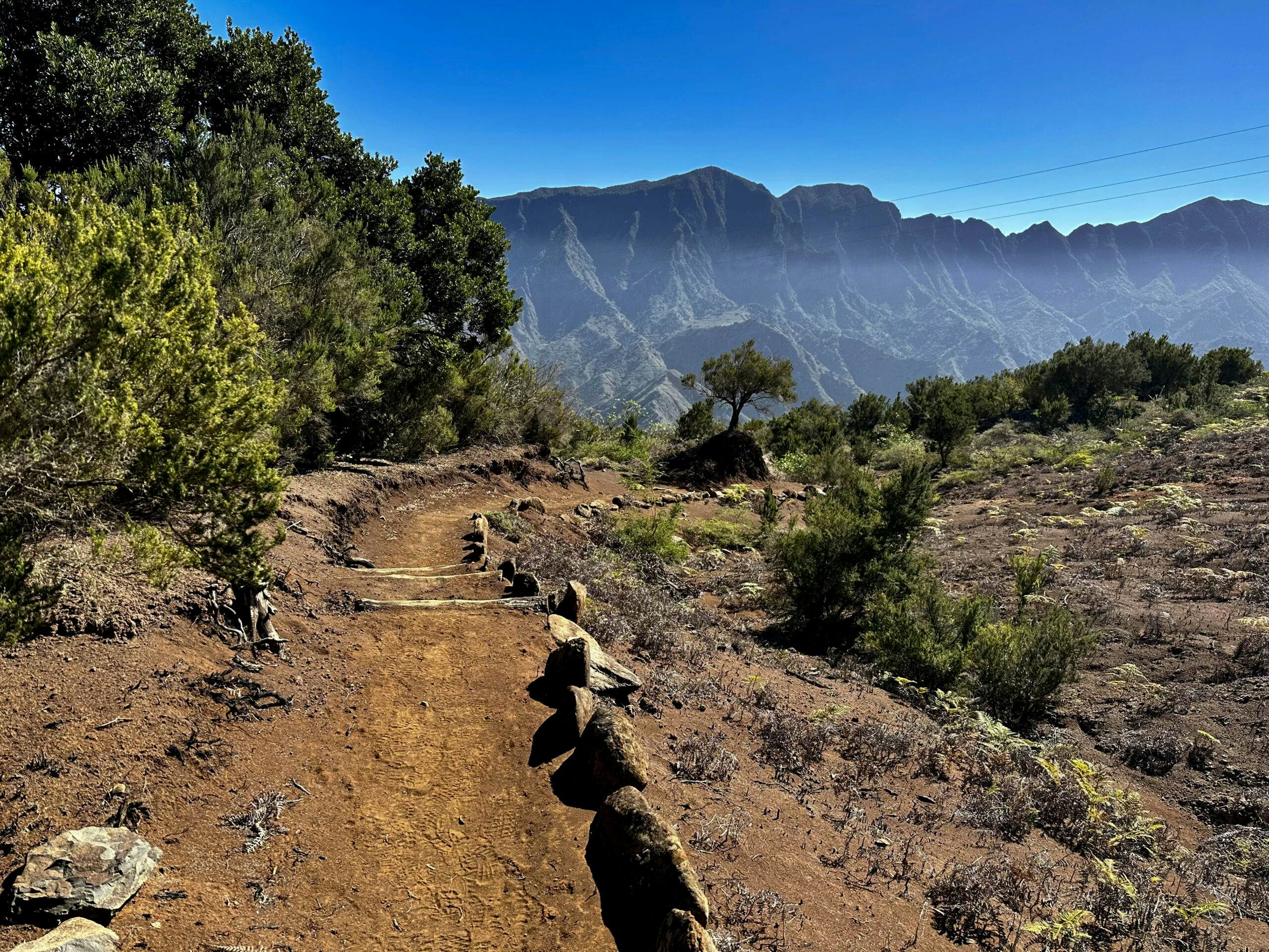
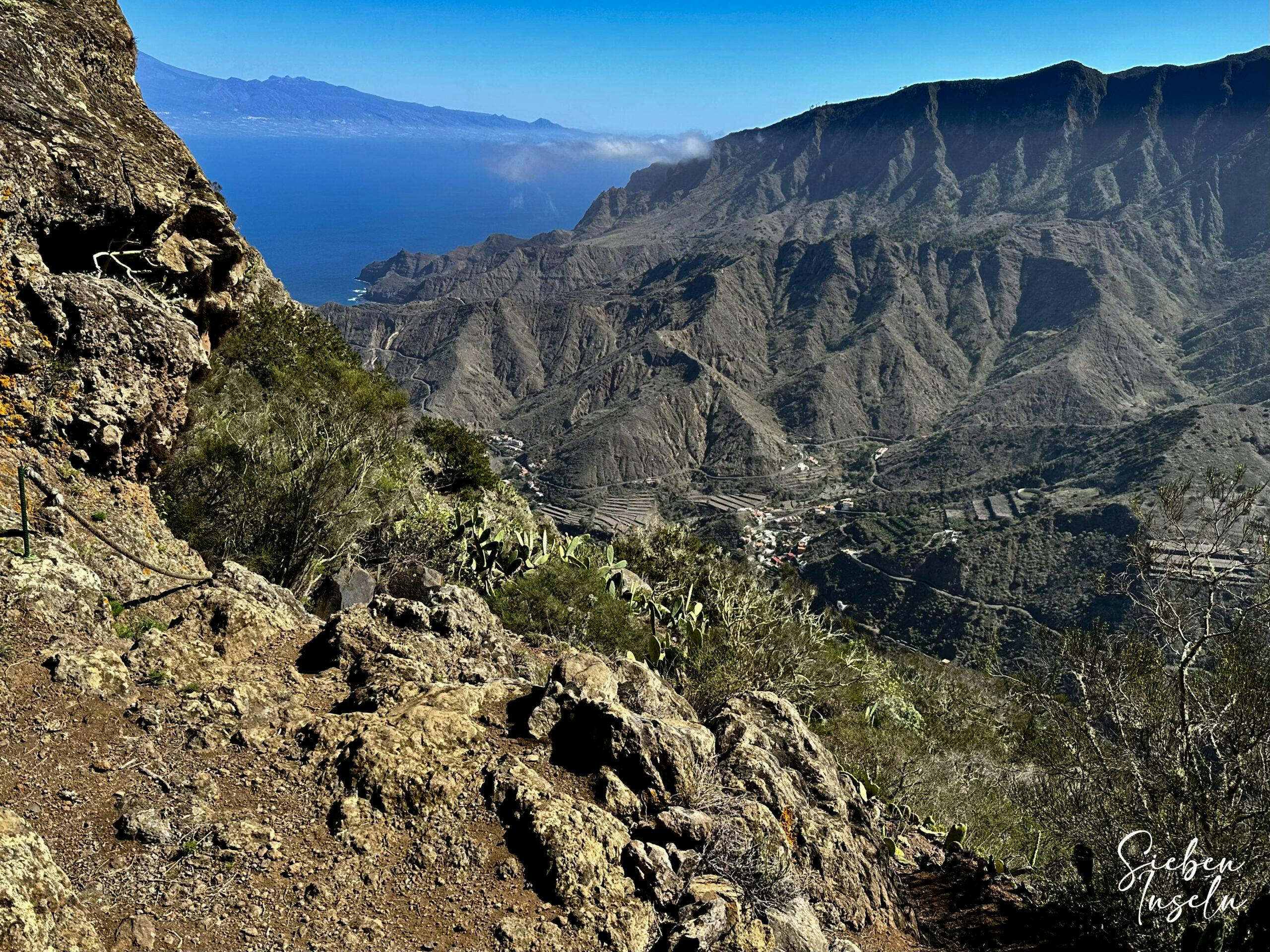
Shortly thereafter, the hiking trail goes uphill to the right, passing some farms into the forest. You hike along the slope in the forest for some time. On a ridge, you cross over to the next slope. Here, you continue uphill on the left side. At the top, you reach a ridge with a dirt road. Cross it and follow a small dirt road downhill. Once at the bottom, you climb up again to the next ridge. From this vantage point, you can enjoy magnificent views in all directions.
Hiking trail on the mountain high above Hermigua (High-Level hiking trail) close to the edge of the descent
Section High-Level Hiking Trail above Hermigua to Hermigua
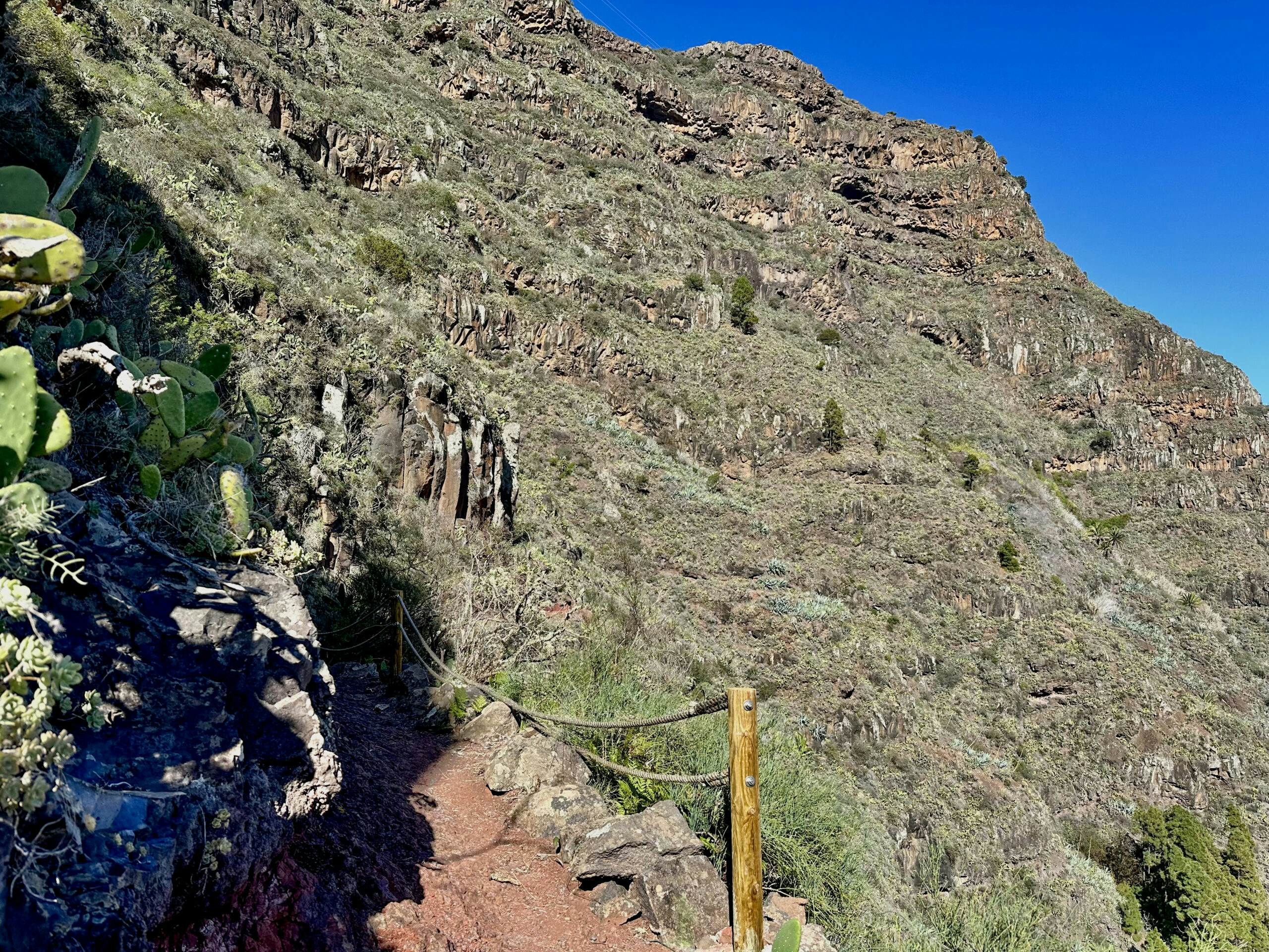
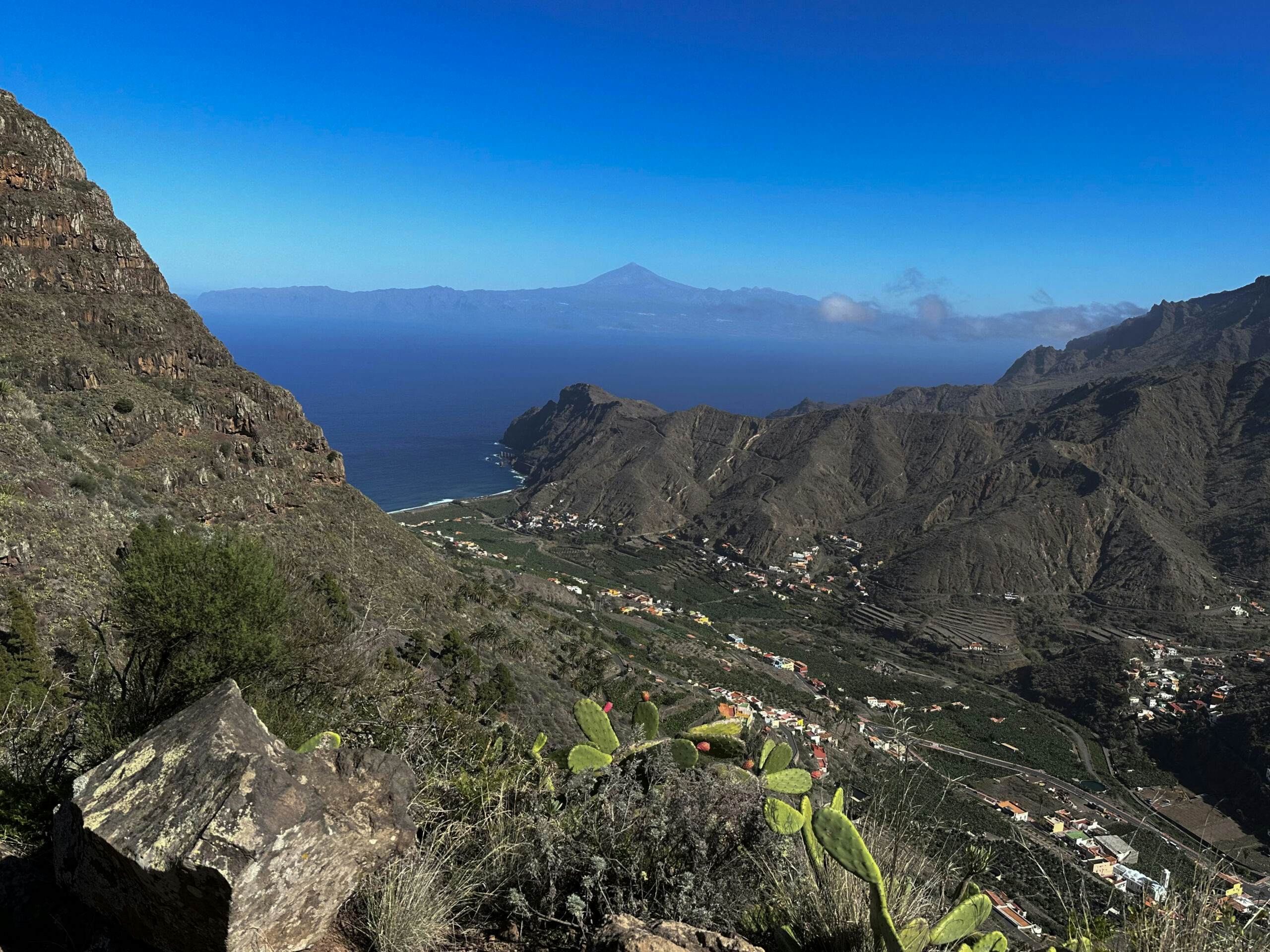
From up here, above Hermigua, it’s all downhill. But before the steep descent, you traverse a larger undulation. Suddenly, from the height, you can overlook the entire Hermigua Valley. You hike downhill on a good trail with splendid views. However, the trail is quite steep in parts. Here, you should be surefooted and free from vertigo.
Descent path to Hermigua
After this wonderful steep descent, you reach the middle of the Hermigua Valley at Calle El Tabaibal. I stopped my track shortly afterward. Now it depends on where exactly you want to go. To the main road GM-1, walk down via the streets Piedra Roman El Tababa and Calle del Portillo
View of Hermigua and Tenerife with Teide in the background from the descent path
And finally
I hope you enjoyed this beautiful high-level hike between Vallehermoso and Hermigua. It can be combined with many other hikes that you can find on SiebenInseln. Wherever you hike, I wish you wonderful and safe adventures.
Dagmar from SiebenInseln
Thank you for reading!
If you've found my hiking guides on SiebenInseln helpful for your Canary Islands adventures, please consider leaving a small tip. Your support is greatly appreciated and helps cover the costs of maintaining this blog.