Far distance Hiking Trail GR-132, Stage 2
On the small Canary Island of La Gomera, there are two long-distance hiking trails, GR-131 and GR-132. While GR-131 traverses the island’s heights, GR-132 follows the coastline, navigating the ups and downs along numerous ravines, more or less parallel to the coast. I previously described my hike on GR-131 from San Sebastián across the heights of La Gomera to Valle Gran Rey. During my initial attempt at circumnavigating the island, I walked counterclockwise and already covered Stage 8 from San Sebastian to Playa Santiago on SiebenInseln. Unfortunately, due to unforeseen circumstances, I had to abort the circumnavigation shortly after this stage in November 2023. Over Christmas 2023, I embarked on a new attempt with a friend. I documented the first stage from San Sebastian to Hermigua, and now we continue with GR-132, Stage 2. Map

GR 131 and GR 132, 2nd stage with start in Hermigua
Here are all the stages:
The Coastal Hiking Trail GR-132 consists of the following officially marked stages:
2.0 Hermigua – Vallehermoso – approx. 19 kilometers
3.0 Vallehermoso – Alojera
4.0 Alojera – Valle Gran Rey – combined approx. 22 kilometers (stages 4 and 5)
5.0 Valle Gran Rey – La Dama – approx. 18 kilometers
6.0 La Dama – Alajeró
7.0 Alajeró – Playa de Santiago – approx. 23 kilometers (stages 6 and 7)
Now, let me describe Stage 2 of GR-132, from Hermigua to Vallehermoso.
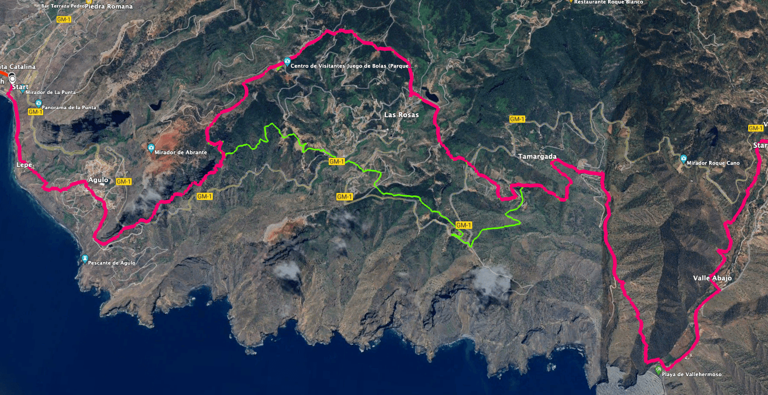
Track of the GR 132 hike, 2nd stage La Gomera - Hermigua - Vallehermoso
General Information about Hike GR 132, Stage 2 – Hermigua to Vallehermoso
Starting Point and Access
You begin your hike in Hermigua, Santa Catalina, on Calle Santa Catalina at a bend where Carretera de Lepe turns right.
Access by Car
Hermigua is accessible via the main island road GM-1. In Hermigua, you turn right from the lower part of the valley onto Carretera Playa. This road merges with Carretera Santa Catalina just before the starting point of the hike.
Access by Bus
Article summary and large selection of GPS hiking tracks
Sign up for my newsletter now and get exclusive access to my collected GPS tracks as well as all the brief information about my articles.
Sign up nowBus line 2 between San Sebastian and Vallehermoso stops in Hermigua. For detailed schedule information, please check here. Time
I hesitate to provide time estimates as they can vary significantly. For GR 132, Stage 2 from Hermigua to Vallehermoso, we took slightly over 7 hours, including long breaks and carrying heavy backpacks.
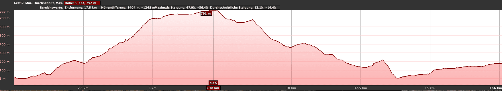
Elevation profile of the GR 132 hike, 2nd stage, La Gomera - Hermigua - Vallehermoso
Elevation Difference and Distance
The elevation difference is just over 1200 meters, and the trail is approximately 21 kilometers long.
Difficulty
The hike follows the well-marked Coastal Hiking Trail GR-132, Stage 2, so the trails are generally well-maintained. However, some sections require a head for heights and surefootedness. Excellent physical condition is essential for this lengthy stretch. Unfortunately, it had rained the night before our hike, making some downhill sections on wet stones a bit slippery. If possible, I strongly advise undertaking the hike only in dry weather.
Refreshment Stops
Refreshment options are available at the beginning and end of GR 132, Stage 2, in Hermigua and Vallehermoso. Along the way, you could also stop in Agulo or at Restaurante Juego de Bolas. Nevertheless, be sure to carry sufficient water and, if needed, snacks.
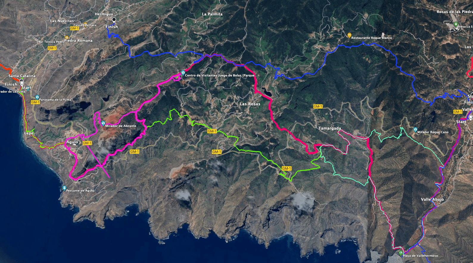
Track of the GR 132 hike, 2nd stage La Gomera - Hermigua - Vallehermoso (red) and neighbouring hiking tracks
Variants
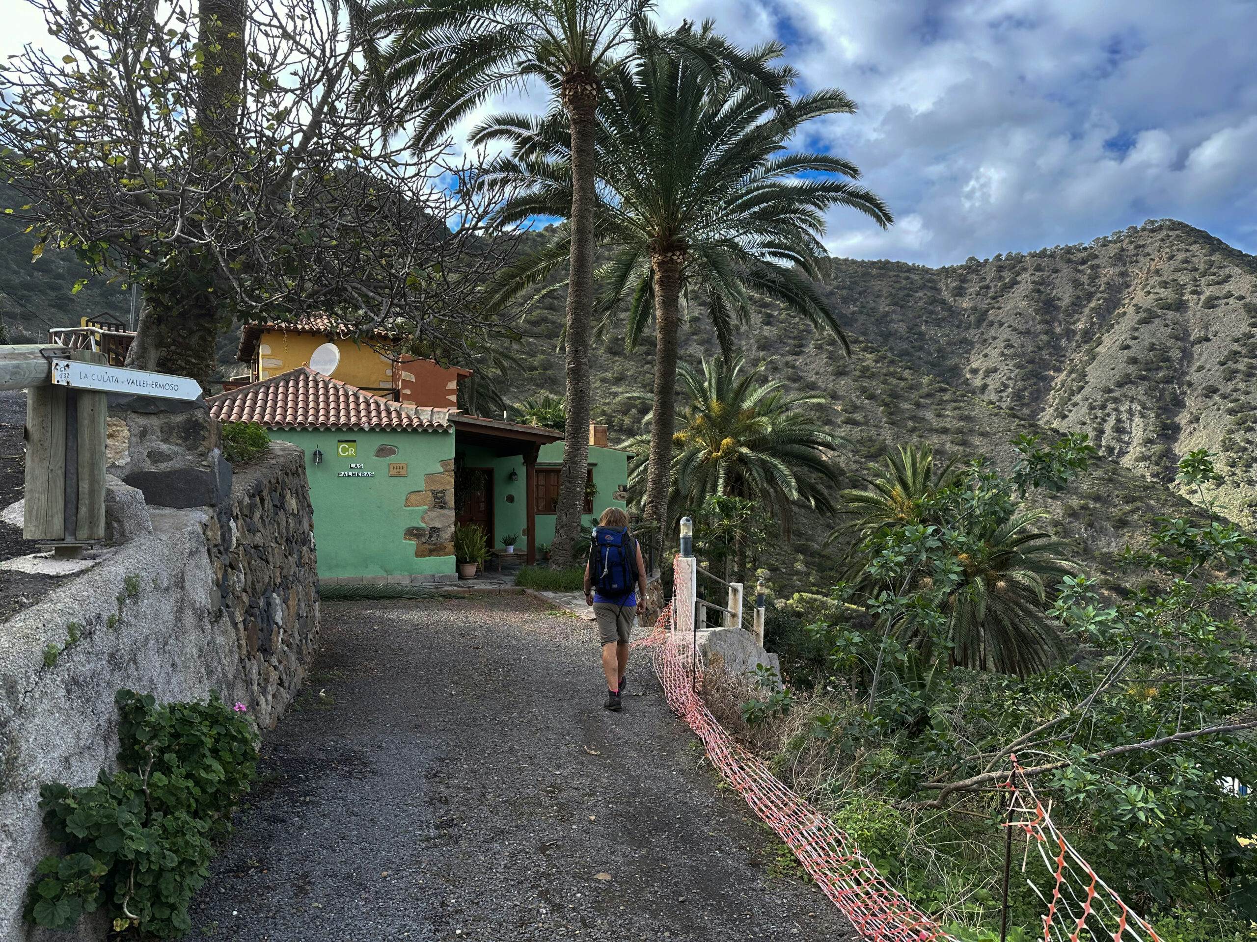
There are no variations if you strictly follow the Coastal Hiking Trail GR-132, Stage 2. However, if you prefer an alternative route, there is a much shorter and beautiful hiking option from Hermigua to Vallehermoso (see blue track on variations). Finally, between Hermigua and Vallehermoso, I’ve also described the extensive Tamargada Circuit, which shares parts with GR 132, Stage 2. However, it can be used to shorten the hike slightly by skipping the ascent to Centro de Visitantes and turning right onto a path directly to Mirador de La Punta Del Callao (see variations, green track). 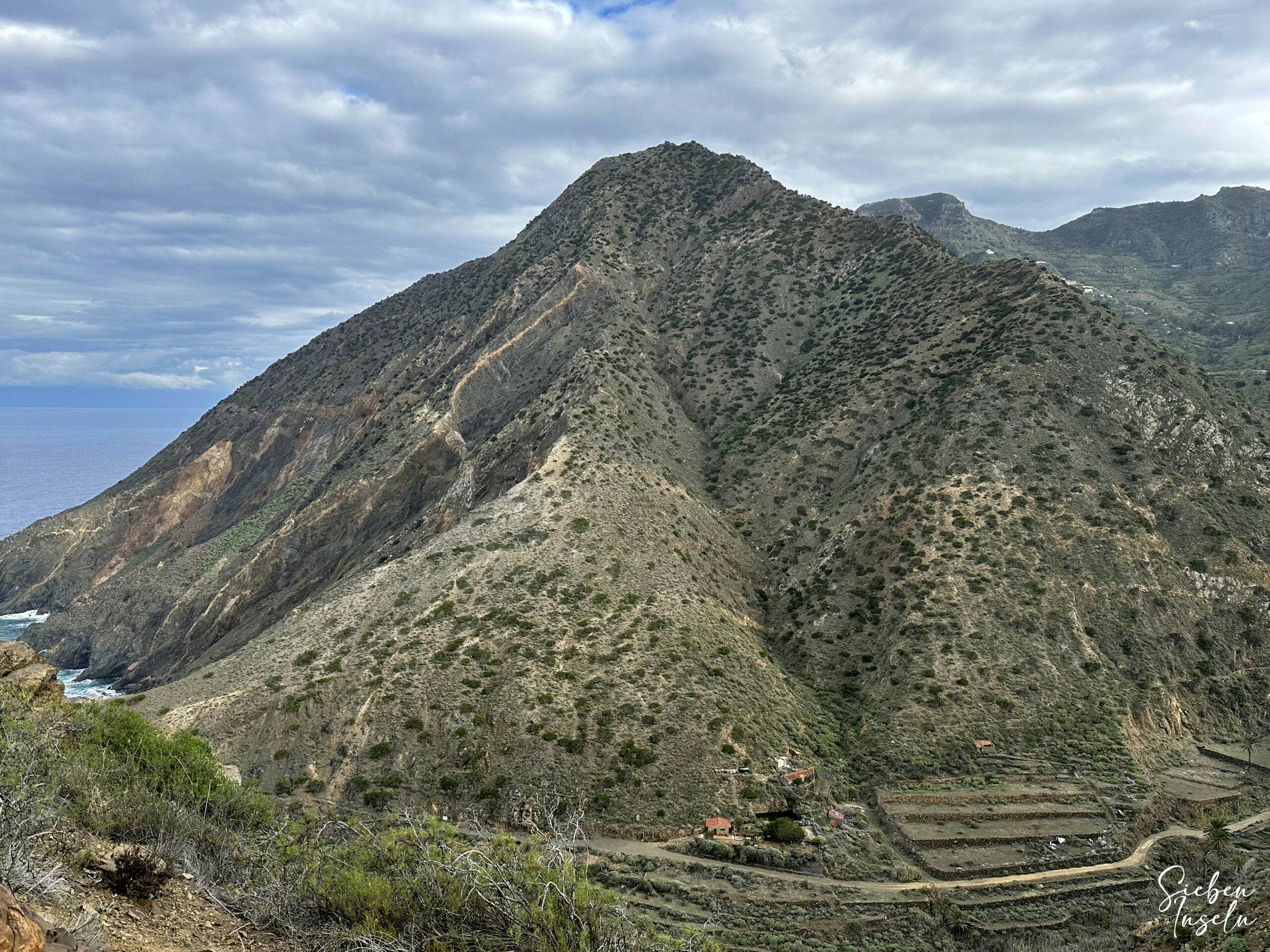
View from the coastal hiking trail before Playa Vallehermoso back to the hiking trail in the Barranco
From Playa de Vallehermoso, I’ve described the Great Circular Hike along the northwest cliff coast at Chijeré, which is also part of GR 132, Stage 3, 1st variation. 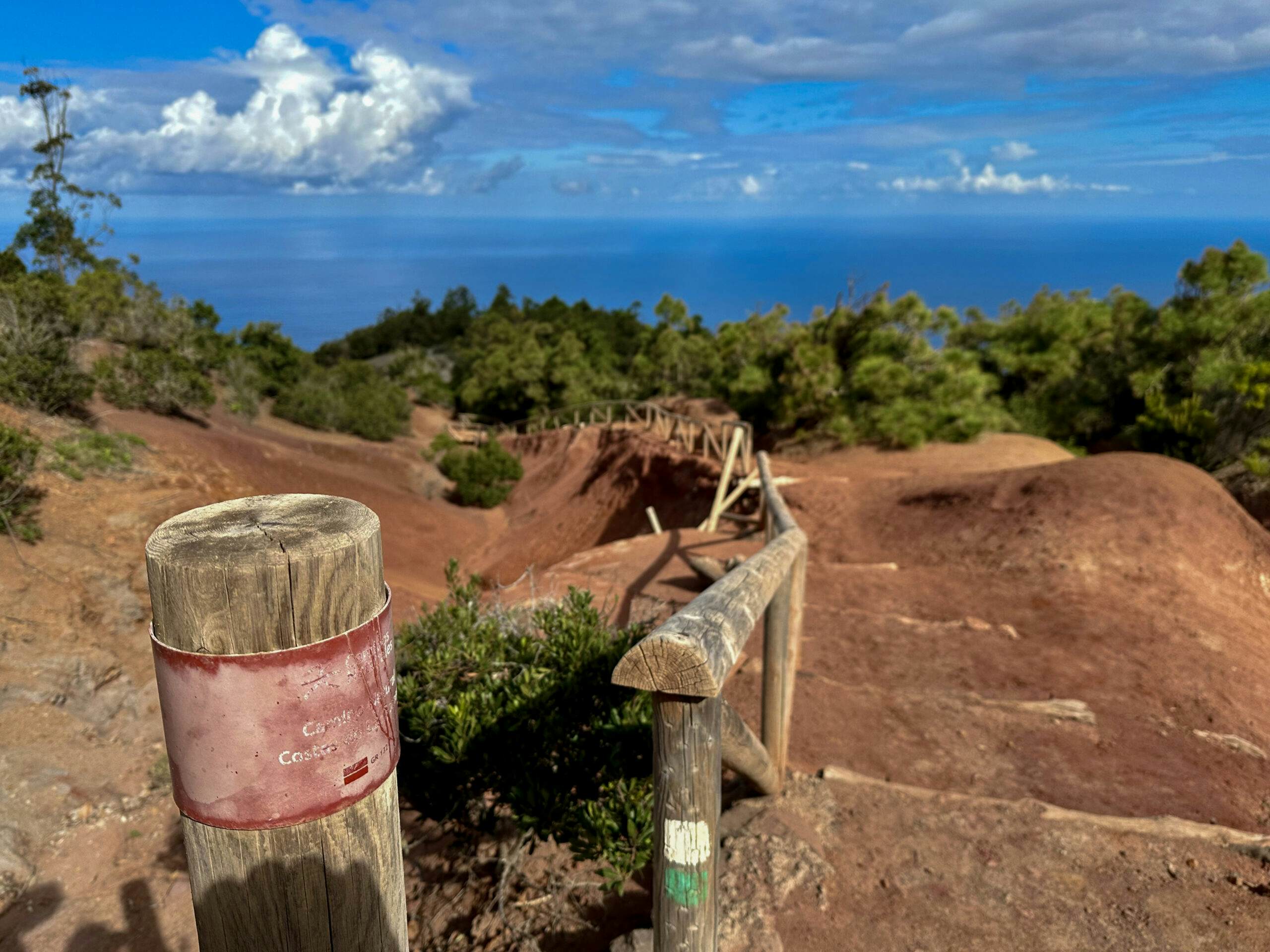
Hiking over eroded red sandy ground on the GR 132 marked in green and white, 2nd stage on the ridge near Mirador Juego de Bolas
Far distance Hike GR 132, Stage 2 – Hermigua to Vallehermoso
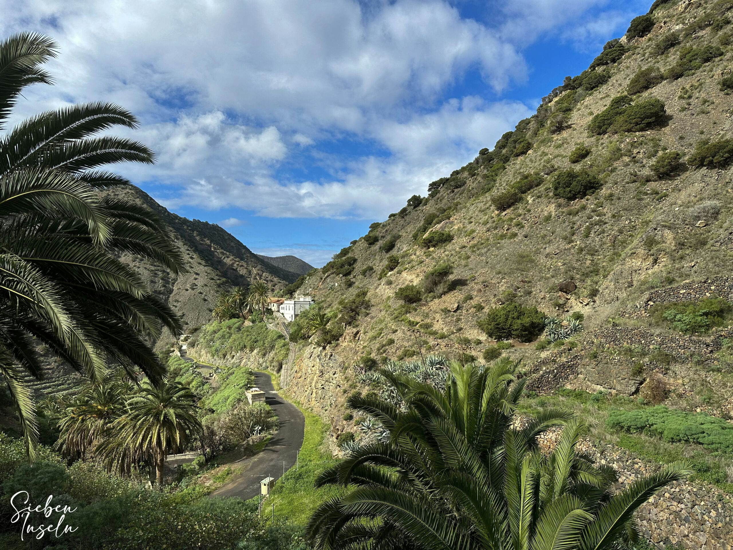
Trail Section Santa Catalina (Hermigua) to Agulo
You start your hike on GR 132, Stage 2 from Hermigua to Vallehermoso in Santa Catalina (Hermigua) on Calle Santa Catalina. Large trail signs are located there. Turn onto Carretera de Lepe and follow it uphill along the coast. I’ve described this initial trail section in the opposite direction in the Coastal Hike from Agulo to Hermigua, so I’ll keep it shorter here. Walk along the quiet coastal road to the village of Lepe. Article summary and large selection of GPS hiking tracks
Sign up for my newsletter now and get exclusive access to my collected GPS tracks as well as all the brief information about my articles.
Sign up now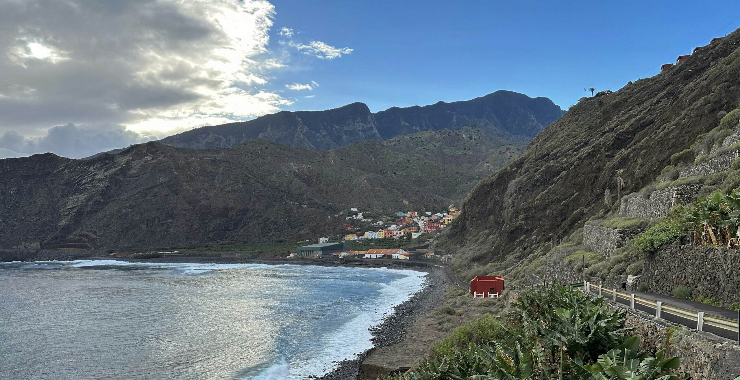
GR 132 hiking trail, 2nd stage behind Santa Catalina Hermigua in the direction of Lepe
In Lepe, leave the road and descend a bit to terraced fields. Cross these fields and then ascend on a partially paved path on the other side, heading steeply uphill towards Agulo. Continue on small roads, well signposted towards the center of Agulo. Ahead, you’ll see Mirador Abrante atop the steep slope. Walk through the center of Agulo on Calle Pedro Bethencourt, which you can explore at this point. 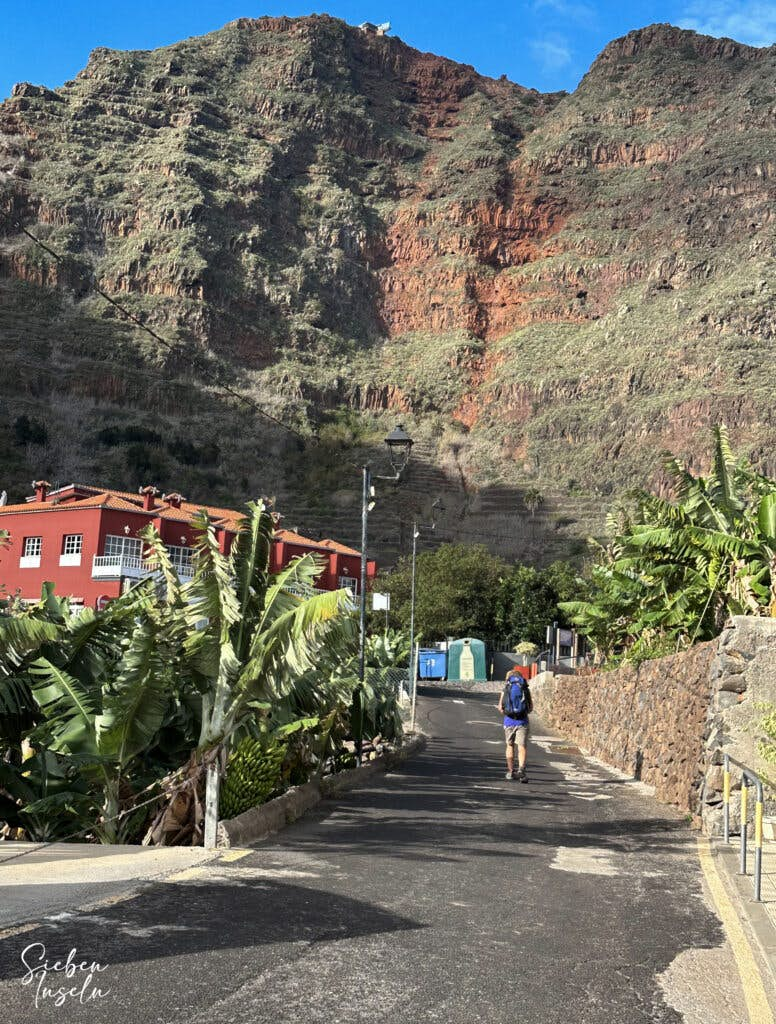
Hiker on the hiking trail in Agulo below the Mirador Abrante
Trail Section Agulo to Junction behind Restaurante Juego de Bolas
At the end of Agulo’s center, turn right into Calle Calvario and follow it for a while out of the village. Shortly after the cemetery, the hiking trail branches off to the left from the road. It leads you along the hillside above island road GM-1 for a long time. You’ll circumnavigate a ridge and continue ascending for a considerable time, offering splendid views of the surrounding heights and valleys. Just before the path turns sharply left through the forest, the trail to the right, which I described in the Tamargada Circuit, branches off. 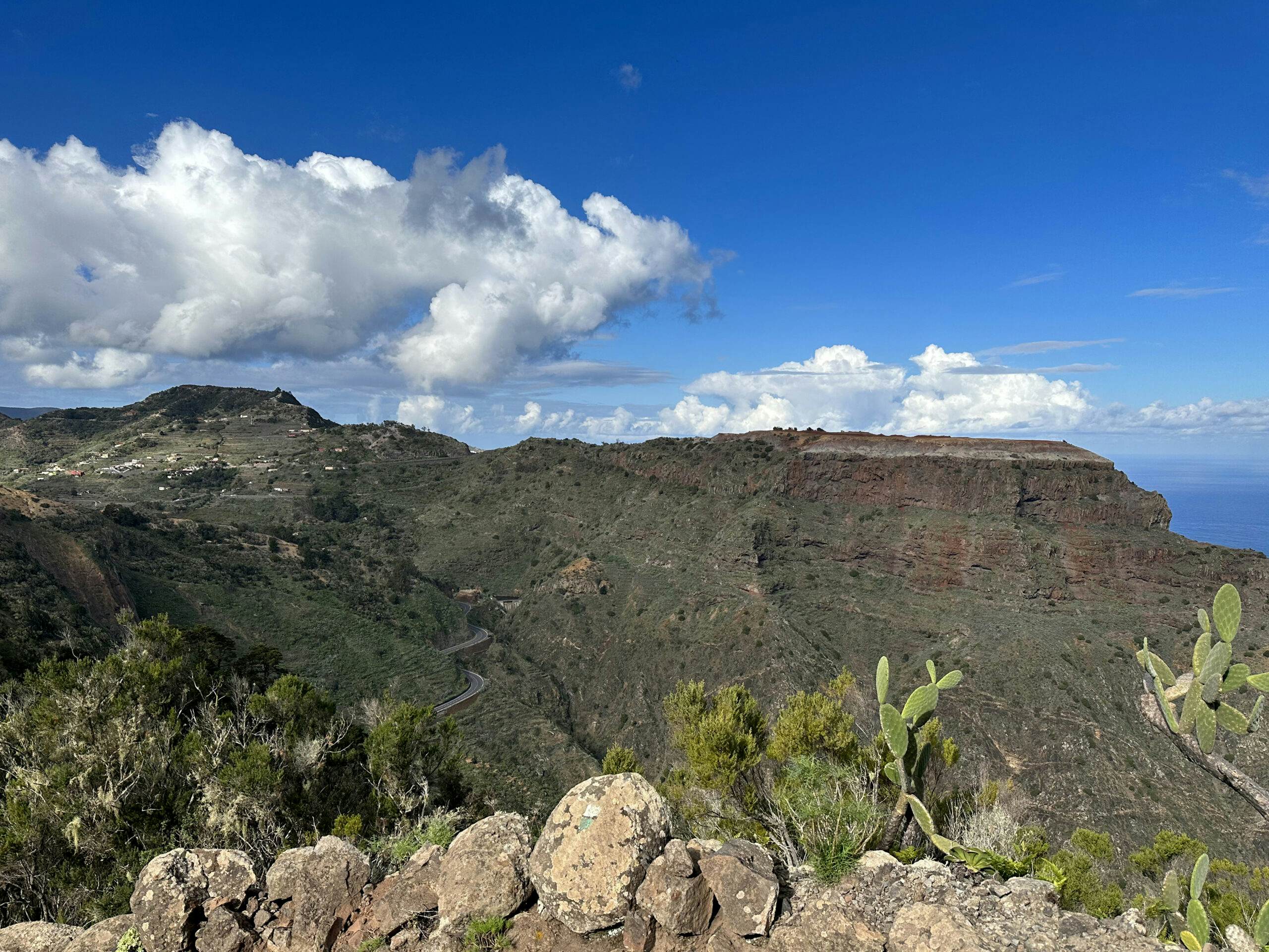
View from the ridge path towards Centrum Juego de Bolas - GR 132, 2nd stage
However, on GR 132, Stage 2, you ascend to the left onto the ridge. Once at the top, the trail continues on the left side of the slope, ascending gently. At times, you’ll walk on red eroded sand dunes, enjoying views of Tenerife and Mount Teide from above. You’ll pass by the Centro de Visitantes Mirador de Juego de Bolas and later cross the Carretera Laguna Grande on the ridge road, also passing Restaurante Juego de Bolas. In a subsequent large right curve, the GR 132, Stage 2, marked by signs to Hermigua, descends on a small footpath to the left.
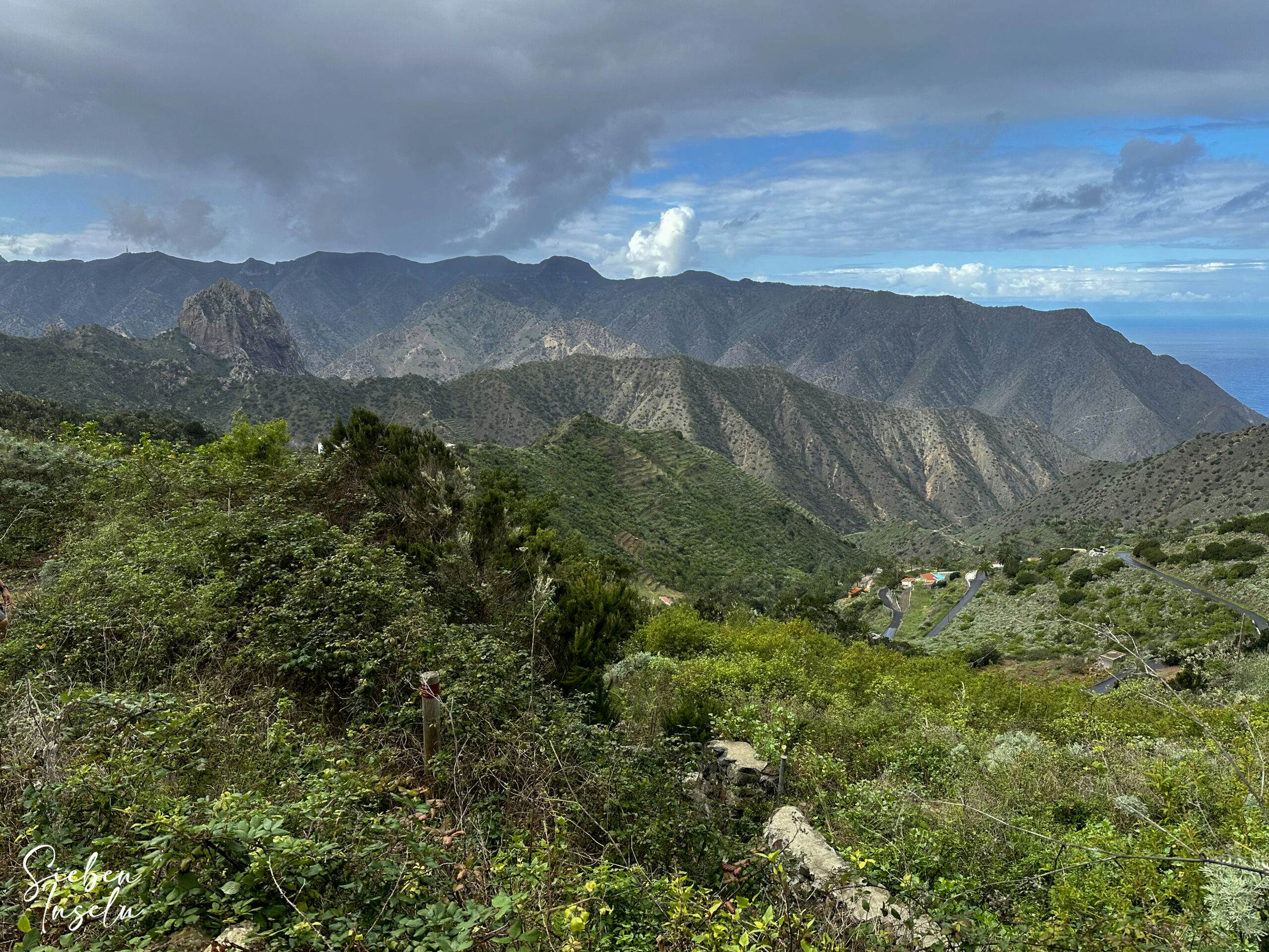
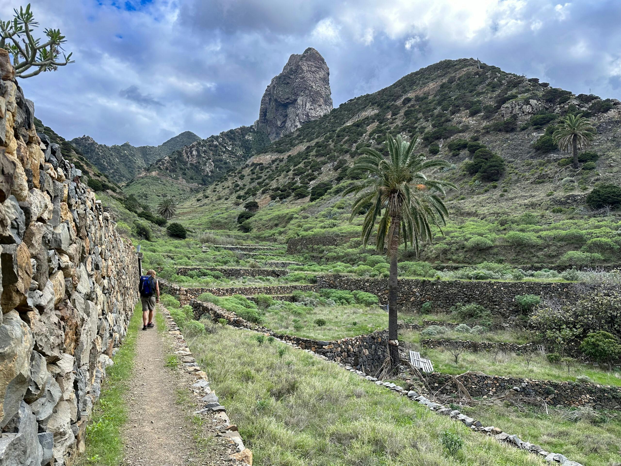
View from the hiking trail to Tamargada and the Roque Cano in the background - GR 132, stage 2
Trail Section Junction behind Restaurante Juego de Bolas to Ermita de Nuestra Señora de la Caritas del Cobre
The trail takes you through the forest downhill into a valley that you cross. After ascending on the other side, you reach a road that you cross. Continue uphill. Then you reach a fork. To the left, you’ll encounter the Great Tamargada Circuit. However, you keep to the right, descending on a hiking trail over an elongated ridge, eventually reaching Presa de Las Rosas. Cross the dam and then follow the road uphill to the right. 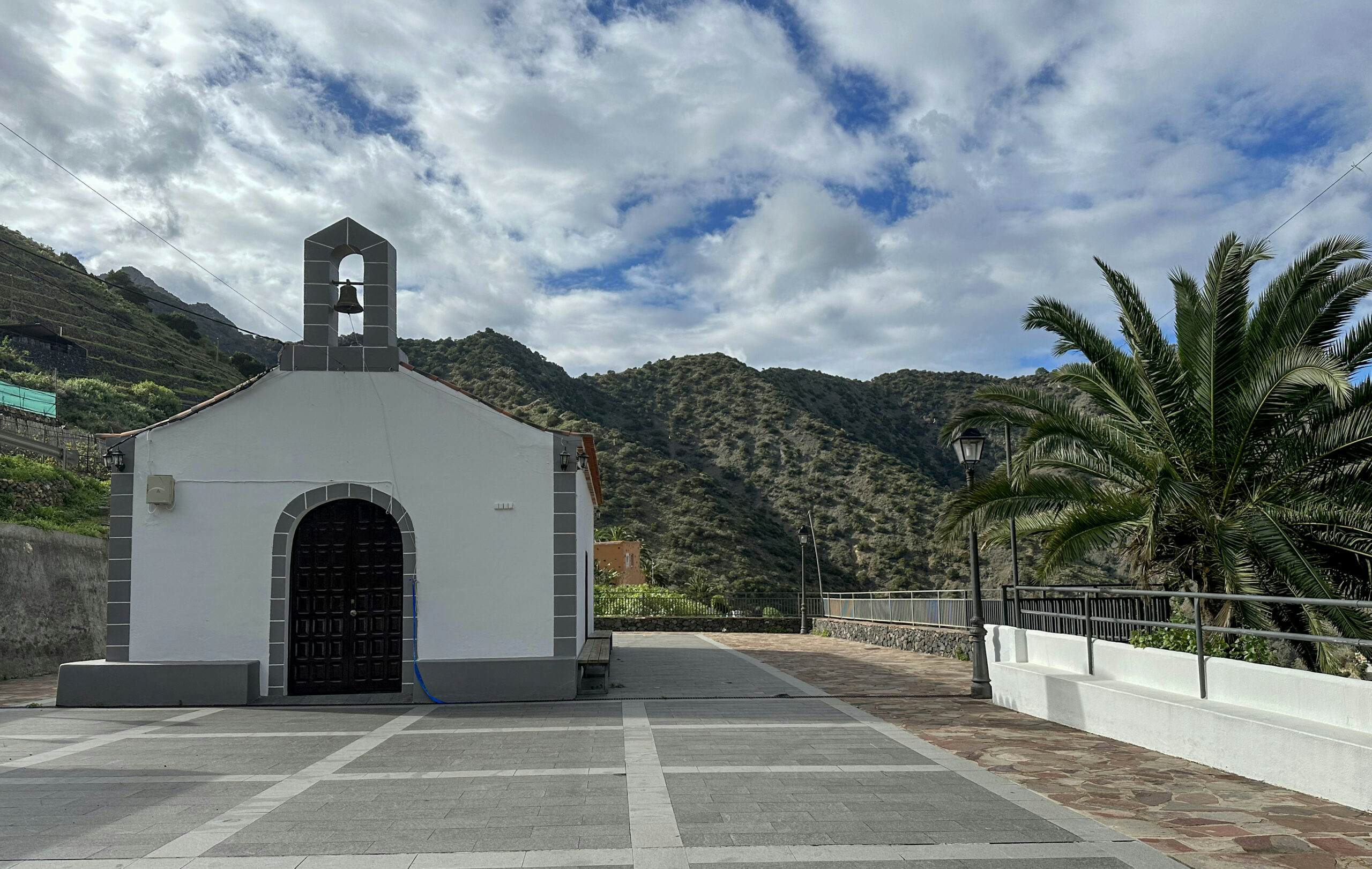
Ermita de Nuestra Señora de la Caritas del Cobre at the GR 132, 2nd stage
You’ll then arrive at a ridge, and from here, a very narrow, stony path steeply descends through bushes and forest. While descending, you’ll cross the GM-1 again and eventually reach Calle Simancas, which you’ll follow to the left for a while until you reach the village of Simancas. Leave the road here and hike over Loma de Palmarejo on a pretty hillside path around a mountain. On the other side of the mountain, you’ll steeply descend towards Ermita de Nuestra Señora de la Caritas del Cobre.
Hiker on the GR 132, 2nd stage in Simancas
Trail Section Ermita de Nuestra Señora de la Caritas del Cobre to Hermigua
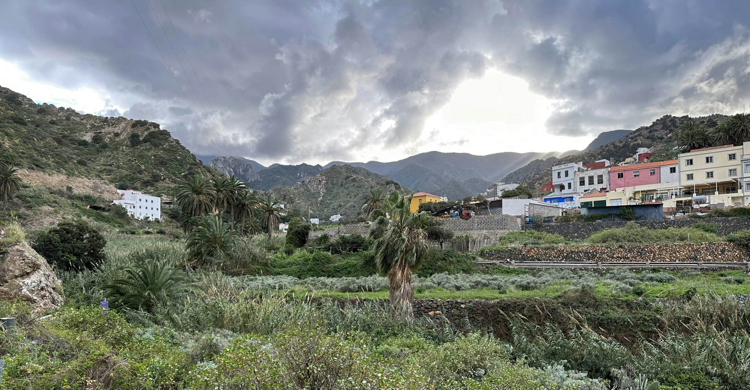
From the hermitage, the GR 132, Stage 2, trail takes you down towards Barranco de los Zarzales. Walk through Tamargada and then follow along the right side of Barranco del Valle. Finally, you’ll reach a road, which you follow to the left. This road takes you through the ravine and then uphill on the other side over Lomo de la Culata. Once on the ridge, you’ll see Playa Vallehermoso far below. Descend steeply towards it on winding switchbacks. After reaching the bottom, cross the valley to TF-712, which you follow uphill towards Vallehermoso.
Hiking trail down to the Barranco de los Zarzales
At this point, GR 132, Stage 2, offers two different options. You can ascend to the right from Playa Valle Hermoso (Start of Stage 3, 1st variation). I described this route in the Great Circular Hike along the northwest cliff coast at Chijeré. However, as we had accommodation in the town of Vallehermoso, we opted for the 2nd variation of Stage 3, starting directly in Vallehermoso. Therefore, in our Stage 2, we had to walk to the center of Vallehermoso. 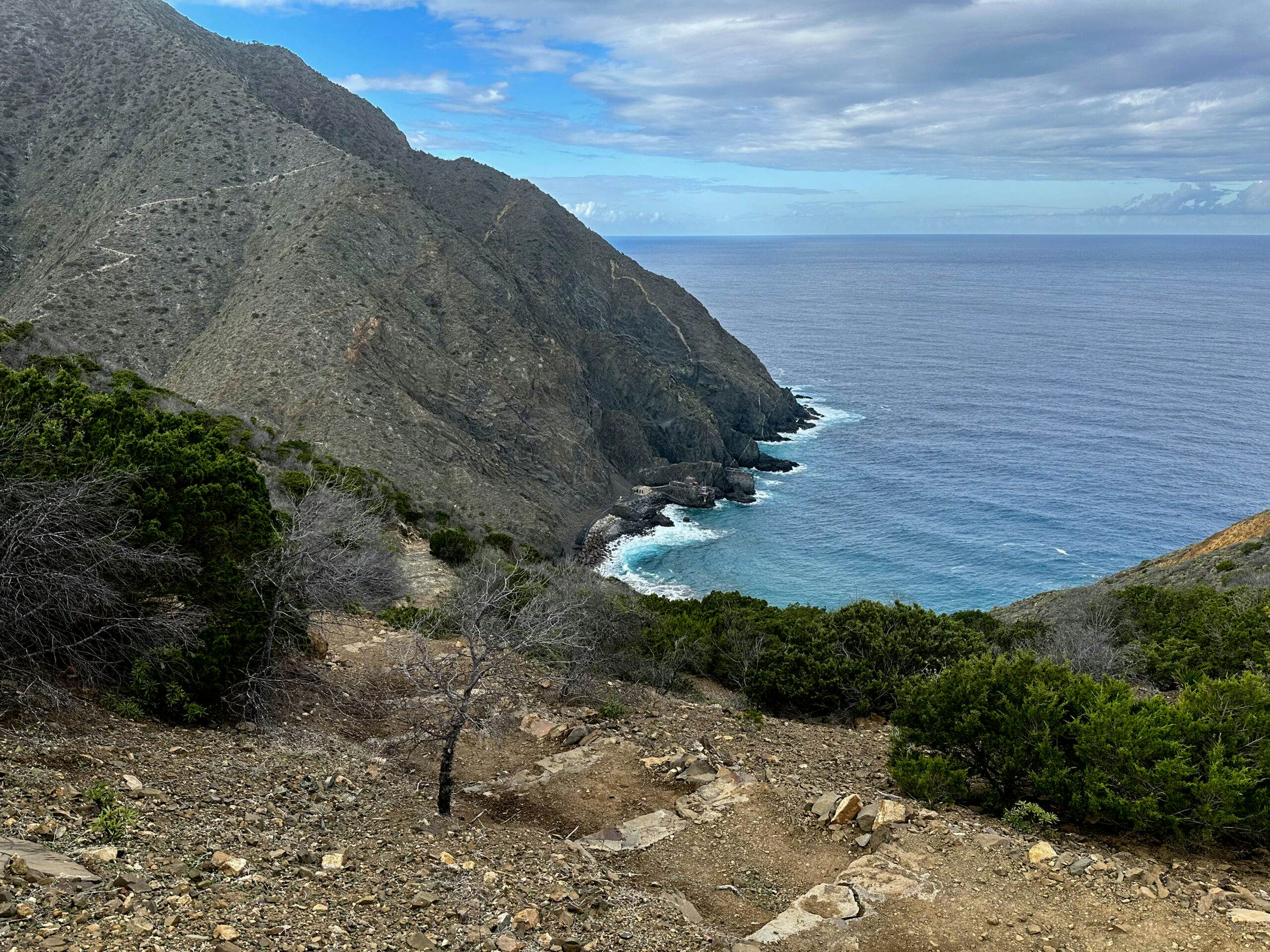
Hiking trail along the coast towards Vallehermoso GR 132, 2nd stage
With this variation, you’ll follow TF-712 for a long time. Then, turn left into Calle Lomo Barro, which takes you uphill for a while over Barranco del Valle with several switchbacks. Eventually, it ends, leading you for an extended stretch over terraced fields with beautiful views along the slope towards Vallehermoso. Just before Vallehermoso, you’ll cross the ravine and TF-712. Then, walk into the town and hopefully find a good rest after this long hike.
Hiking trail along the slope and through the Barranco below Vallehermoso
And finally
I hope you enjoyed the description of my hike on GR 132, Stage 2, and that you’re still eager to accompany me. The remaining stages will follow gradually. I wish you beautiful and safe hikes,
Dagmar from SiebenInseln