Taganana – an idyllic place and hiking hub in the Anaga Mountains
As already announced, today I present another and therefore for the time being last hiking tour around Taganana to Gollada Abicore. Taganana is a hiking hub in the Anaga mountains. The village is located at the northern tip of the island Tenerife and can be reached over a curvy, narrow serpentine road. So the village itself is built on a steep rocky ridge. The picturesque houses and alleys can be explored almost exclusively on foot.
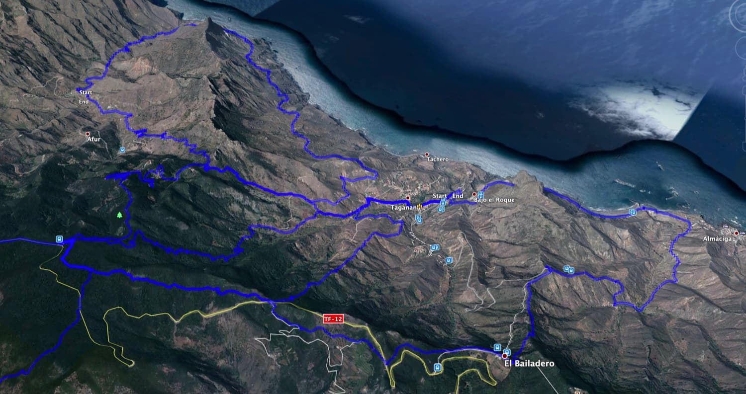
Map

Starting point Taganana Plaza
Everything in and around Taganana with its winding alleys seems cosy, natural and still untouched. Since I have a long drive to the Anaga mountains myself, I prefer to stay a few days a year and then hike around the area. In February 2020 I was allowed to spend a hiking holiday week in Taganana. I liked the old settlement, the simple accommodation and the untouched nature so much that it was certainly not my last stay there.

Bridge over the Barranco in Taganana
Taganana – El Dorado for hikers
In the village centre there are cosy bars and restaurants and the small church Nuestra Señora de las Nieves y San Blas, which dates back to the 16th century. In front of the church there is the central plaza that is the meeting point of the villagers every evening. But what I specially liked was the little food shop at the other side of the Barranco. It is hidden and inconspicuous at the roadside. In the small shop there are, beside the daily needs and fresh bread, fruits and a lot of fresh vegetables of the region.

fresh water in the village centre
For hikers, this area is a real El Dorado, which meets all requirements. It ranges from the old donkey path „Llano de los Loro“, which used to be the only access path to the village and which is now used for hiking, to the rugged slopes for high demands of experienced climbers. The sea, bathing beaches and idyllically situated fish restaurants by the sea also invite you to stay. Taganana is a place you should not miss when you are hiking in the Anaga mountains.
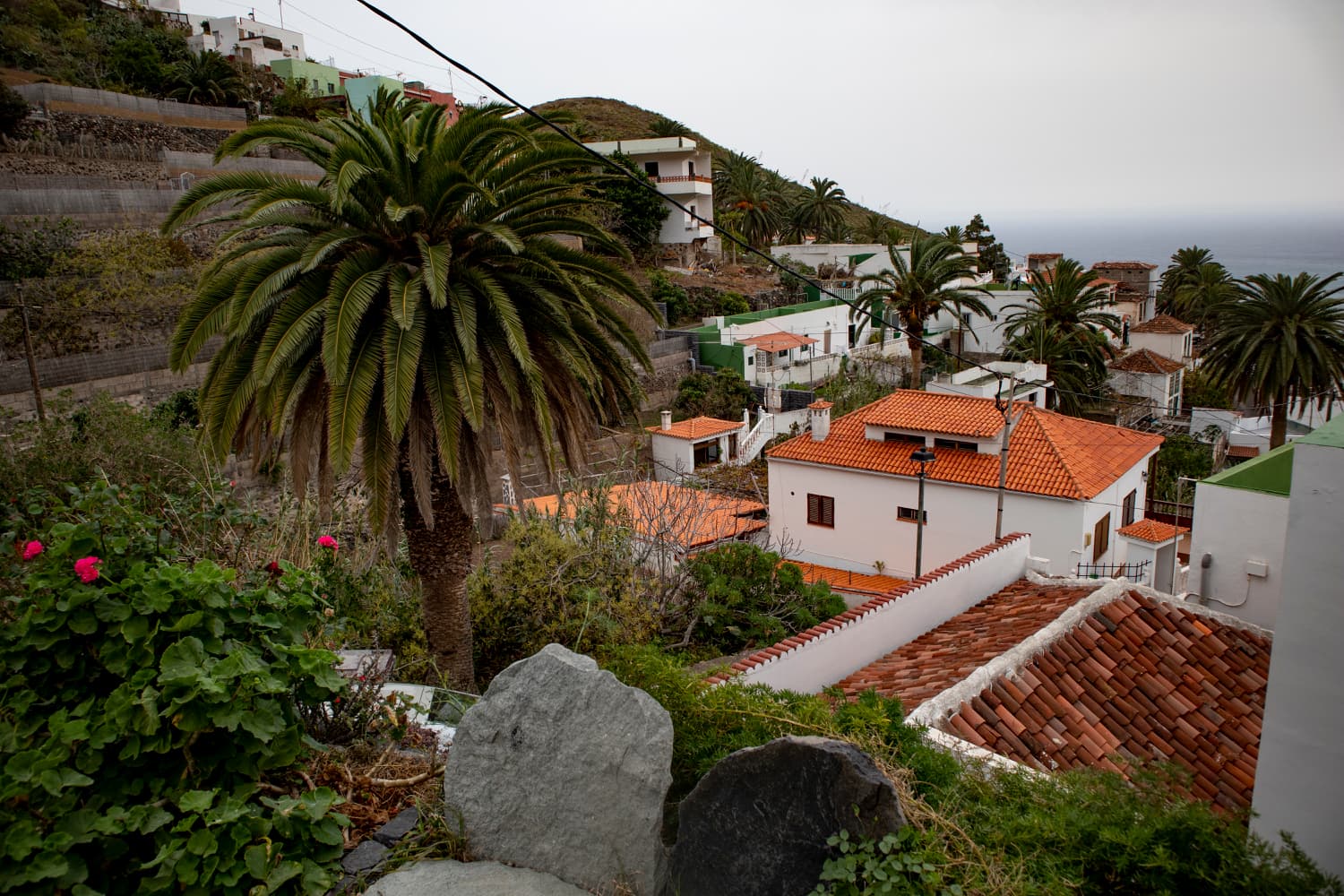
View of the district Portugal - Taganana
Hike Cumbrecilla and Gollada Abicore and other tours around Taganana
On Seven Islands I had already presented the big round trip from Afur via Taganana. And also the Great Anaga Roundtrip starts very close to Taganana. Also the round tour into the Valle Brosque borders on today’s tour. And then there is the recently presented round tour from Taganana up to the Casa Forestal de Anaga and in a big arch from there down to the coast near Almácige. 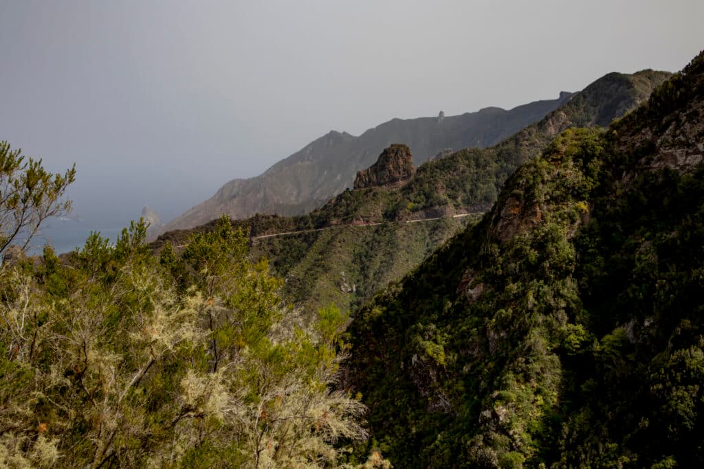
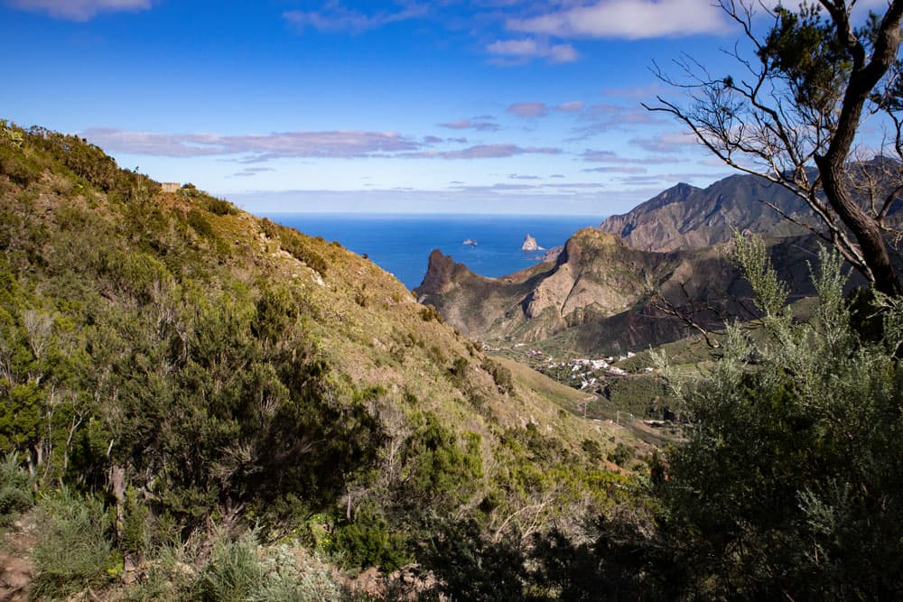
View of mountains and sea
Today’s tour and also the last one around Taganana to the Gollada Abicore starts in the centre of Taganana at an altitude of about 160 metres. From there you climb up to the Cumbrecilla and then in a wide arc up to the Casa Forestal de Anaga at 832m. From there you will go through the cloud forest to Gollada Abicore. At the Gollada Abicore begins a very old hiking trail that takes you over a ridge steeply downhill back to Taganana.
General information about the circular hike Taganana – Cumbrecilla – Gollada Abicore
Starting point and approach
You start your walk in the centre of Taganana on the small plaza in front of the church. You cannot go there by car. Cars stay in a small parking lot outside the village on the main road Camino la Cuestilla in a sharp right turn or at the roadside. From the small car park, go up the stairs to the village, keep left on the path and after a small steep climb you are already in the village square.
Access by car
You can reach the village by TF 13 and TF 12 via La Laguna or from the south side by TF 11 and TF 12 from San Andrés. Shortly before El Bailadero the road splits and you turn off on the TF-134 towards Taganana. The road leads through a tunnel and then in many serpentines down into the village.
Article summary and large selection of GPS hiking tracks
Sign up for my newsletter now and get exclusive access to my collected GPS tracks as well as all the brief information about my articles.
Sign up nowApproach by bus
Titsa bus line 946 goes to Taganana. It stops at the main road near the centre of the village. There are more stops at the bottom of the coastal road, so you can get on there on your way back and shorten the walk a little. If you only want to walk halfway, you can also get on or off the bus in El Bailadero. The bus lines 946, 947 and 77 stop there, details can be found on the Titsa homepage. Time
I don’t like to give general time indications for hiking tours, as the times are very individual. We needed 4,5 hours for this round trip with some breaks.
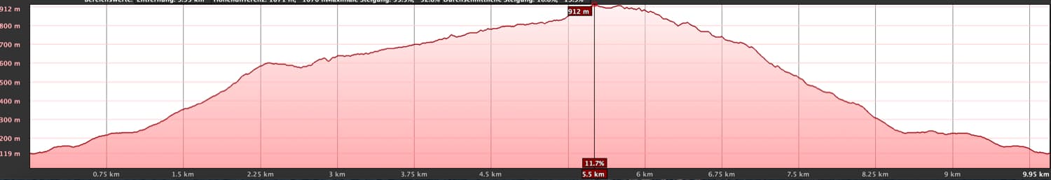
Elevation profile of the Taganana - Cumbrecilla hike
Difference in altitude and length of the route
The difference in altitude is almost 900 meters and the route is about 10 kilometers long.
Request
A partly strenuous hike in the descent. A bit of fitness is also necessary for the ascent. But the hiking trails themselves are well maintained and easy to find.
Refreshment
Restaurants, bars and shops can only be found at the starting point in Taganana. So make sure to take enough water and food with you.
variants: Tracks in the Taganana area
Variants
There are many other hiking trails around Taganana. On Seven Islands I already presented the big round trip from Afur via Taganana. And also the Great Anaga Roundtrip starts very close to Taganana. Also the round tour into the Valle Brosque borders on today’s tour. And then there is the recently presented round tour from Taganana up to the Casa Forestal de Anaga and in a big arch from there down to the coast near Almácige. 
View from the height to Taganana and the sea
Round trip Taganana – Cumbrecilla – Casa Forestal – Gollada Abicore
Route section Taganana village square to the Afur/Cumbrecilla junction
You start your walk on the village square in front of the church in Taganana. There is a paved path, the Camino Cruz de Limera, which you follow to the left (along the church). Don’t be irritated by my track, which starts a little further down the road, because that’s where I used to live. You pass a nice water cooler and descend into the Barranco, which you cross over a bridge. Then a big dragon tree comes up and you take the first road to the left. The trail is marked yellow and white. This is the Camino Portugal, which takes you a little bit steep up to the district Portugal. At the top, the road leads into a kind of small square or wide road (Caserio Portugal).

Taganana - in front of the Plaza
From there you turn left onto the road Caserio Los Naranjos. After a short time, the PR TF-8 hiking trail to Casa Forestal branches off on the right-hand side, signposted. This path, partly paved with stones, climbs steeply between fields and planted terraces. After a short time the trail forks. To the left is Casa Forestal (Hiking tour). Keep right to Cumbrecilla (signposted to Afur). 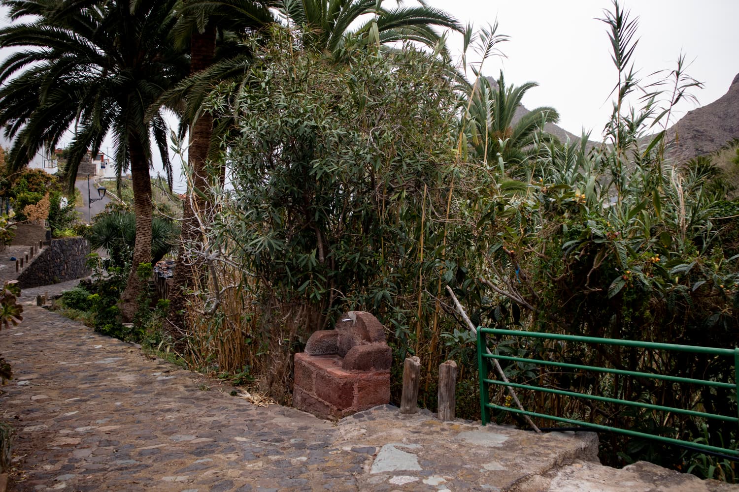
Hiking trail near Taganana - start of the ascent
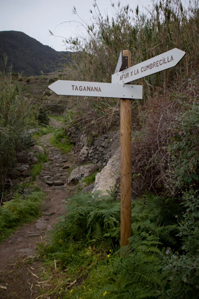
Branch off Afur to the Cumbrecilla
Article summary and large selection of GPS hiking tracks
Sign up for my newsletter now and get exclusive access to my collected GPS tracks as well as all the brief information about my articles.
Sign up nowFrom the fork in the path, you walk briefly uphill in a small barranco with terraced fields. Then you come to a wide road which you follow to the left. This road is also the route of the circular hike from Afur via Taganana (LINK). After not too long the road makes a bend to the left. At this point there is a signposted hiking trail uphill on the right side. On a small white signpost is written in black: Cumbrecilla Afur. Some steps lead uphill. After that the path goes steeply up the mountain. At first it winds around some houses and private gardens and then continues up through green bushes.
Crossroads - Cumbrecilla junction
Power lines run to your right. Finally the path turns into a forest path. Through the forest, the steep Camino winds its way up in serpentines more and more. After about half an hour you have made it. You reach the Cumbrecilla (607 meters altitude difference). Here is not only a crossroads where many paths converge. From Cumbrecilla you can also enjoy a magnificent view towards Taganana, Afur and the surrounding area.
View from the Cumbrecilla to the next mountain ridges around Taganana and the wide valley
Route section Cumbrecilla to Casa Forestal hiking fork
From the Cumbrecilla, there is a hiking trail on the right down to Afur. However, you continue straight on the hiking trail (not uphill on the left). It leads you through a pine forest on a wide road, at first a little downhill. You walk below a small hamlet and along some private houses and farms. Terraced fields and isolated farmsteads alternate with pine forest. Then the path climbs steadily in wide serpentines through the pine forest. From time to time the forest thins out and you can enjoy magnificent views over the heights of the Anaga Mountains.
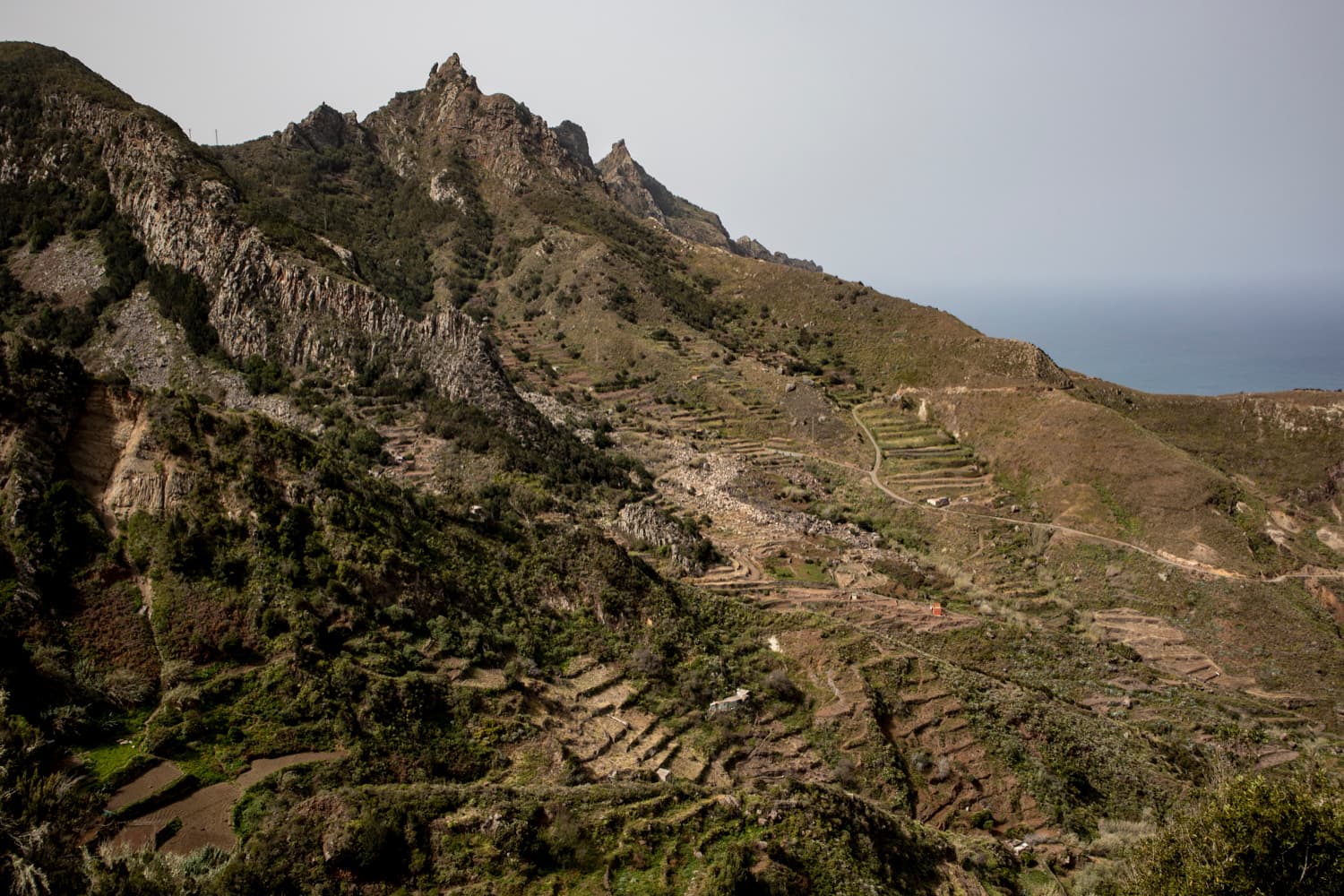
View of the terraced fields above Taganana
Finally you will see terraced fields below you on the right. The path makes a long winding to the right and ends after a last long climb at the parking lot of Casa Forestal de Anaga. Many hiking trails start from here. Another hiking hub in the Anaga mountains. See also below the variants. To the left and then behind Casa de Forestal the trail continues. On small steps it goes up in a short time to another hiking fork at a brick cave.
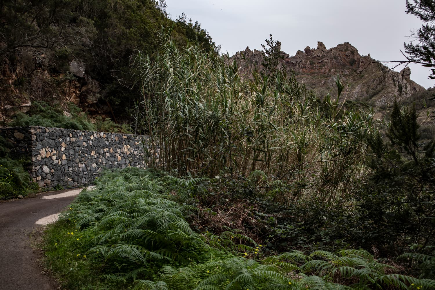
Hiking road, reeds and jagged rock crests
Route section Casa Forestal hiking fork to Gollada Abicore
At this fork in the road, turn left and take another route back to Taganana (see Taganana – Casa Forestal. On the right you come back on the hike Valle Brosque. Keep right in the direction of Valle Brosque. The path climbs slightly uphill and after a while goes downhill. You will reach another, but before you reach a discreet fork. Continue straight on with the PR TF-3 into Valle Brosque. But you go uphill on the narrow path on the left. From here, the trail now takes you along a narrow path on the slopes of the Roque de los Pasos, always slightly downhill. 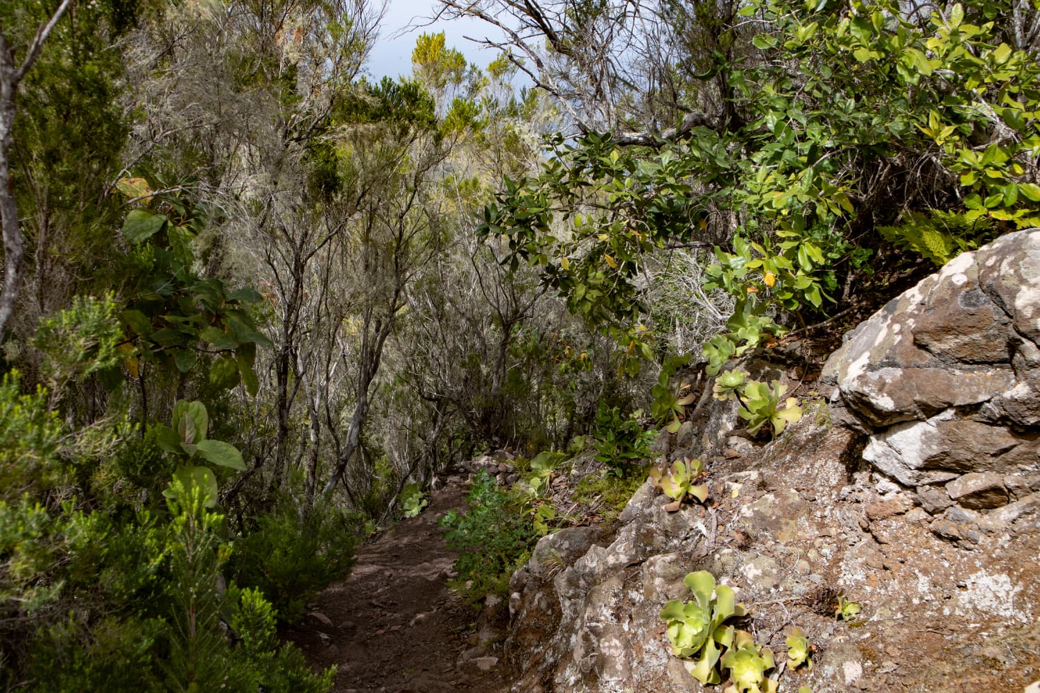
Hiking path down over the mountain ridge
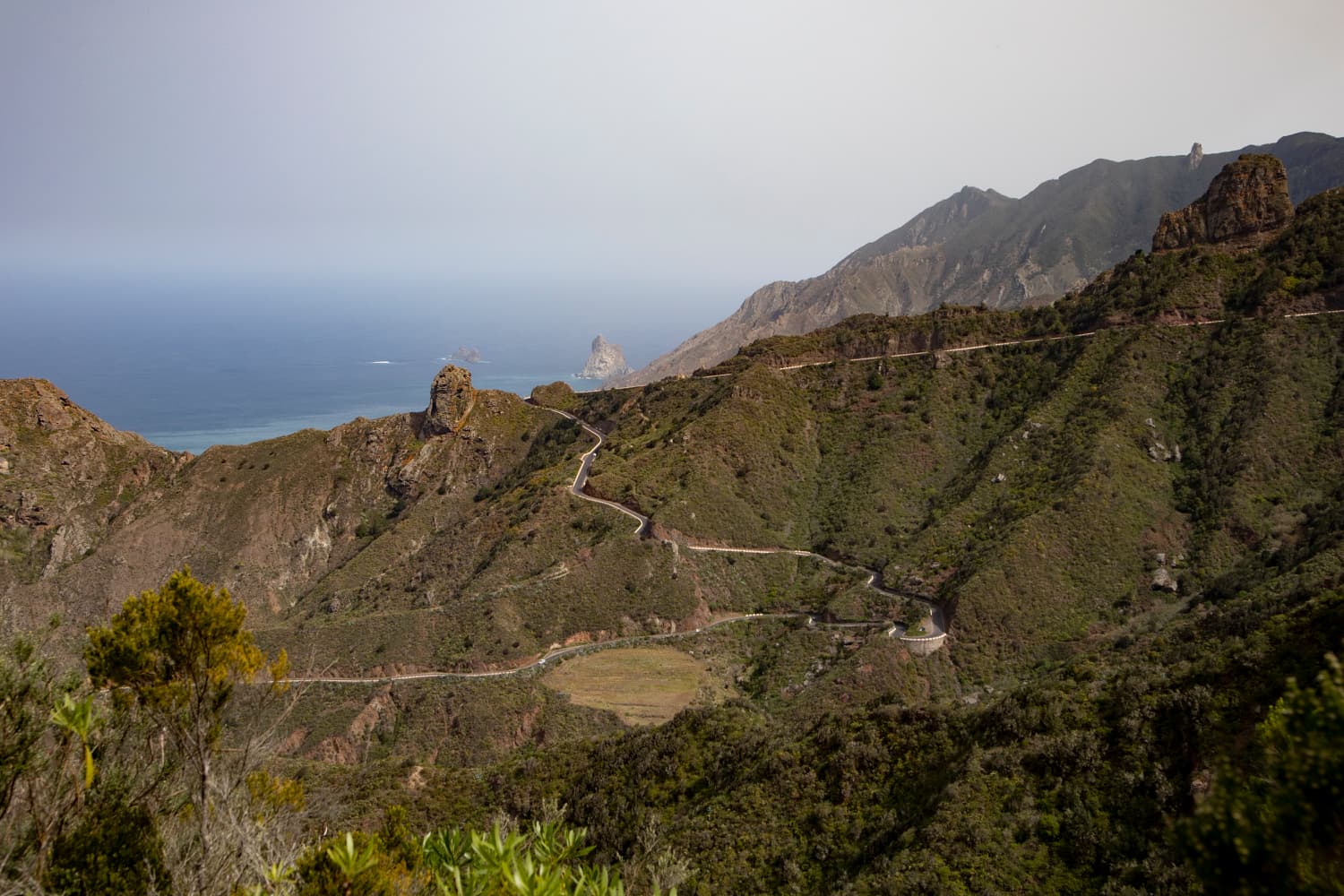
You hike parallel high above the Anaga high altitude road TF-12. From time to time you can now also have a look at the other Anaga side towards Santa Cruz de Tenerife. This section from Casa Forestal to Gollada Abicore is identical to the Taganana – Casa Forestal hike. Finally, at Gollada Abicore you will reach the TF-12, where you can enjoy magnificent views of both sides of the Anaga. On the opposite side of the road the trail continues to El Bailadero. Immediately on the left side of the road the descent begins over the old hiking trail Abicore to Taganana. 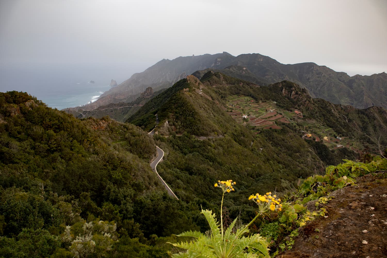
View down to the road and to the coast
Section Gollada Abicore to Taganana
The first 100 meters of the hiking trail seemed to be overgrown during my last visit in February 2020. You have to fight your way through some high grass and bushes. Then you come to a house, on whose roof you probably have a beautiful view over the whole valley. But entering this „Mirador“ is of course forbidden. From here you walk downhill on steep serpentines through the pine forest. Later the forest thins out and you hike steeply down over a mountain ridge. Sometimes you can enjoy magnificent views of Taganana and the valley between the bushes.
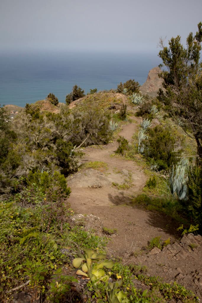
Hiking trail on the ridge - way back
Further down, the path leads you along the left side of the mountain over a transverse passage onto another ridge. The first houses of Taganana are already directly below you. You descend on the hiking trail and walk past them. Behind them you will find yourself on the Avenida los Cubanos. You go around to the left. After a short time a small street branches off to the right. If you follow this road you will come back to the center of the village on the shortest way. As you can see from the track, we followed the main road Camino Lomo los Lirios and made a bigger turn around a barranco. At the road Caserio los Naranjos we were again on the way there, on which we could go back to the center of Taganana.
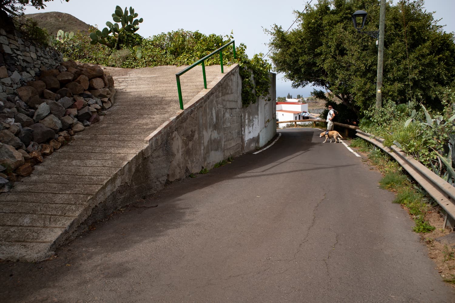
Exit of the trail over the mountain ridge and arrival on the small road
And at the end
I hope you enjoyed this last round of hiking around Taganana for the time being. These tours are the „yield“ of my last stay in the Anaga mountains in February 2020. From mid-March to the end of May, I stopped hiking here on Tenerife because of the hard Spanish lockdown. But since a few weeks the hiking trails are now open again and we are freed from the „captivity“ (as of June 23, 2020). Therefore I wish all readers that you may now or hopefully soon have the opportunity to enjoy the beautiful nature on the Canary Islands on all hiking routes,
Dagmar von SiebenInseln