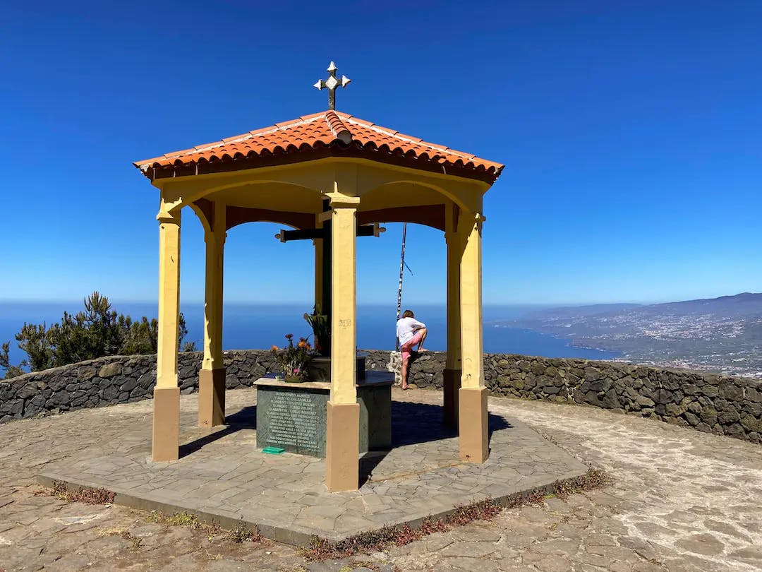
Mirador de La Corona – Starting point of many hikes
The Mirador de la Corona viewing platform is located at an altitude of approx. 780 metres above Los Realejos and Icod Alto. From up there you have a wonderful view of the entire north coast of Tenerife and the Orotava Valley. There is a pavilion on the large viewing platform, some radio masts further up and a paragliding runway. The Mirador de La Corona is one of the most spectacular viewpoints on the island. From here, I had already described the hike to the Chanajiga rest area.
Map
The hiking trail leads onto trail 0.4.0, which leads from El Socorro beach to the Teide.
But there is not only a hiking trail there. The Mirador is a junction for several hiking trails. The famous trail route 0.4.0. also runs over the Mirador de La Corona. This hiking or running route starts at Playa de El Socorro in Los Realejos and leads via the Mirador de La Corona and the hiking trail PR-TF 41 up to the Teide. If you feel fit, you can run 27 kilometres on this trail from 0 to 4000 metres altitude in one day. It is guaranteed that such a trail is not suitable for everyone. But today’s hike also takes you a little way along Trail 0.4.0.
Circular hike Mirador de La Corona – Fuente del Bardo
The hike described here first takes you from the Mirador de La Corona, holding altitude for a very long time along the north side of the island. You walk along the Camino de Santiago de Tenerife (Way of St. James of Tenerife) with beautiful views of the coast, the Atlantic Ocean and the neighbouring island of La Palma towards La Guancha. After a while, you will pass the small village of Fuente del Bardo.
the trail crosses some ravines in the pine forest
But before you reach La Guancha, you leave the main path and hike quite steeply uphill. Finally, you will reach the pine forest. There, the ascent continues on forest paths for quite a while. You will cross some ravines and finally reach the long-distance hiking trail BC-1 Ruta Norte. Finally, the BC-1 meets the PR-TF 41 trail and the 0.4.0 trail, which will take you steeply downhill back to the Mirador de La Corona.
Track of the circular hike Mirador de La Corona - Fuente del Bardo
General information about the circular walk Mirador de La Corona – Fuente del Bardo
Starting point and route
The starting point of the hike is the Mirador de la Corona above Icod el Alto..
Approach by car
You can get there by car via the TF-5, then from the north via Los Realejos on the TF-343 and TF-342 to Icod el Alto. From there, turn left up to the Mirador de La Corona. Coming from the west/south, take the La Guancha exit and then take the TF-342 towards Icod el Alto. Before you get to the village, turn right up to the Mirador de La Corona.
Approach by bus
You can take the Titsa bus 354 to Icod el Alto. From there you can take a taxi to Mirador de La Corona or climb up. For more information on bus timetables, visit the Titsa Homepage.
Time
Article summary and large selection of GPS hiking tracks
Sign up for my newsletter now and get exclusive access to my collected GPS tracks as well as all the brief information about my articles.
I don’t like to give general times for hiking tours, as the times are very individual. This circular walk took me 3 hours and 20 minutes.
Altitude profile of the circular walk Mirador de La Corona - Fuente del Bardo
Altitude difference and route length
The difference in altitude is about 600 metres and the route is about 14 kilometres long.
Requirements
You hike the entire time on good hiking and forest paths.
Refreshments
There are no refreshment stops along the entire hike. However, it is possible to walk down a little from the hiking trail to the village of Fuente del Bardo. There, with a bit of luck, you might find an open bar. Nevertheless, please take enough water and, if necessary, food with you for the hike.
Track of the circular hike Mirador de La Corona - Fuente del Bardo (centre blue) and neighbouring tracks of hikes around Chanajiga and El Lagar
View from the hiking trail behind the Mirador de La Corona to the coast and La Palma
Circular Walk Mirador de La Corona – Fuente del Bardo
Section Mirador de La Corona to TF-344
You start your hike at the Mirador de La Corona. After a few metres, the path forks. Turn left onto the PR- TF 41 trail towards Chanajiga. This is your way back. Therefore, you now follow the wide path around to the right. Even though there is a white and yellow cross, you continue straight on for a very long time on the wide track. This path is actually the Camino de Santiago de Tenerife. Even though it is not signposted, from the Mirador de La Corona until you leave the road to the left, you are walking uphill on the Camino de Santiago de Tenerife.
View of the Teide from the hiking trail (Jakobsweg Tenerife)
Article summary and large selection of GPS hiking tracks
Sign up for my newsletter now and get exclusive access to my collected GPS tracks as well as all the brief information about my articles.
The trail takes you through terraced fields with magnificent views of the coast and surrounding villages. In an arc, you cross a small gorge and climb up again on the other side. You always keep straight ahead and ignore all the paths and roads branching off to the left and right. At Barranco de la Aguilla, the path changes temporarily into a narrower dirt track. Shortly afterwards, it takes you downhill to the TF-344, which you follow to the left.
The ascent path begins between these houses and branches off from the TF-344 road past the Casa Rural.
Route section TF-344 to hiking trail BC-1
There is hardly any traffic on the road. You cross a large gorge, the Barranco el Moro. On the other side, after a short climb, you reach the village of Fuente del Bardo. For a trip to the centre of the village, you should turn right off the main road and walk downhill. Otherwise, continue along the road above the village. Then cross the Barranco de Ruiz and continue until you reach a small settlement of houses (Casa Rural La Fuente del Bardo). Here you leave the road and the Way of St James to the left and walk up the small road that leads uphill between the houses.
Forest track on the ascent path in the pine forest
This is quite steep and you will quickly gain height. For a long time, the path goes uphill through meadows and terraced fields along the left side of the Barranco la Chaurera. Finally, the road crosses the gorge to the right and you enter the pine forest. From here, the path continues uphill on forest tracks. You can walk leisurely in wide serpentines or follow the straight steep path uphill (see my track). Now you have the Barranco de Vergara on your right. Finally, your path meets the long-distance trail BC-1.
Here the ascent trail through the pine forest meets the long-distance trail BC 1
Section of hiking trail BC-1 until after crossing Barranco de Ruiz
While a track in the forest continues uphill to the right towards La Fortaleza, keep to the left on the forest track BC-1. The forest track takes you further uphill through the pine forest with a view of the neighbouring island of La Palma. You cross the larger Barranco Chaurera in a large loop back to the left. After climbing gently for a while, the BC-1 turns right. Once again, you have the choice of following the big long serpentines of the BC-1 rather leisurely or shortening them on a smaller path to the left uphill.
View through the pine forest to the neighbouring island of La Palma
I opted for the straight steep ascent.The ascent path runs steeply up the ridge. To your left is the Barranco Rambla de Ruiz. Finally, the BC-1 comes up again from the right and you continue along it on the right side of the barranco. Finally, the path crosses the barranco and you continue uphill on the other side of the slope. At the top of the ridge, the path turns away from the barranco. The path continues gently up and down through the pine forest.
Shelter with view of the Orotava valley - Mirador El Asomadero
Route section crossing Barranco de Ruiz to Mirador de La Corona
You walk straight on for quite a while on the BC-1 through the pine forest, ignoring all the branching paths. After a while you will have reached an altitude of 1360 metres. From here, the BC-1 turns downhill. The path takes you downhill again with views of the coast. Finally, PR-TF 41 (Trail 0.4.0) comes from the right, and you continue on it from here on. The BC-1 now goes around to the right towards Chanjiga.
Information board at the Asomadero with Teide in the background
Follow PR-TF 41 and after a short while you will reach the Mirador El Asomadero viewpoint. From here you walk downhill through the pine forest on a narrow and very steep path, trail 0.4.0 and PR-TF 41. After rainfall, the trail is sometimes very muddy and slippery. Otherwise, however, it is very well marked and cannot be missed. The descent is quite steep for a long time. Finally, you reach a wider track on which you can walk the rest of the way down to the starting point of your hike, the Mirador de La Corona.
View from the descent path to Mirador de La Corona
And finally
I hope you enjoyed this great circular walk from the Mirador de La Corona. I can recommend it especially in the summer months, as it goes for a large part through the shady pine forest and offers a lot of shade. Whichever tour you choose, I wish you lots of fun on all your hikes,
Dagmar from Siebeninseln
Thank you for reading!
If you've found my hiking guides on SiebenInseln helpful for your Canary Islands adventures, please consider leaving a small tip. Your support is greatly appreciated and helps cover the costs of maintaining this blog.