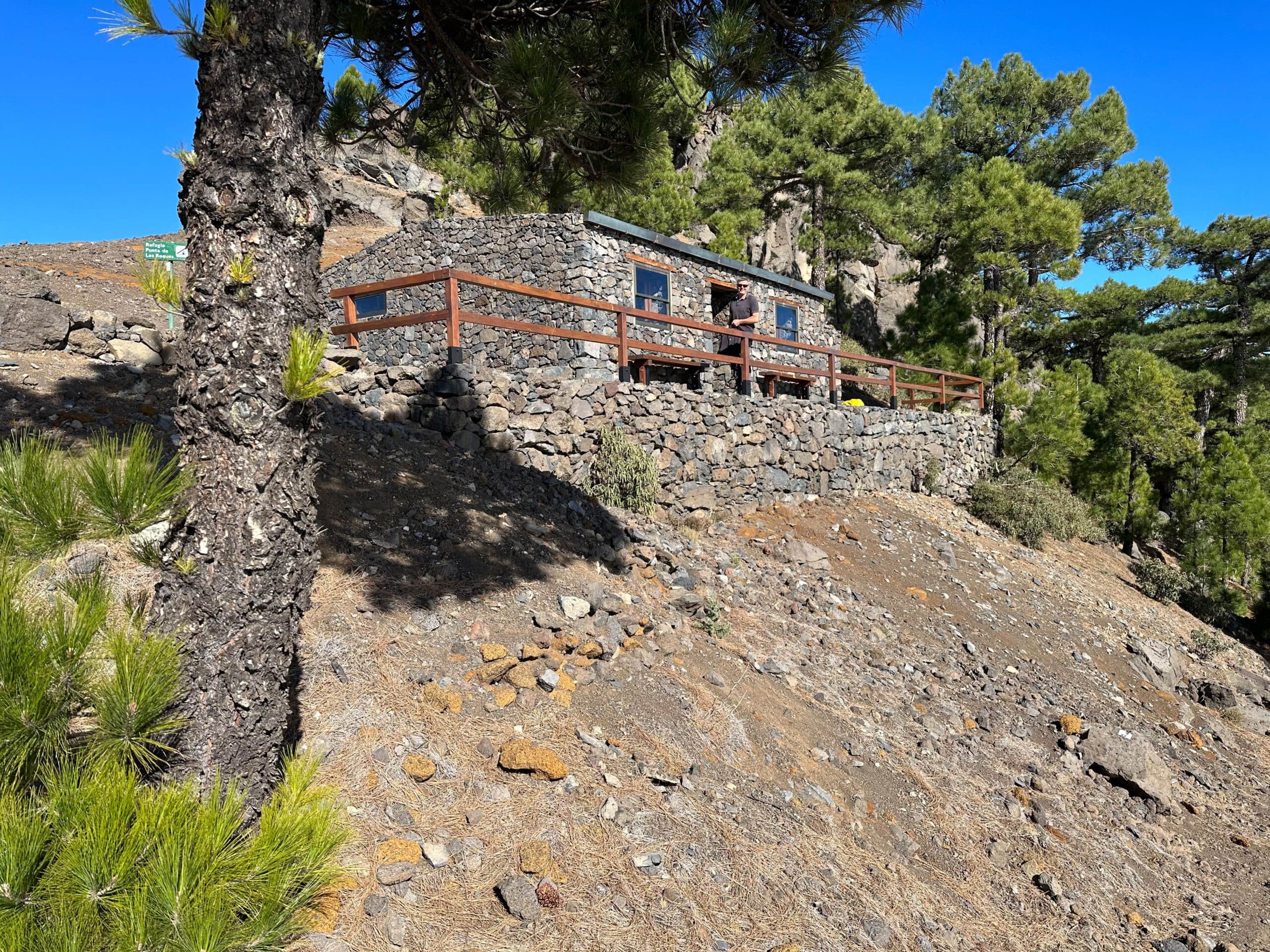
Refugio Punta de Los Roques – a refuge high up on the Cumbre
Today there is finally another hike on Isla Bonita La Palma. This one also takes you to the well-known Refugio Punta de Los Roques. Refugio Punta de Los Roques is the focus of the hike described here, as you will pass it on all your hikes from El Pilar northwards towards Pico de la Nieve. The Refugio Punta de Los Roques is a beautiful refuge, so ideally situated that you can enjoy views from up there in really almost all directions.
Map
Refugio Punta de Los Roques
And the Refugio Punta de Los Roques is located on an exposed corner on the ridge of the National Park in the middle of the path from the Ermita del Pino de la Virgen to the Pico de la Nieve.It is designed for a maximum of 20 people. Admission is free. In return, there is only basic equipment, which is absolutely necessary for an overnight stay. Consequently, you can combine this hike – if you don’t mind camping in a mountain hut – with an overnight stay in the Punta de Los Roques refuge. 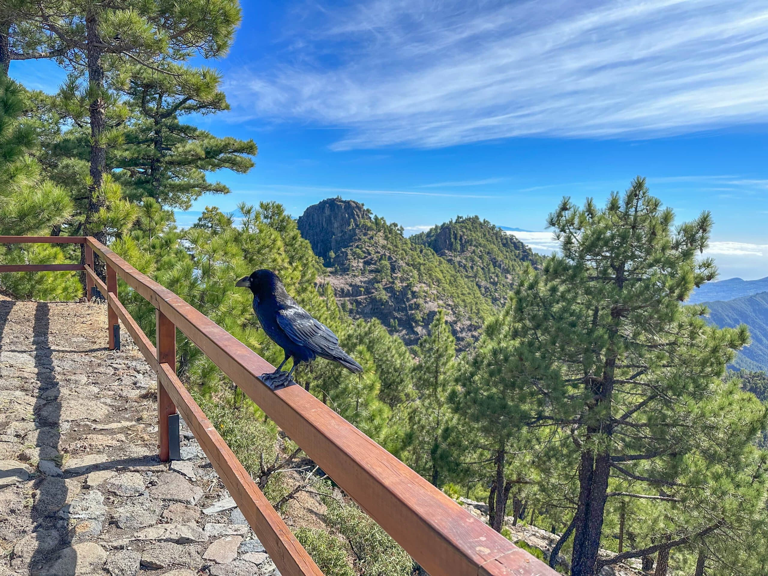
Raven at Refugio Punta de Los Roques - very tame, but watch out. The ravens pounce on everything edible.
Hiking on the Cumbre of La Palma
I have already described the hike on the Cumbre of La Palma between the Roques de Los Muchachos and the Pico de la Nieve. Another short hike on the Cumbre is the Hoya Grande hike. And of course the well-known Ruta de Los Volcanes also belongs in this category. Today I would like to close a „hiking gap“ with the hike from El Paso, Ermita de la Virgen del Pino via the Refugio Punta de Los Roques to Pico de la Nieve. 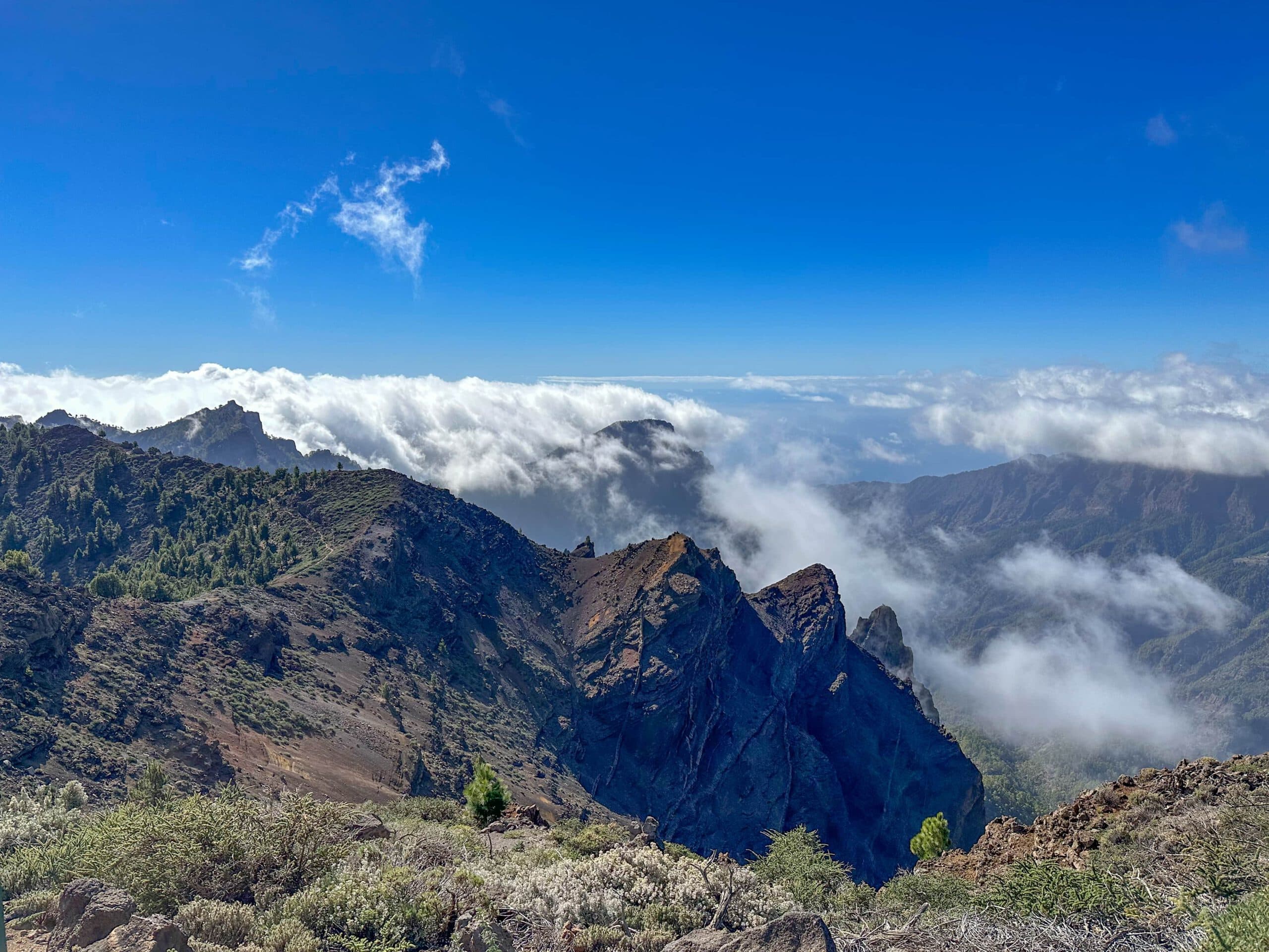
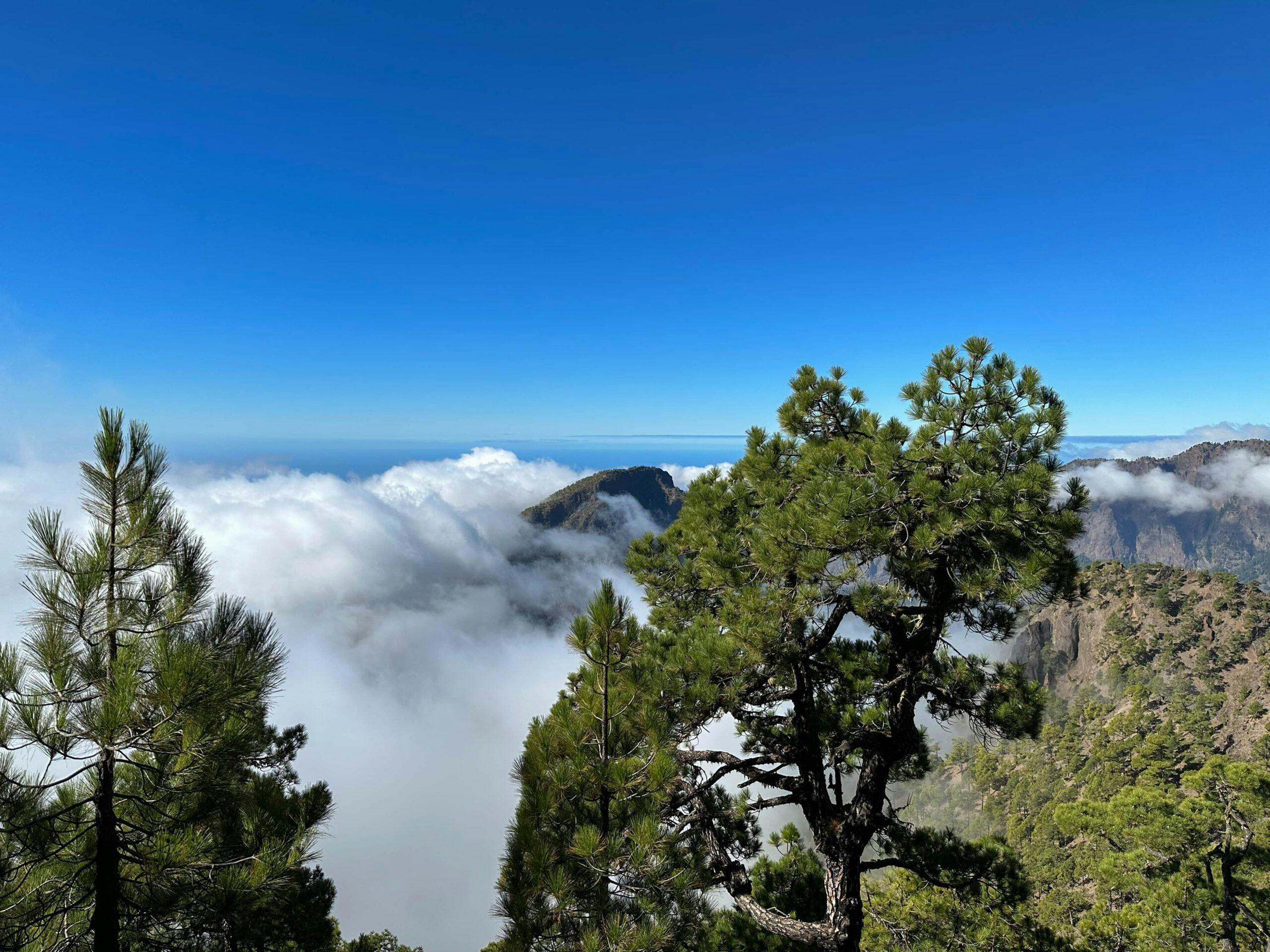
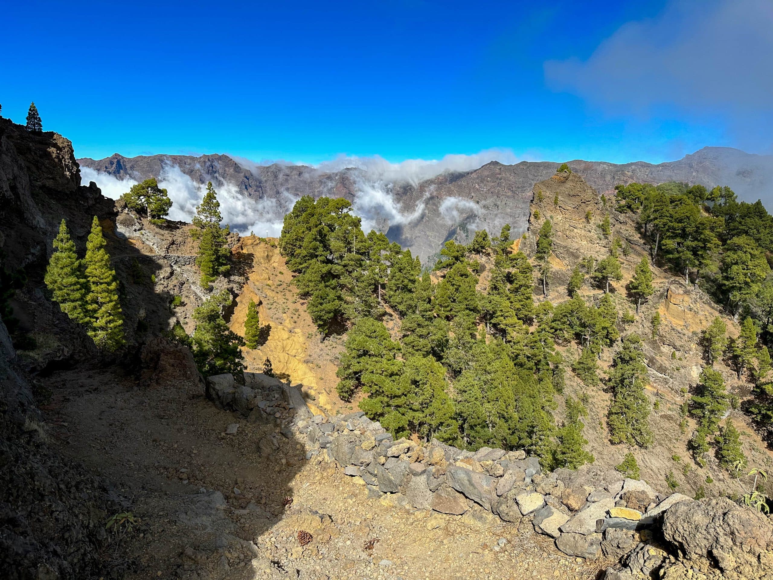
View from the Cumbre above the clouds
I describe the hike to and via the Refugio Punta de Los Roques to Pico de la Nieve both from El Paso and from the rest area El Pinar. Of course, you can combine individual parts of the hike with the other hikes over the Cumbre. Mountain bikers walk the whole way from Fuencaliente over the entire caldera to Tazacorte, for example, on the Transvulcania in one day. I myself prefer a more moderate pace. 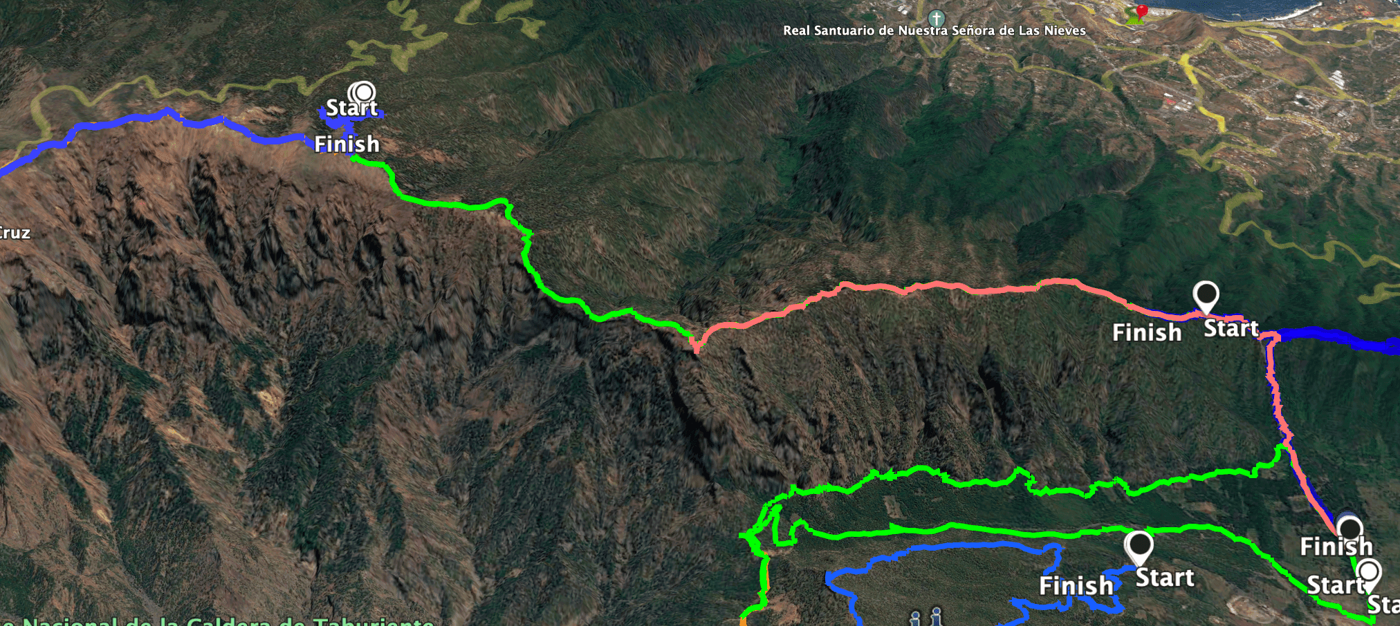
Track El Paso - Refugio Punta de Los Roques - Pico de la Nieve
General information about the Refugio Punta de Los Roques hike
Starting point and approach
The starting point of the hike is the small town of El Paso, Calle Virgin del Pina at the small church Ermita de La Virgin del Pino.
Alternatively, you can start at the Area Recreativa El Pilar or further along the Pista Hillera de la Cumbre. I describe this alternative in the article.
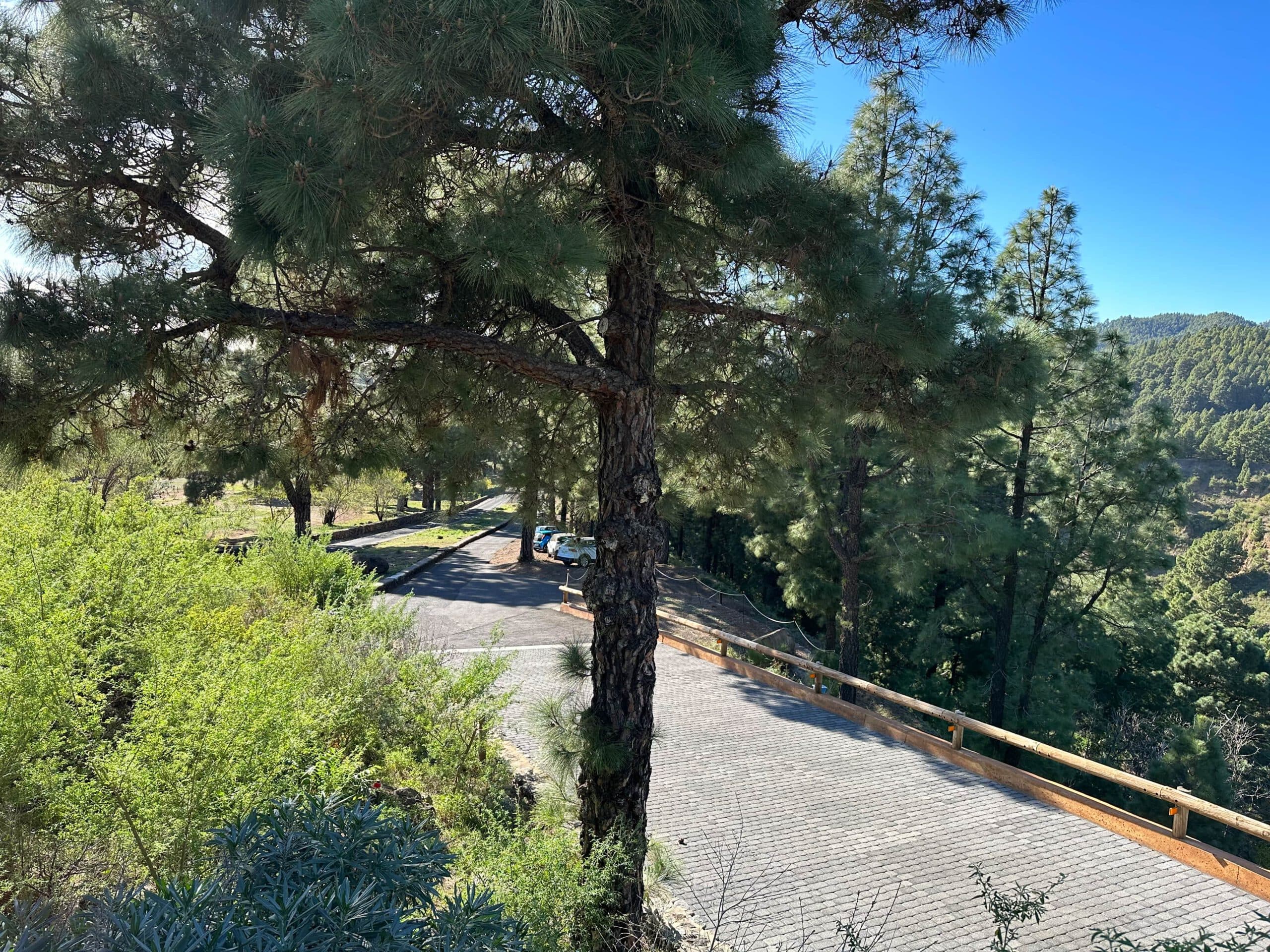
Parking in front of the Ermita de la Virgen del Pino
Arrival by car
Take the LP-3 and turn off at the visitor centre at El Paso. Continue past the Visitor Centre and follow the LP-302 road. At the first real intersection, turn right onto Calle Virgin del Pino. The road ends at the Ermita de La Virgin del Pino. There is plenty of parking along the road and at the Ermita.
The alternative option is to take LP 3 and LP 301 up to Cumbre. You can either start directly from the Area Recreativa El Pilar or from a point on the Hillera de la Cumbre piste (for example at the Revetón pass). You can take this runway from El Pilar.
Arrival by bus
You can get to El Paso near the visitor centre by taking bus number 300, which runs along the main road LP-3. See the Tilp homepage for details. From there you can take a taxi to the starting point or walk to the starting point (about 2 kilometres). Article summary and large selection of GPS hiking tracks
Sign up for my newsletter now and get exclusive access to my collected GPS tracks as well as all the brief information about my articles.
Sign up nowIf you want to start from El Pinar, you have to take a taxi, there is no bus connection.
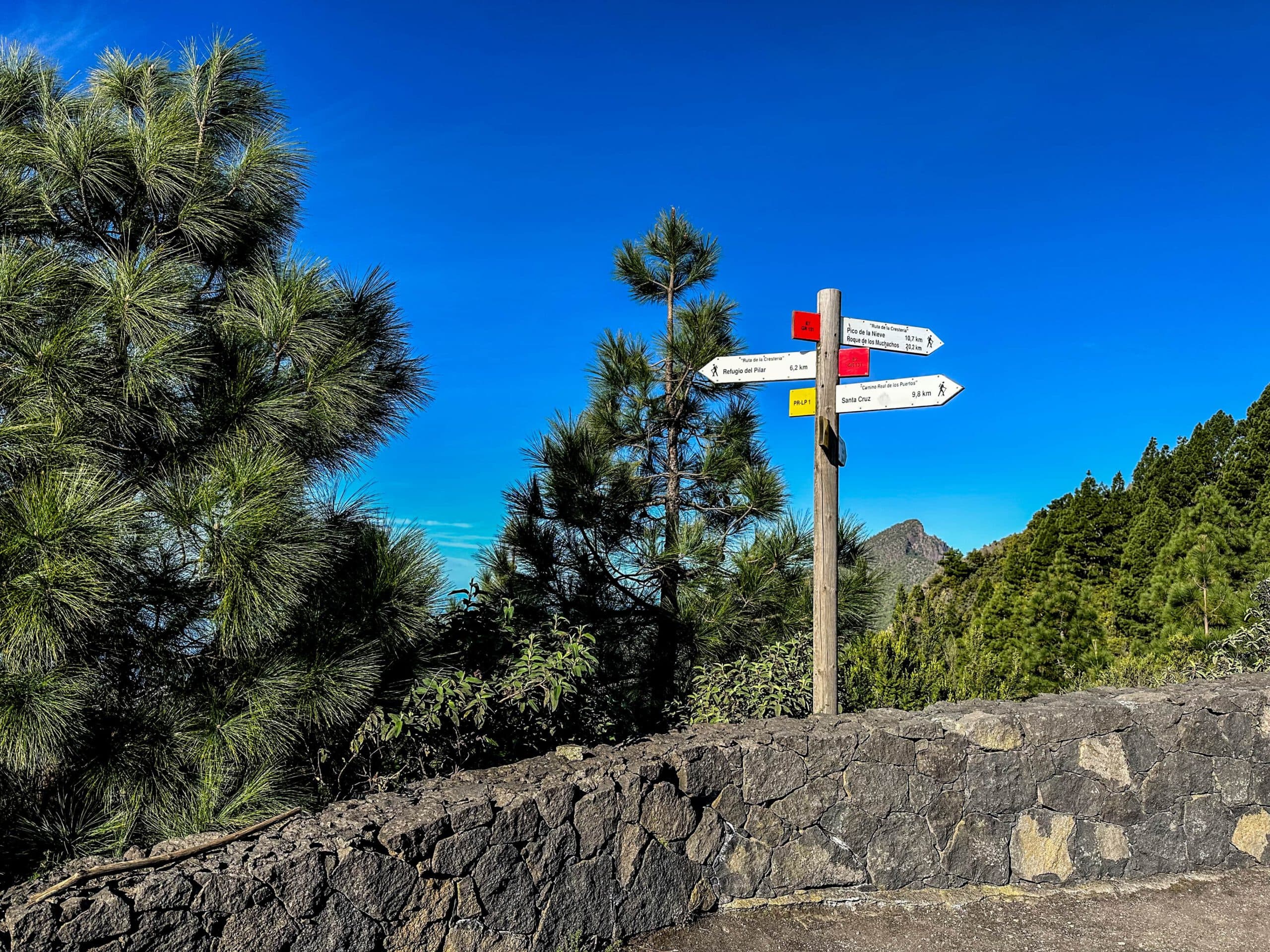
Signposting on the Cumbre
Time
I don’t like to give general times for hiking tours, as the times are very individual. The hike from El Paso up to the Refugio Punta de Los Roques and back took me 6.5 hours. On another tour, where I started on the Cumbre, it took me 6 hours to walk via the Refugio Punta de los Roques to the Pico de la Nieve and back. If you are only going one way, you should allow about 4.5 hours according to these times.
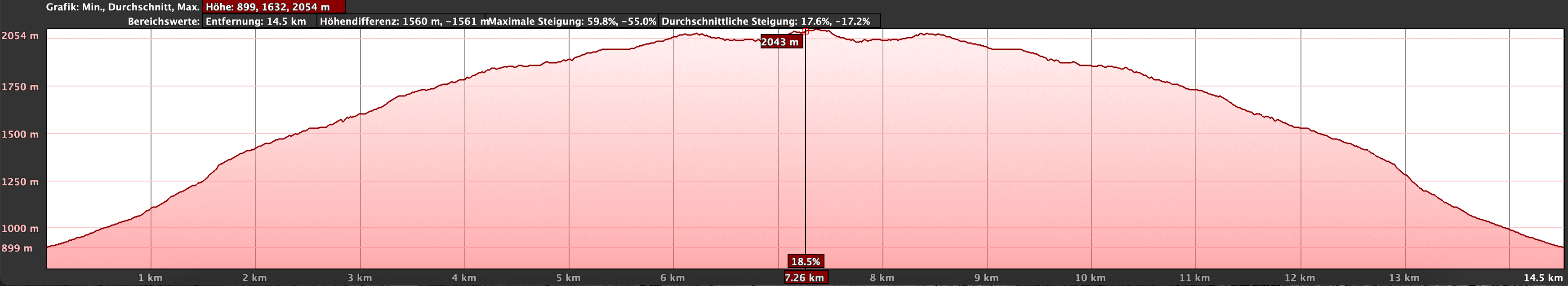
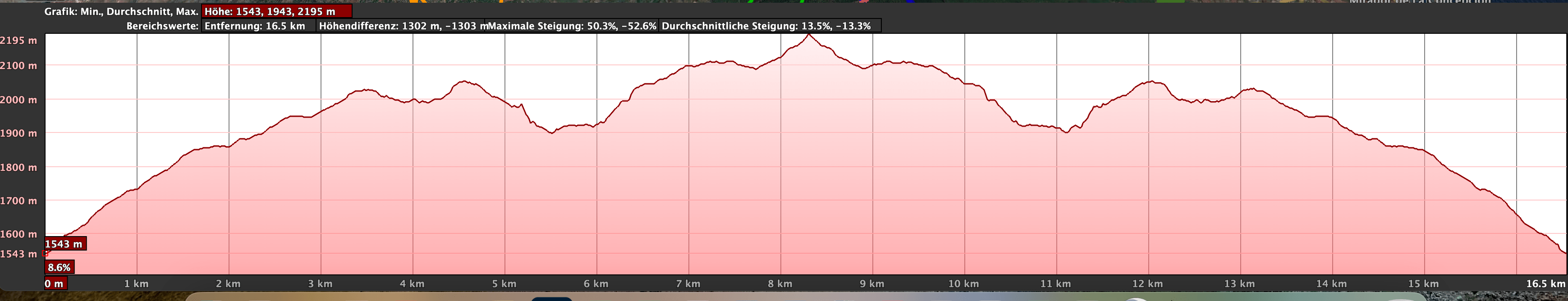
Altitude profile of the hike El Paso Ermita to Refugio Punta de Los Roques and back
Altitude difference and route length
The difference in altitude on the tour from El Paso to Refugio Punta de Los Roques is approx. 1250 metres. The route is about 16 kilometres long (outward and return). When starting from Cumbre to Pico de la Nieve, there are about 1,100 metres of altitude difference. This route is just under 19 kilometres long (outward and return). The total distance would be about 32 kilometres (outward and return) or about 16 kilometres from El Paso to Pico de la Nieve (one way). The pure difference in altitude from the Ermita to Pico de la Nieve is about 1300 metres. Another 300 metres in altitude are added by going up and down the path.
Altitude profile Cumbre - Refugio Punta de Los Roques - Pico de la Nieve and back
Requirement
You hike on relatively good hiking trails the entire time. Nevertheless, a little sure-footedness and a head for heights are required in some places. Because of the length of the tour and the many metres in altitude, a good level of fitness is an absolute prerequisite.
View from the Refugio Punta de Los Roques to the Bejenado, the Caldera de Taburiente and the Valley
Refreshment
Restaurants, bars and shops can only be found in El Paso. I also saw water bottles at Refugio Punta de Los Roques. But I don’t know if the water is for public use or if the water bottles are always there. Therefore, please take enough water with you for the hike.
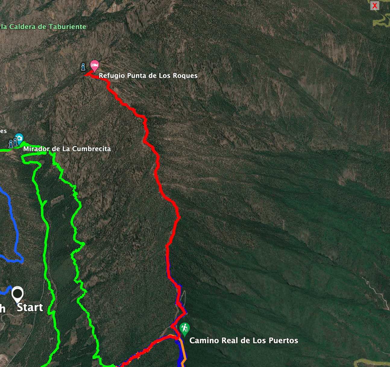
Track El Paso - Refugio de Los Roques
Variants
You can vary this tour according to your needs. For the tour described here, I climbed from El Paso to the Refugio Punta de Los Roques. Another time I started the tour on the Cumbre. I have also started at the Area Recreativa El Pilar. So there are many possibilities.
I have always done my tours with an outward and return route. Of course, you can also do all the tours on the Cumbre as a one-way tour, either descending or ascending. For the section described here, you can take a taxi to the lower car park at Pico de la Nieve and then descend to El Paso or, alternatively, to Area Recreativa El Pinar. However, you can also hike up from El Paso or from El Pinar and be picked up at Pico de la Nieve. For long-distance hikers who want to walk the entire Cumbre, there is of course also the possibility of spending the night at the Refugio Punta de Los Roques. I have already mentioned the connecting hike from Pico de la Nieve to the Roques de Los Muchachos above. And now enjoy the description of the hike. 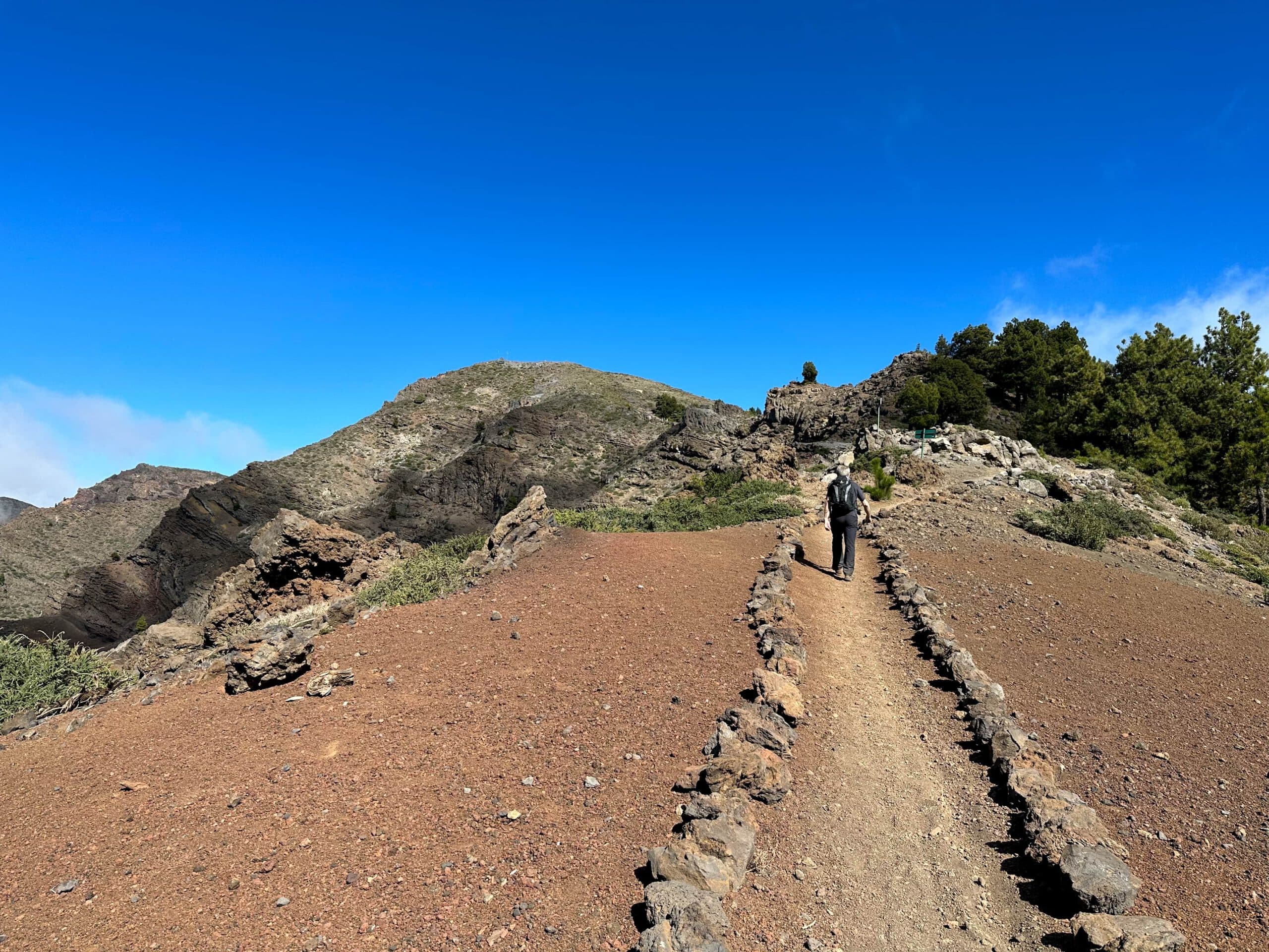
Hiking trail below Pico de la Nieve
Hike El Paso Ermita de la Virgin del Pino via Refugio Punta de Los Roques to Pico de la Nieve
Section Ermita de la Virgin del Pino to Reventón Pass
You start the hike at Calle Ermita Virgin del Pino at an altitude of approx. 840 metres and first walk in the direction of the small chapel. Behind the church, the actual ascent path begins through the pine forest (PR LP 1, marked in white and yellow) towards Cumbre Nueva. At first, the Cumbre Nueva and La Cumbrecita paths are identical. But then, after a short time, a wide path branches off down to the left. It is bordered with stones and signposted to La Cumbrecita. Article summary and large selection of GPS hiking tracks
Sign up for my newsletter now and get exclusive access to my collected GPS tracks as well as all the brief information about my articles.
Sign up now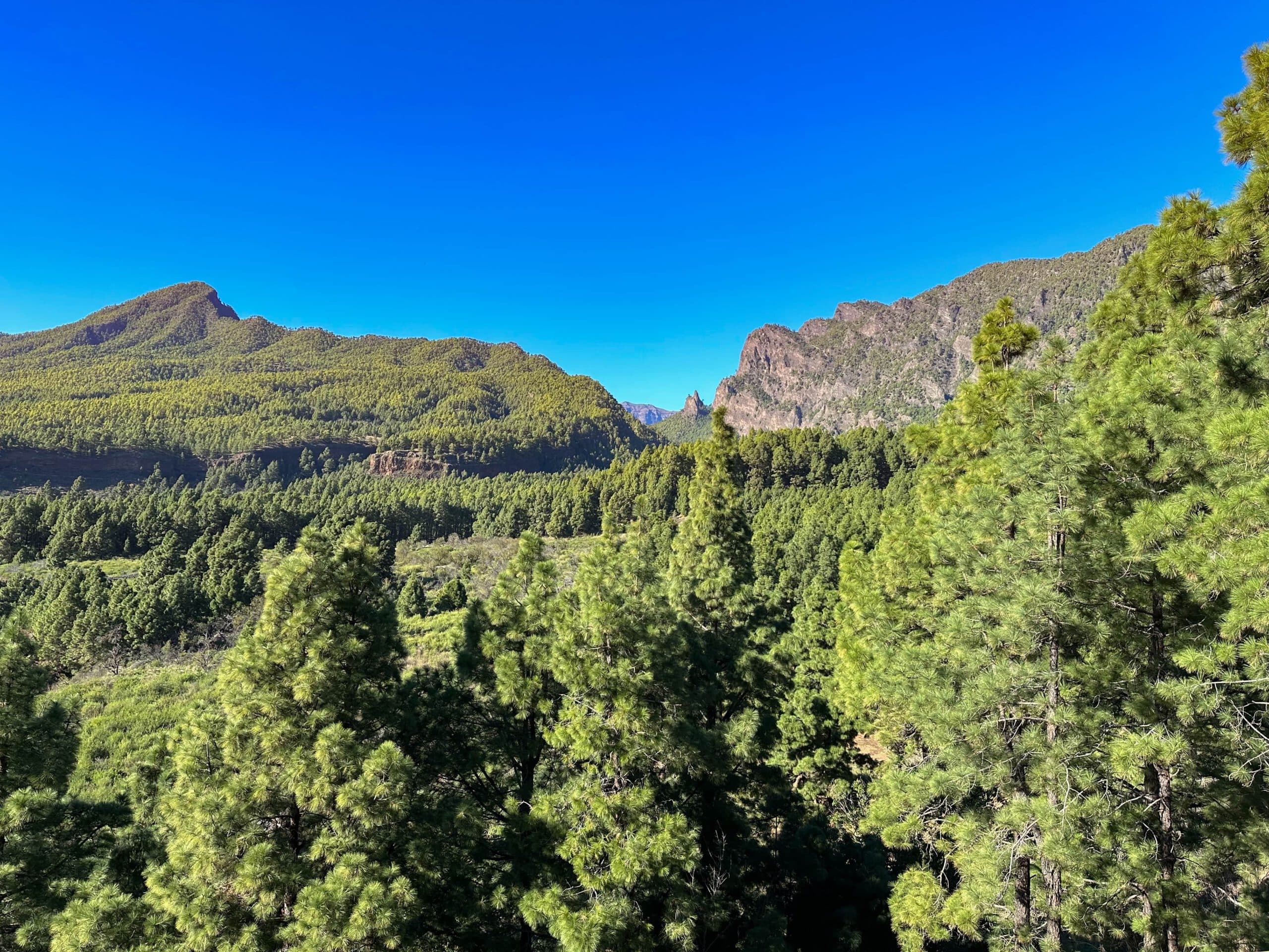
View of the Bejenado, the Cumbrecita and Los Roques
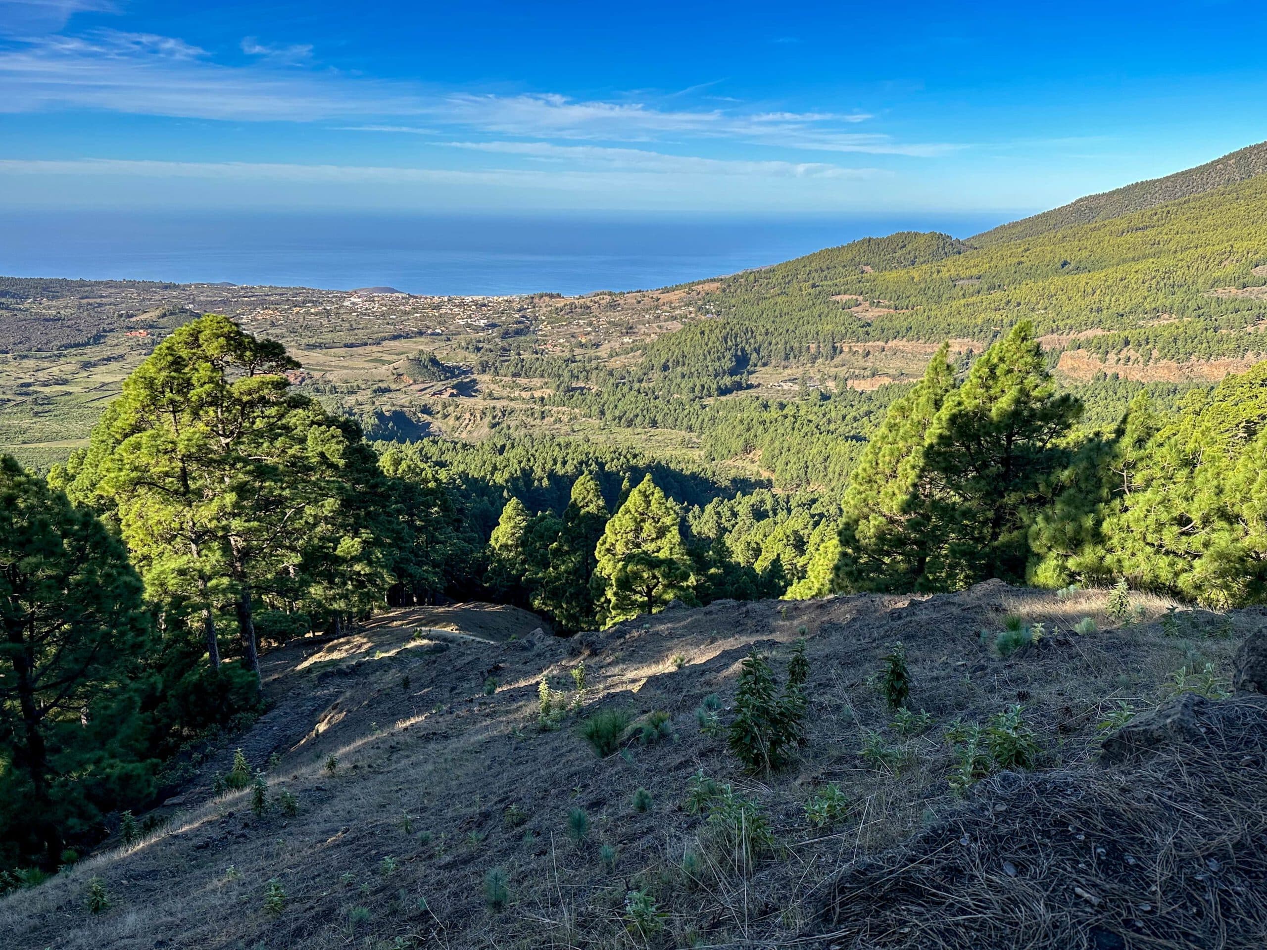
However, you continue to hike somewhat steeply uphill straight ahead. After a short while you will reach the steep face. From now on, the path continues uphill through the steep face, at first in wide and later in sometimes narrow serpentines. Looking back, you can already enjoy beautiful views of the entire Aridane valley and also of the Cumbrecita. The ascent to the Reventón Pass at 1416 metres altitude is strenuous and steep. But the views from the slope down to the other side of the island make up for it. You are now on the Pista de Hillera de la Cumbre. There is a watering place and hiking information here.
Ascent path above the Ermita with a view of the Aridane valley
Reventón Pass section to end of Hillera de la Cumbre slope
If you want to walk the entire section to Pico de la Nieve and back, and don’t want to spend the night at Refugio Punta de Los Roques, it might be a good idea to take the Pista de Hillera de la Cumbre to here and possibly a little further. Then your hike can start here. However, it is better to use an all-terrain vehicle to drive along the track. The track is currently being worked on (as of December 2022), so that all vehicles will probably be able to drive there in the future.
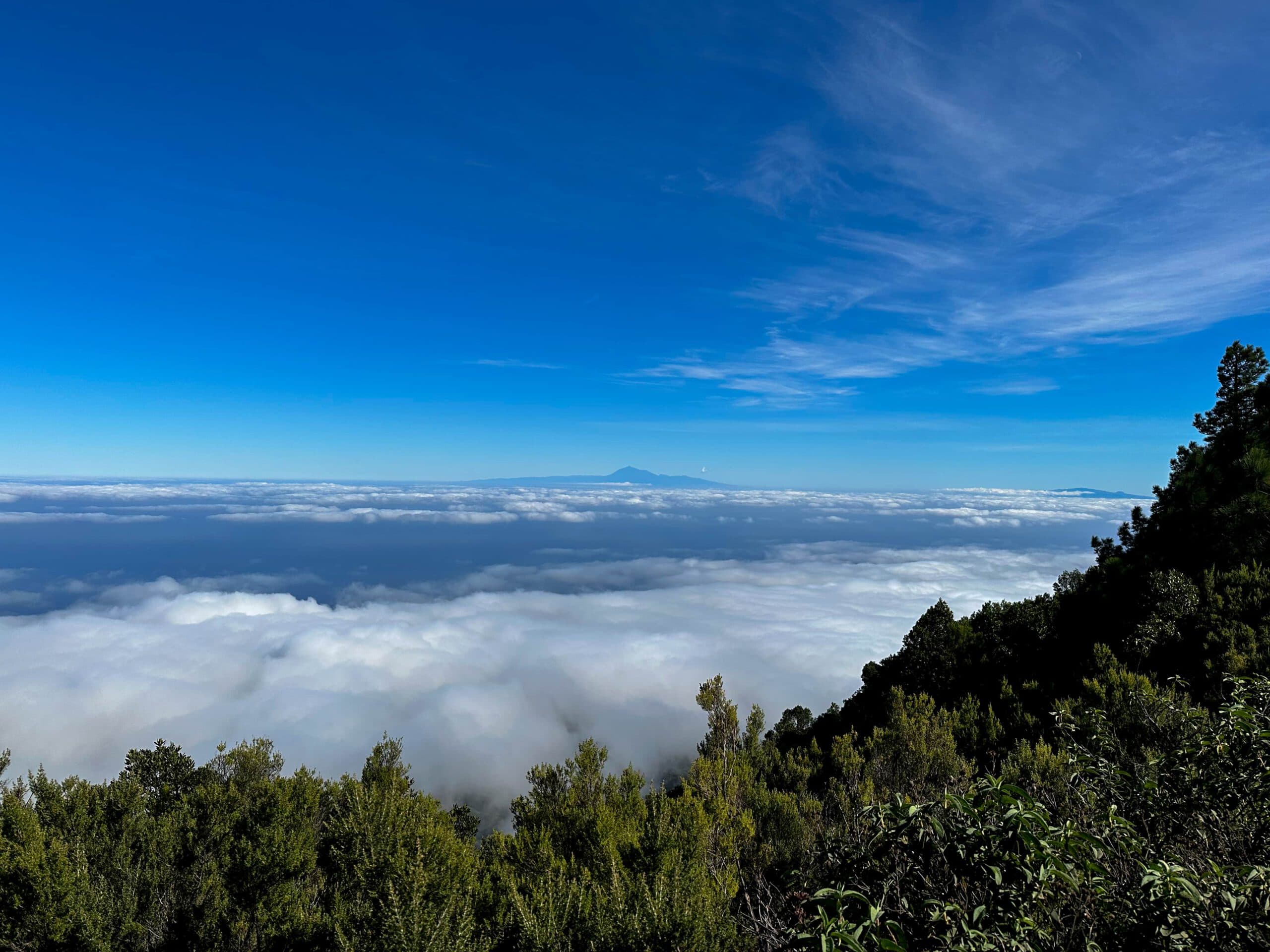
View above the clouds to Tenerife and La Gomera
And however, you can already get to Area Recreativa El Pilar with any vehicle or even a taxi. From the Reventón Pass, follow the track to the left on the signposted GR 131 hiking trail towards Pico de la Nieve. First you walk for a while on the wide track. Then you climb steeply up steps and cross the forest. You will get back to the track, which you follow. After a short while, however, the track turns into a steeper small path.
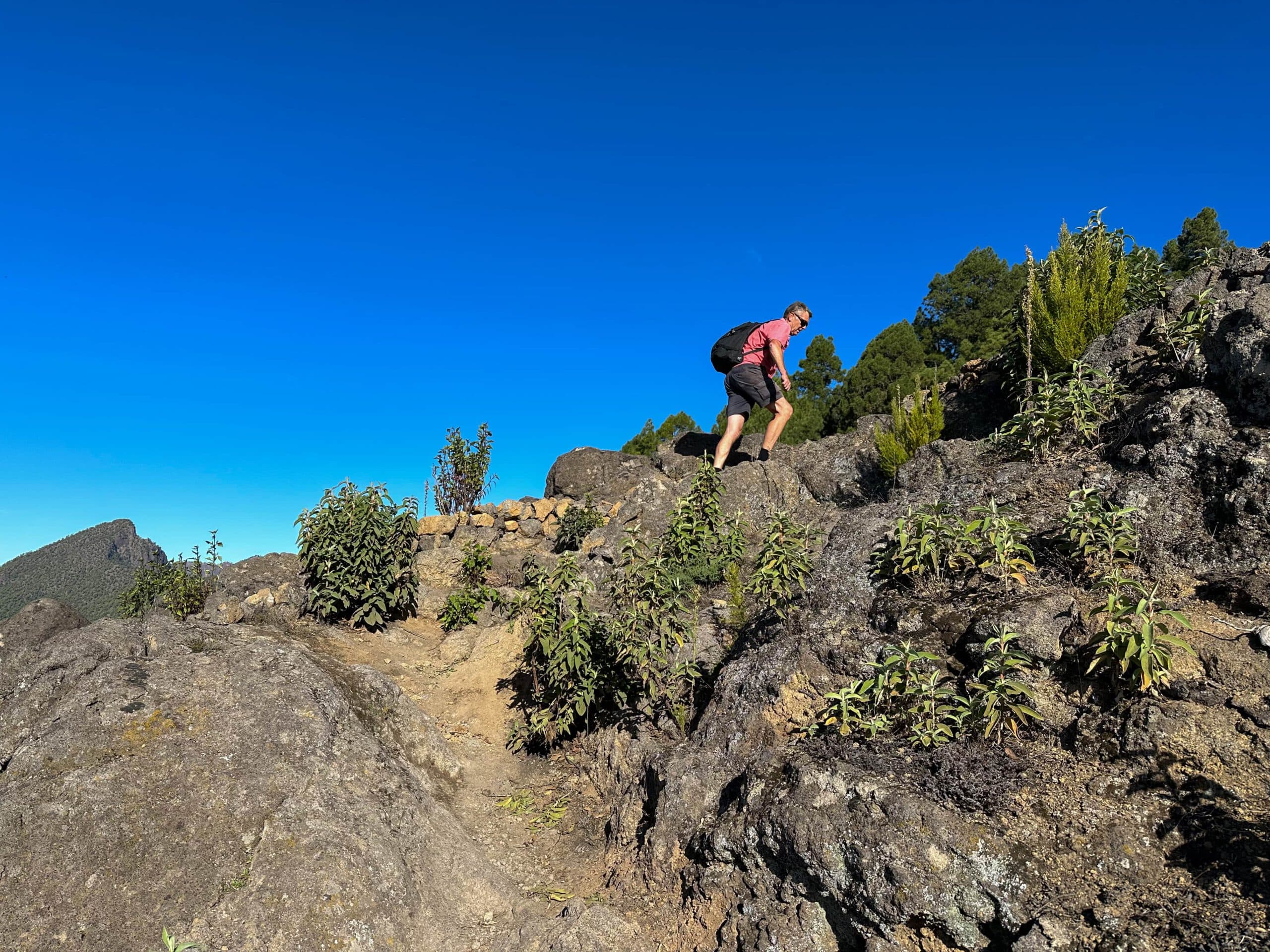
Hiker on the path on the Cumbre
Route section End of Hillera de la Cumbre slope to Refugio Punta de Los Roques
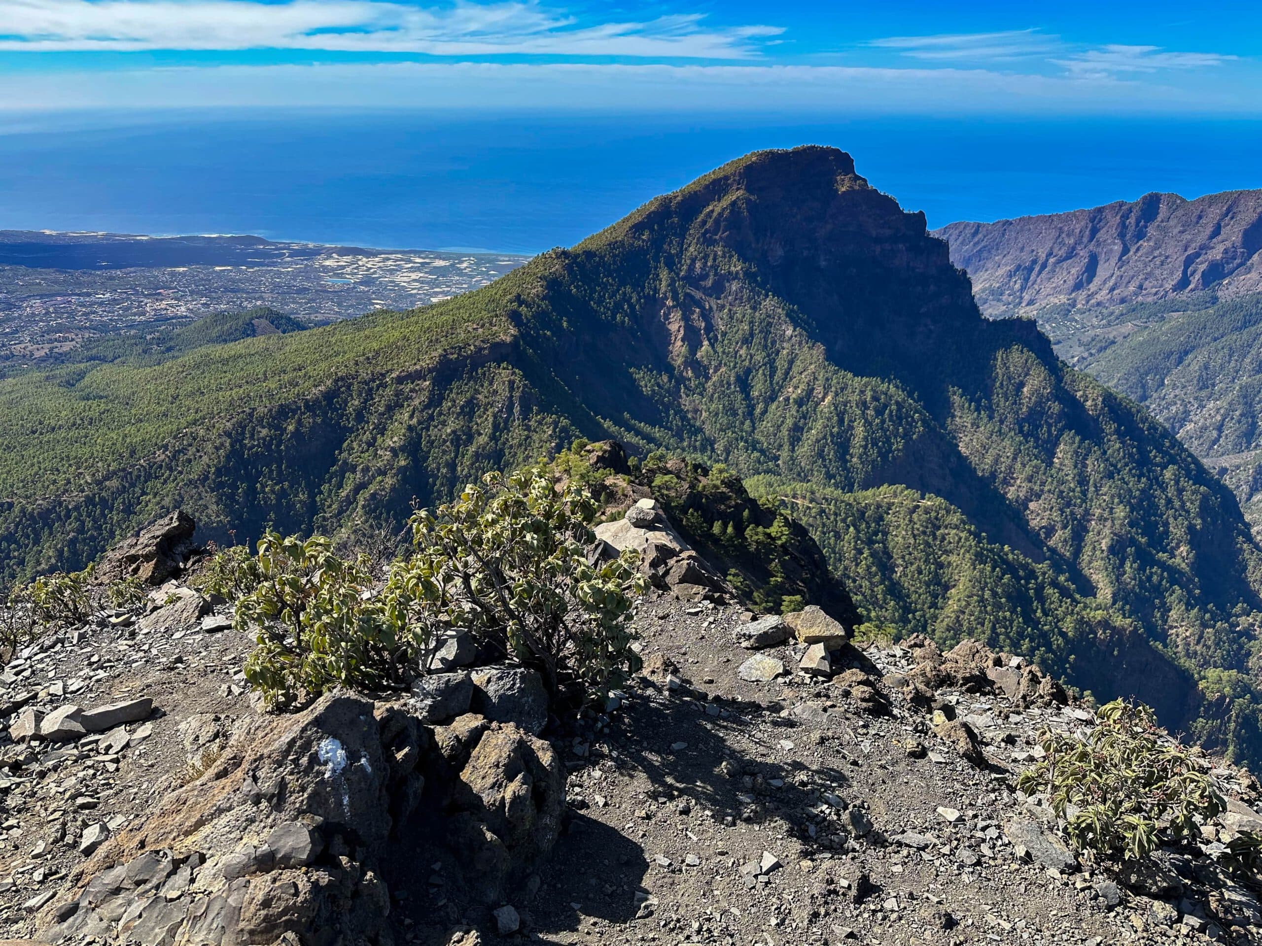
The trail continues along the ridge with beautiful views on both sides. You will pass the Risco de la Perra. At 1854 metres you will reach Pico Ovejas and about 200 metres further, at 2044 metres, Pico Corralejo. From Pico Corralejo, the path descends slightly and then a little more. After a while, you will see the Refugio Punta de los Roques in the distance, leaning high up against a rock face. On your way, you will hike along a larger rock face for a long time, and after a while you will also descend a little.
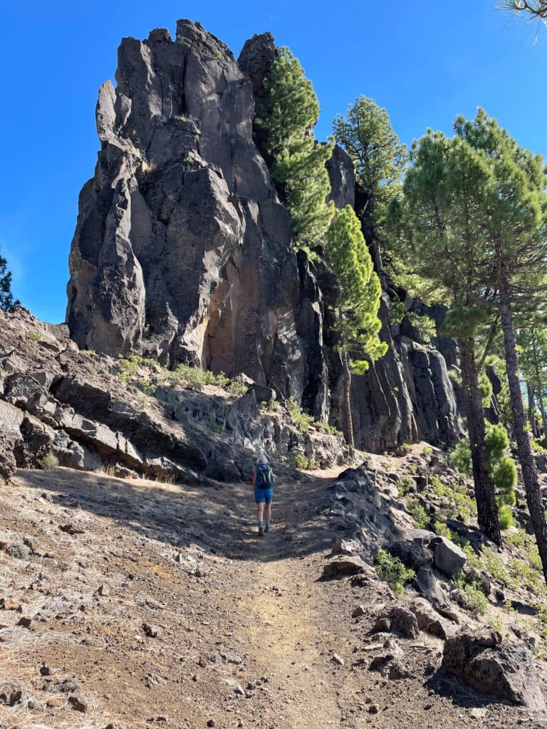
Hiking trail under Refugio Punta de Los Roques in front of the rock face
Afterwards, you will climb up again in long serpentines to the Refugio Punta de Los Roques. If you don’t want to stay overnight, this is the ideal place for a rest with fantastic views. Deep below you are the Aridane valley and the Cumbrecita, as well as the Caldera de Taburiente with its surrounding slopes. The impressions up here at around 2000 metres altitude with fantastic views are simply indescribable.
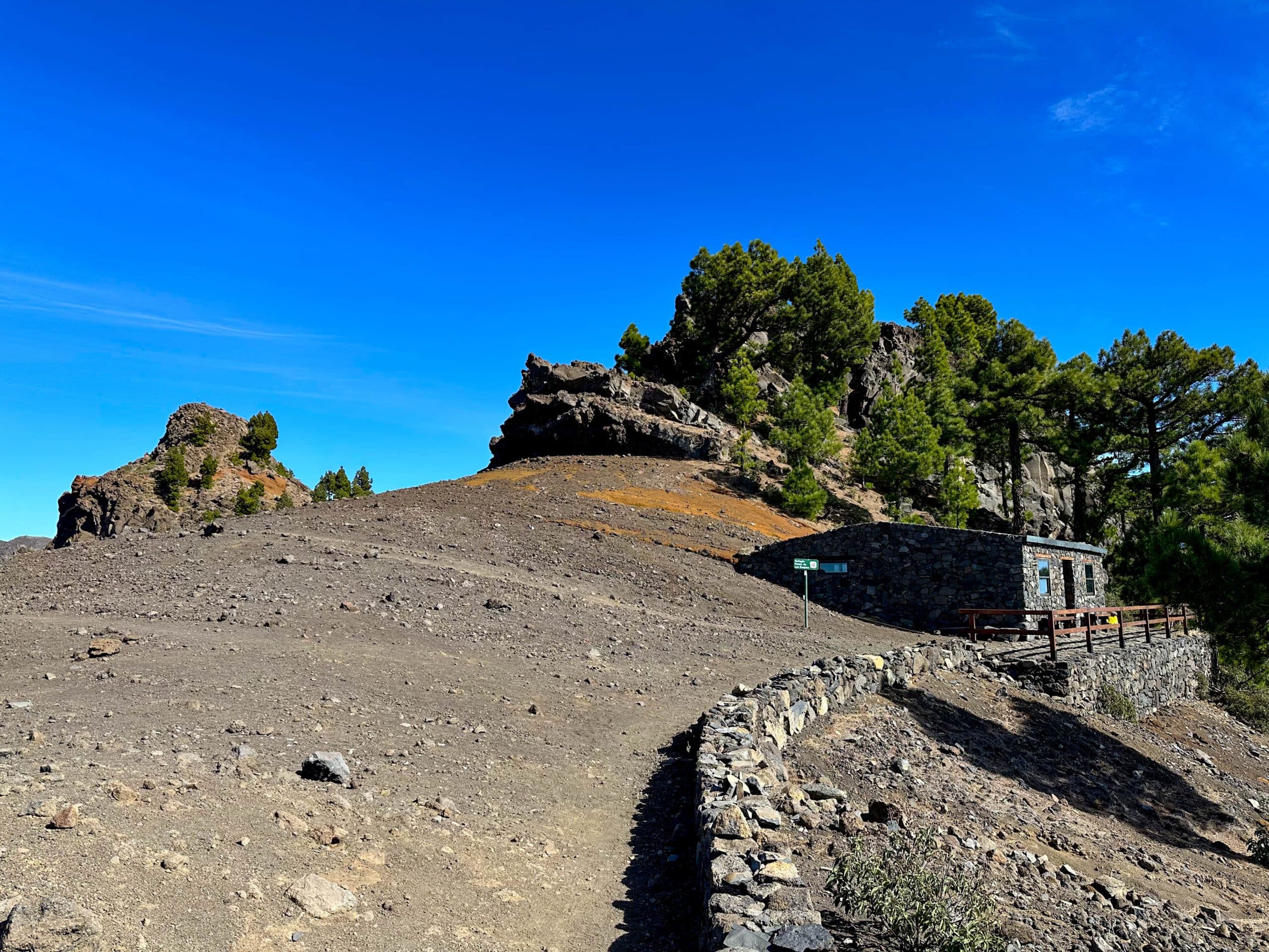
Refugio Punta de Los Roques
Route section Refugio Punta de Los Roques to Pico de La Nieve
From the Refugio Punta de Los Roques you hike a little around the corner, so to speak, towards the northeast. You go up to a small hill. Then you hike down from 2000 metres to about 1800 metres. You cross a large and impressive barranco on the side of the slope. At first it is a leisurely descent, then steep serpentines along jagged rocks. Then you hike back up to the next hill, Pico de La Sabina at 2142 metres altitude. As you always walk close to the ridge, you have great views into and over the Caldera de Taburiente from the viewpoints.
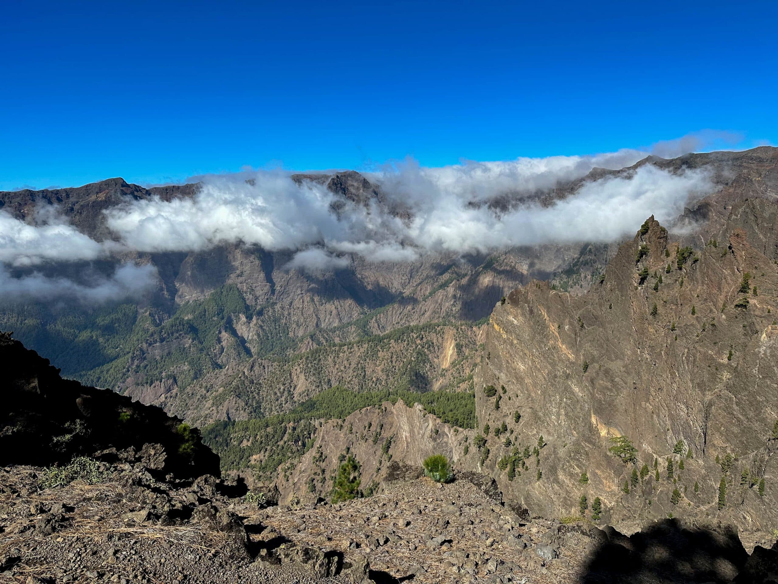
View into the Caldera de Taburiente
You keep walking close to the ridge. At times, the path leads you around and along other peaks. Finally, the path descends a little, crosses a barren plain, and then climbs towards Pico de la Nieve. I walked up to about 2,200 metres in altitude just below the summit of Pico de la Nieve. There my connecting path to the Roques de Los Muchachos began. Now you can also continue – or go back. Or perhaps it would be better to drive? 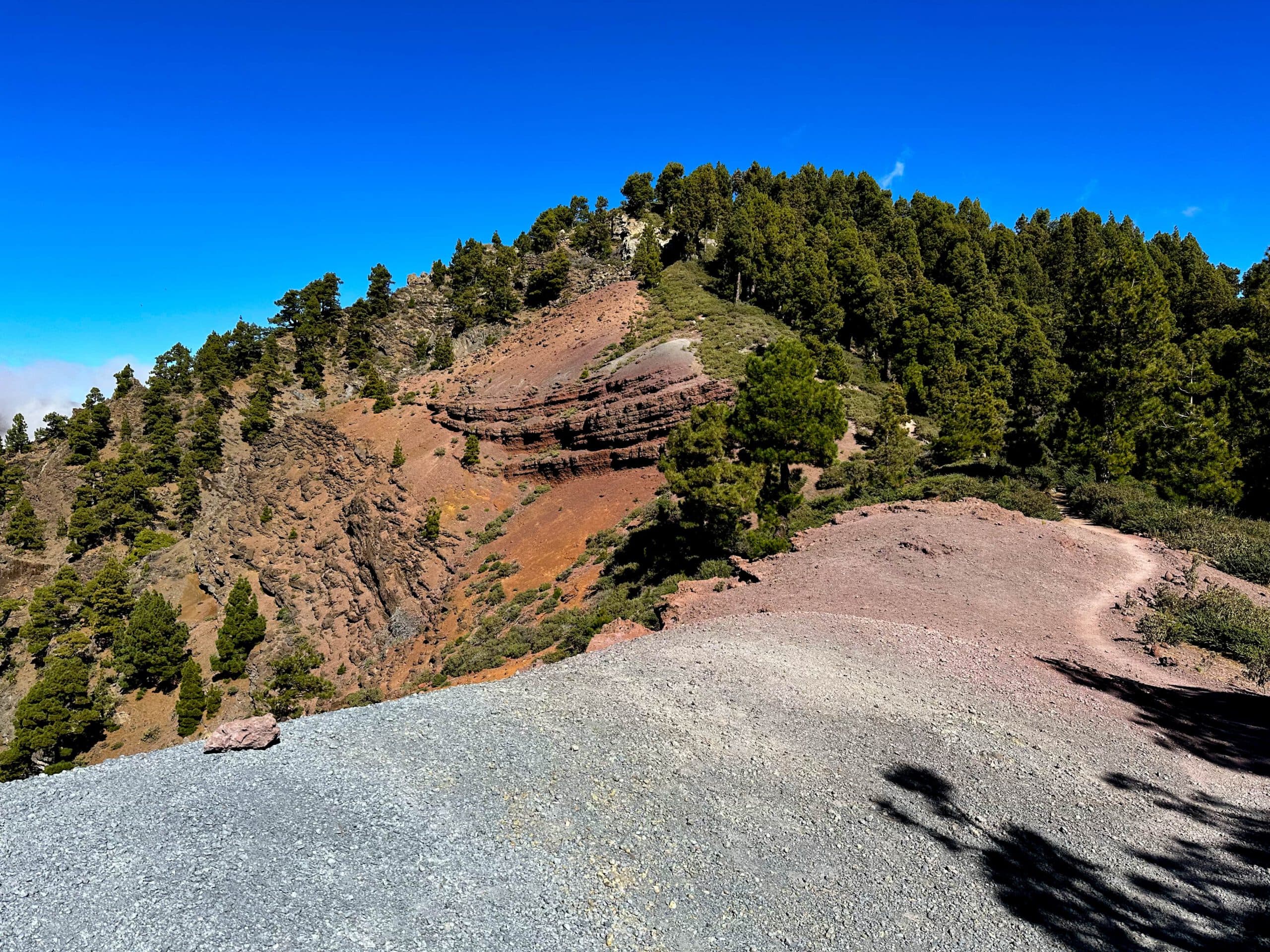
Hiking trail between Refugio Punta de Los Roques and Pico de La Nieve
And finally
I hope you enjoyed this further section on the Cumbre of La Palma. And I myself really enjoy walking up there above the clouds with a view of beautiful nature and the neighbouring islands. So I wish you lots of fun on all your hikes,
Dagmar from Siebeninseln
View from the hiking trail to the path along the ridge