In this article, I’ll describe the 5th stage of the long-distance hiking trail GR-132 from Valle Gran Rey to Playa Rajita. On the small Canary Island of La Gomera, there are the long-distance hiking trails GR-131 and GR-132. While the GR-131 runs through the heights of the island, the GR-132 trail meanders up and down along the coast, more or less parallel to the numerous ravines. I’ve described my hike on the GR-131 from San Sebastian over the heights of La Gomera to Valle Gran Rey here. On my first attempt to circumnavigate the island, I walked around the island’s left side and already described Stage 8, San Sebastian – Playa Santiago, on SiebenInseln.
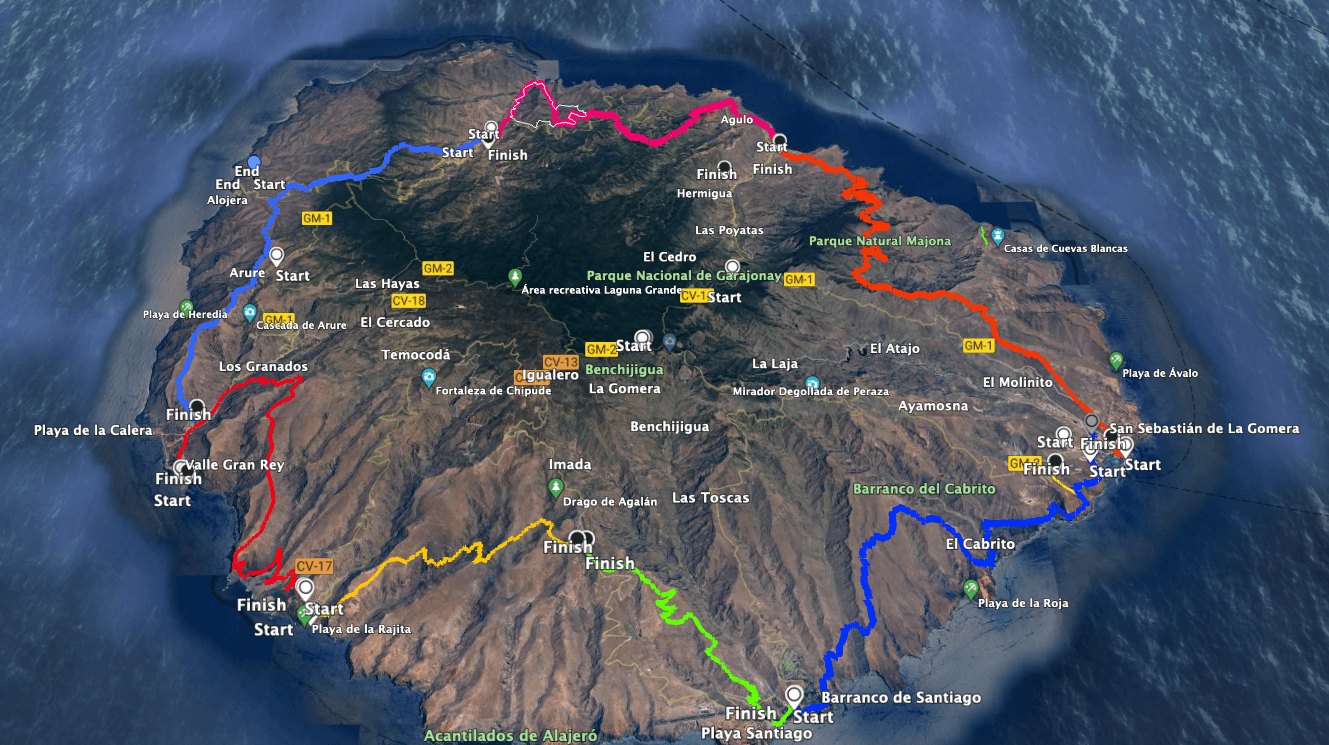
Map
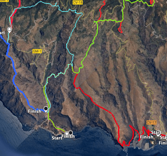
Track of the island hike with all stages
I’ve described the first stage from San Sebastian to Hermigua here. You can find the 2nd stage from Hermigua to Vallehermoso here. Stages 3 and 4 from Vallehermoso to Valle Gran Rey can be found here.
And now, as a „reminder,“ here are all the stages:
The long-distance hiking trail GR-132 is divided into the following officially signposted stages:
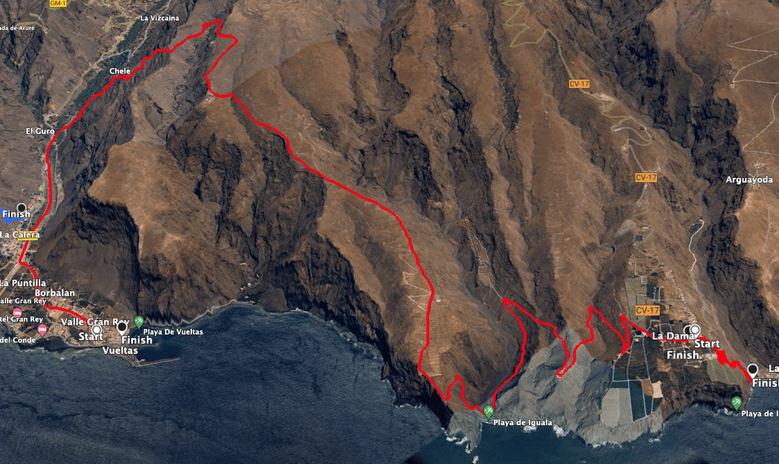
Track of the hike on the GR-132 stage 5 from Valle Gran Rey to La Rajita
General information about the GR-132 Stage 5 hike – Valle Gran Rey to Playa Rajita
Starting Point and Access
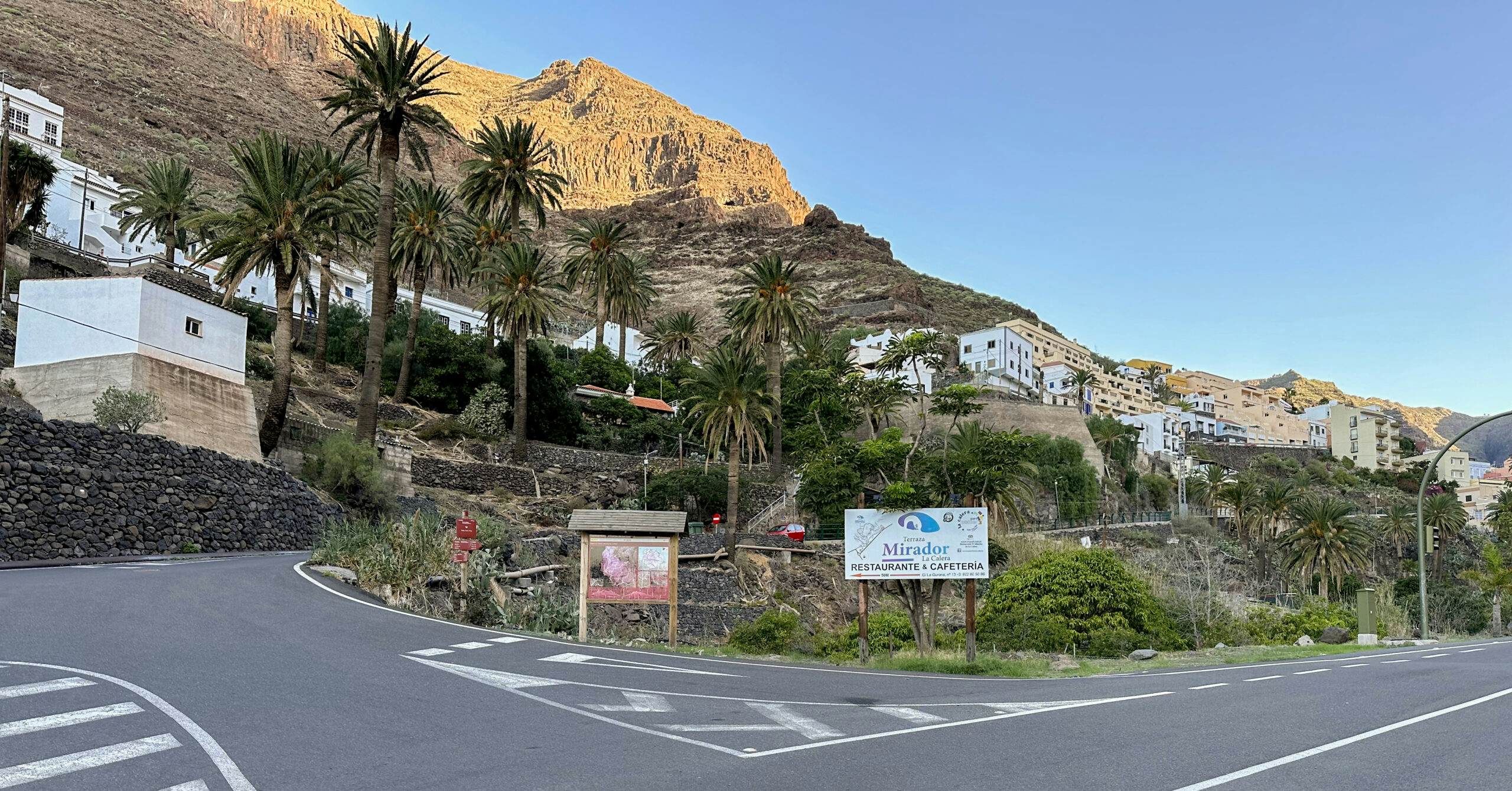
You start your hike in Valle Gran Rey. My track starts in the Vúeltas district because we found accommodation there for the night. But wherever you are in Valle Gran Rey, the actual hike starts on the GM-1, the Carretera General Valle Gran Rey near the Calera district.
Starting point of the hike in Valle Gran Rey on the GM-1 near the Calera district
Access by car
You can reach Valle Gran Rey via the main island road GM-1.
Article summary and large selection of GPS hiking tracks
Sign up for my newsletter now and get exclusive access to my collected GPS tracks as well as all the brief information about my articles.
Bus line 1 operates between San Sebastian and Valle Gran Rey. For more information, visit the website here.
Time
I’m hesitant to give time estimates since hiking is quite individual. For this section, we needed 9 hours with several long breaks.
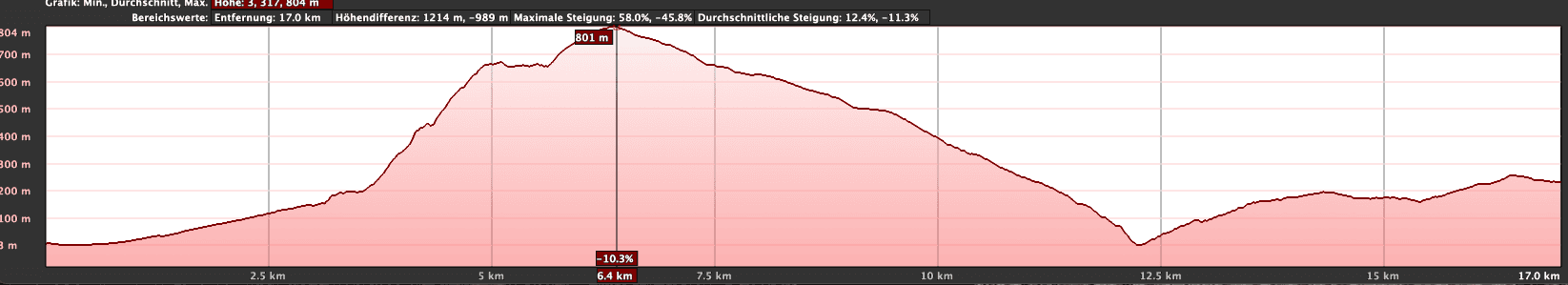
Elevation profile of the hike on the GR-132 stage 5 from Valle Gran Rey to La Dama
Elevation Change and Distance
The route is a little over 22 kilometers long, with just over 1100 meters of elevation gain.
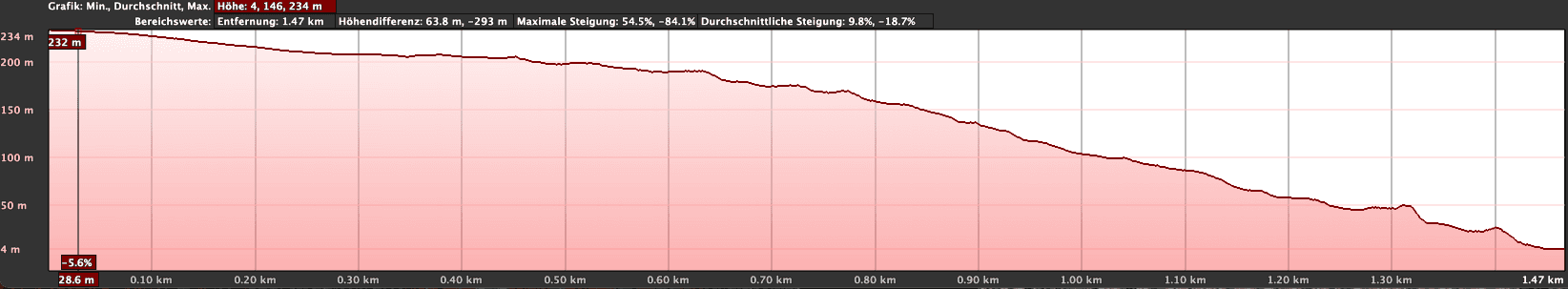
Elevation profile of the GR-132 stage 5 hike from La Dama to Playa La Rajita
Difficulty
You’ll be hiking on a well-maintained long-distance trail, where only a few spots require a head for heights and good surefootedness. However, due to the distance and elevation gain, good physical condition is essential.
This section is the most remote part of the entire circumnavigation of La Gomera. You’ll arrive at La Dama shortly before Playa Rajita at the end of the stage. If you can’t find accommodation there, be prepared to sleep outdoors. (See also under the section Refreshment). Therefore, items such as a sleeping bag, mat, lamp, and suitable clothing are essential to carry.
This naturally includes water and sufficient provisions for 1.5-2 days (Valle Gran Rey to Alojeró).
Refreshment
There are bars and restaurants only at the starting point in Valle Gran Rey. Along the way, you’ll ultimately only find a bar in La Dama, which may also be closed from time to time. When we arrived there on Christmas Day, the restaurant was closed, so we could only request water from helpful residents in La Dama. Therefore, take as much water as possible with you on this section. Otherwise, in La Dama, you have the option to ask residents for water for a small fee.
You should also have sufficient provisions with you. This was the only stage where we couldn’t find accommodation and slept in sleeping bags on the beach of Rajita. There is apparently accommodation in La Dama, but it’s often booked well in advance. If you’ve found accommodation, that’s great. Otherwise, be prepared to sleep on the beach on this section if you don’t want to. If you don’t want that, you should avoid this remote stage.
Track red GR-132,
Track green: island crossing GR-131
Track light blue: large Valle Gran Rey loop
All in a row from Valle Gran Rey to Degollada de Cerrillal
Variants
As a variant, I can only offer you the reverse direction for this lonely section.
You start your hike on GR-132 Stage 5 at the GM-1, Carretera General Valle Gran Rey (roundabout in the Calera district). From here, you walk along the road for a while on the signposted hiking trail upstream towards the El Guro district. After about 10-15 minutes, a small path, Camino los Reyes, branches off to the right into a palm grove. Follow this path, cross a path, and continue uphill to the rock wall. Along the rock wall, the path leads you left to a small chapel, the idyllic Ermita de los Reyes. The path continues along the rock wall even after Ermita de los Reyes.
View back from the ascent path into the Valle Gran Rey
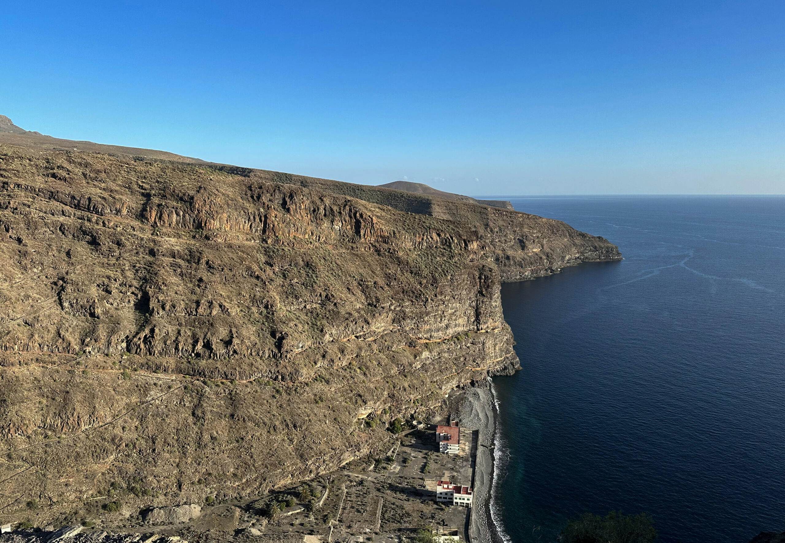
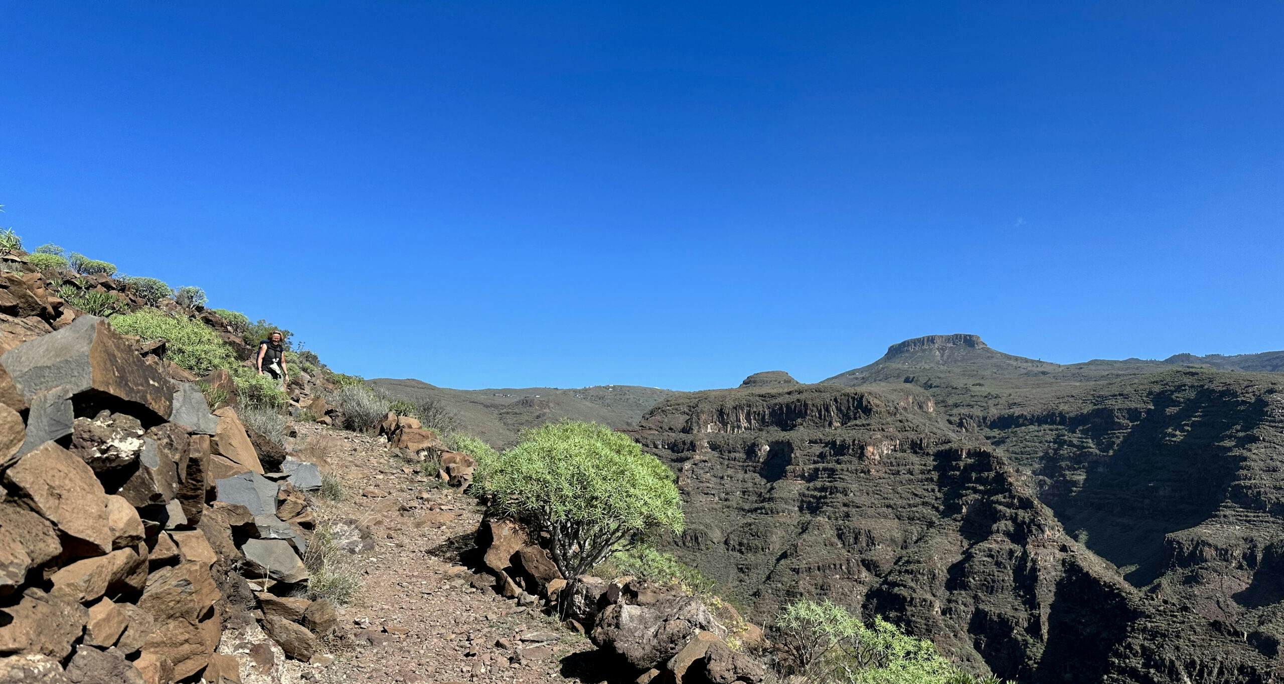
Then the red and white marked hiking trail GR-132 branches off to the right. This path leads you steeply uphill in numerous small switchbacks, first on the right and then on the left side of the slope. After some time, the path forks again. Continue to follow the GR-132 to the right up the mountain. Initially, the path runs along a barranco groove, then it goes uphill on rocky narrow paths along the ridge for a while. Your good condition is needed here. At 660 meters altitude, you reach the ridge, Degollada del Cerillal. The hard climb is rewarded with a wonderful view in all directions.
La Gomera – Degollada del Cerrillal
Route Section Degollada de Cerillal to Cliff Path behind Gerían
At the Degollada de Cerillal, the path forks. Continue to the left on the red and white marked main path GR-132. The path leads you gently downhill into the Barranco de Argaga. Before going uphill again on the opposite side of the Barranco, you cross the watercourse. Then you climb steeply up to a fork in the path at a water channel. To the left leads towards El Cercado (see Great Valle Gran Rey Hike). However, you continue to the right above the canal. After some time, you can see the Ermita de Gerían below to your right. Shortly afterward, you reach another fork. To the left, a track leads uphill to Chipude (see hike on GR-131).
Hiking trail through the small village of Gerián
However, you continue to the right on the excellent hiking trail GR-132 downhill. Below you, you can already see the houses of the small hamlet of Gerían, which you reach shortly. You descend through the village. After this small hamlet, you walk through a barren rocky area on a cliff path parallel to the coast, always slightly downhill. At some points, you have a beautiful view of the sea and the Vueltas harbor in Valle Gran Rey behind you.
Hiking trail GR-132 5th stage towards La Dama
Route Section Cliff Path behind Gerían to Calle Iguala Heights
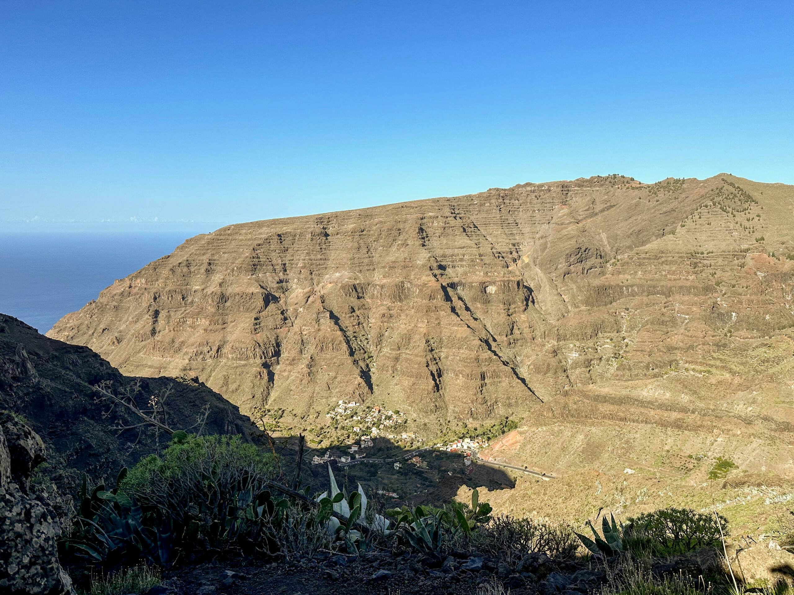
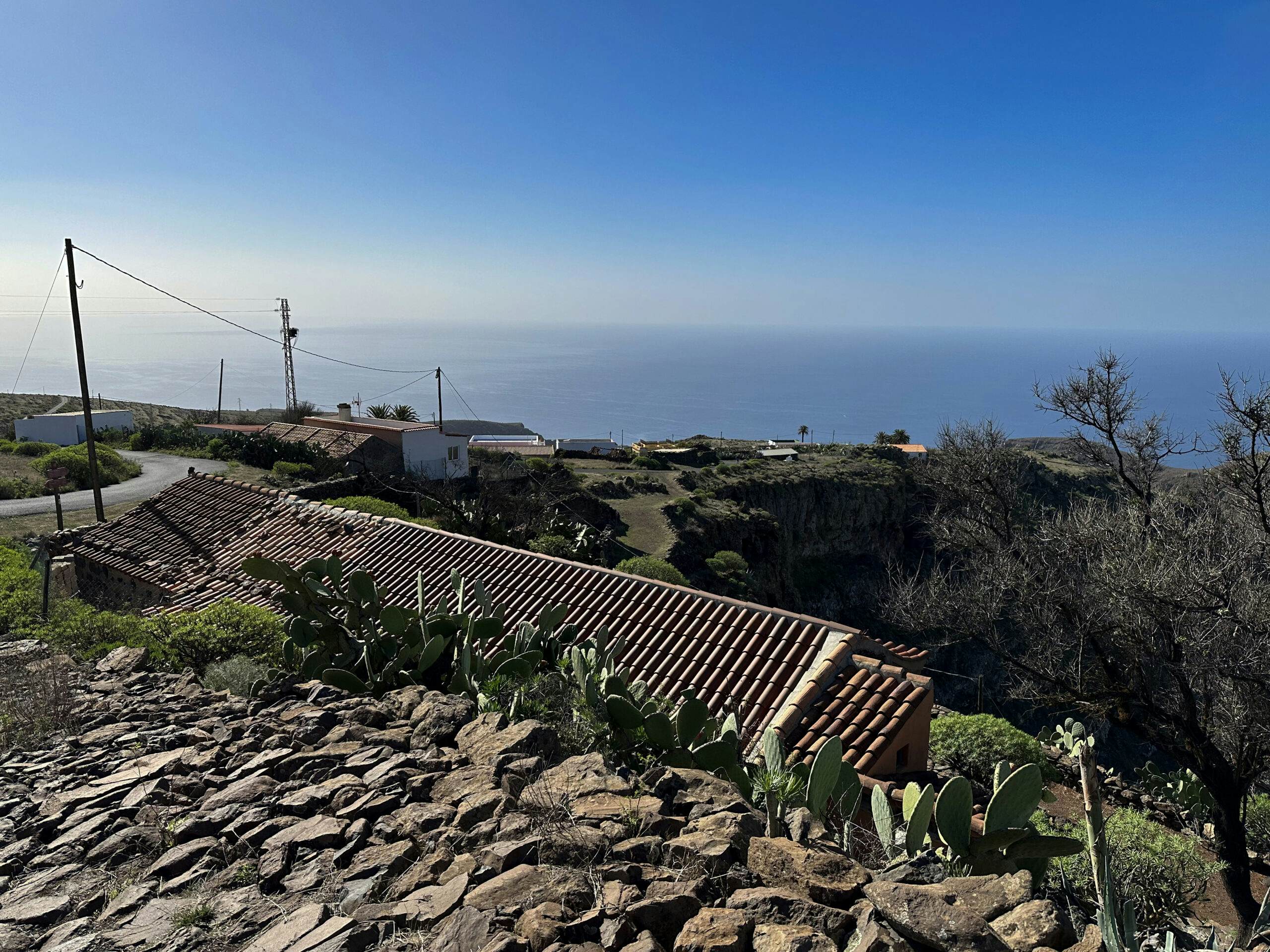
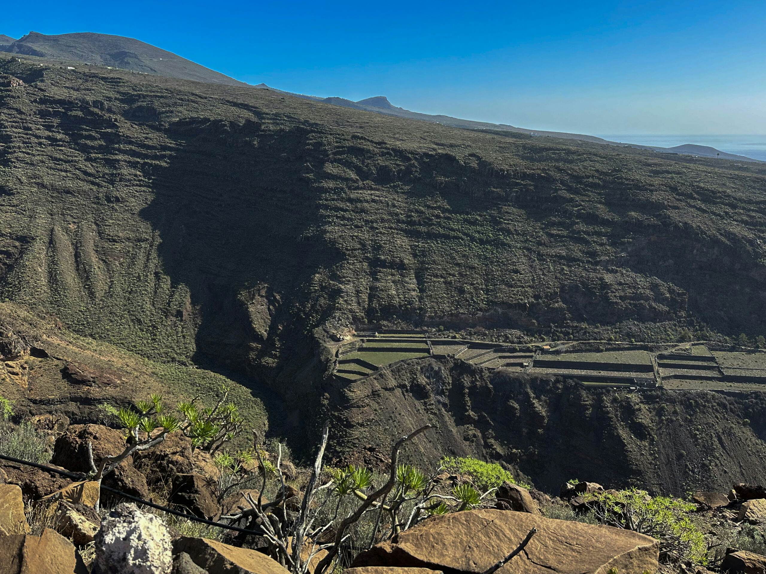
The hiking trail runs parallel to a track, which it meets and cuts several times. Eventually, you pass by some abandoned farmsteads. Then, at the end of the track, you also come across individual inhabited houses. Here, you may possibly get water or even coffee for a small fee. That’s how it was for us, which we were very happy about. After that, the path continues downhill between abandoned terraced fields and banana plantations towards the beach. Eventually, you reach a path along the cliffs at the southwestern point of La Gomera. From here, you can not only look out to the sea but also down into the next ravines and up at the heights behind you.
View from above of the large gorges in front of La Dama and the terraced fields of the village
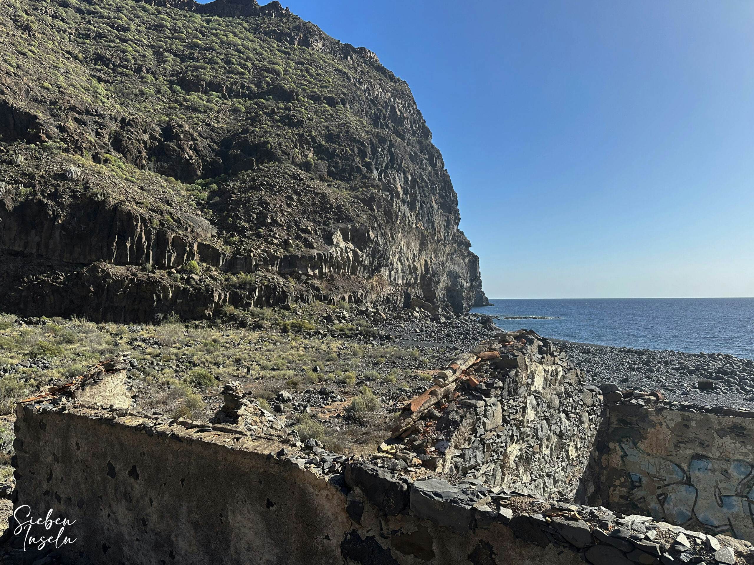
From the height, a path in a large and then many small switchbacks leads you down into the Barranco Iguala. Down at the beach, you come across abandoned ruin buildings. You cross the beach and then climb uphill again on the opposite side on the hiking trail. For a long time, you walk downhill along the cliff wall towards the valley. Ignore a path branching off to the left. Then you reach Calle Iguala, which you now follow uphill to the right for a long time. This takes you to the next ridge.
Hiking trail over the beach in Barranco Iguala with ancient ruins
Route Section Calle Iguala Heights to Playa Rajita
The Calle Iguala then leads you slowly downhill on the other side of the ridge into the Barranco Degollada del Horno. You cross this on the road. Then it’s uphill again on the other side of the mountain. Once at the top, you’re on the outskirts of La Dama, which you’ve seen from a distance several times. After another small climb, you reach the CV-17 road after some time. Simply follow this road straight for a long time. It takes you through the village and through the small town center. If open, you’ll also find a bar on the right here. I stopped my track at this point because we hoped to find accommodation. When that failed, I restarted the track, so you’ll find a long and a short track on GR-132 Stage 5.
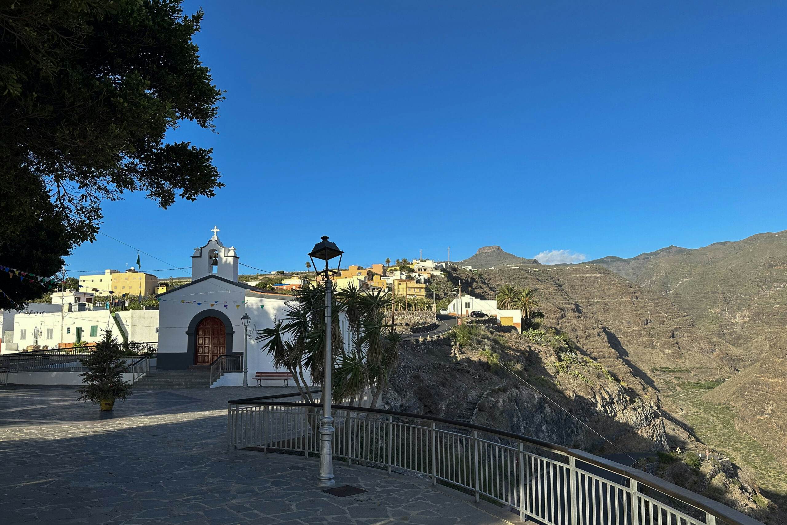
La Dama church square
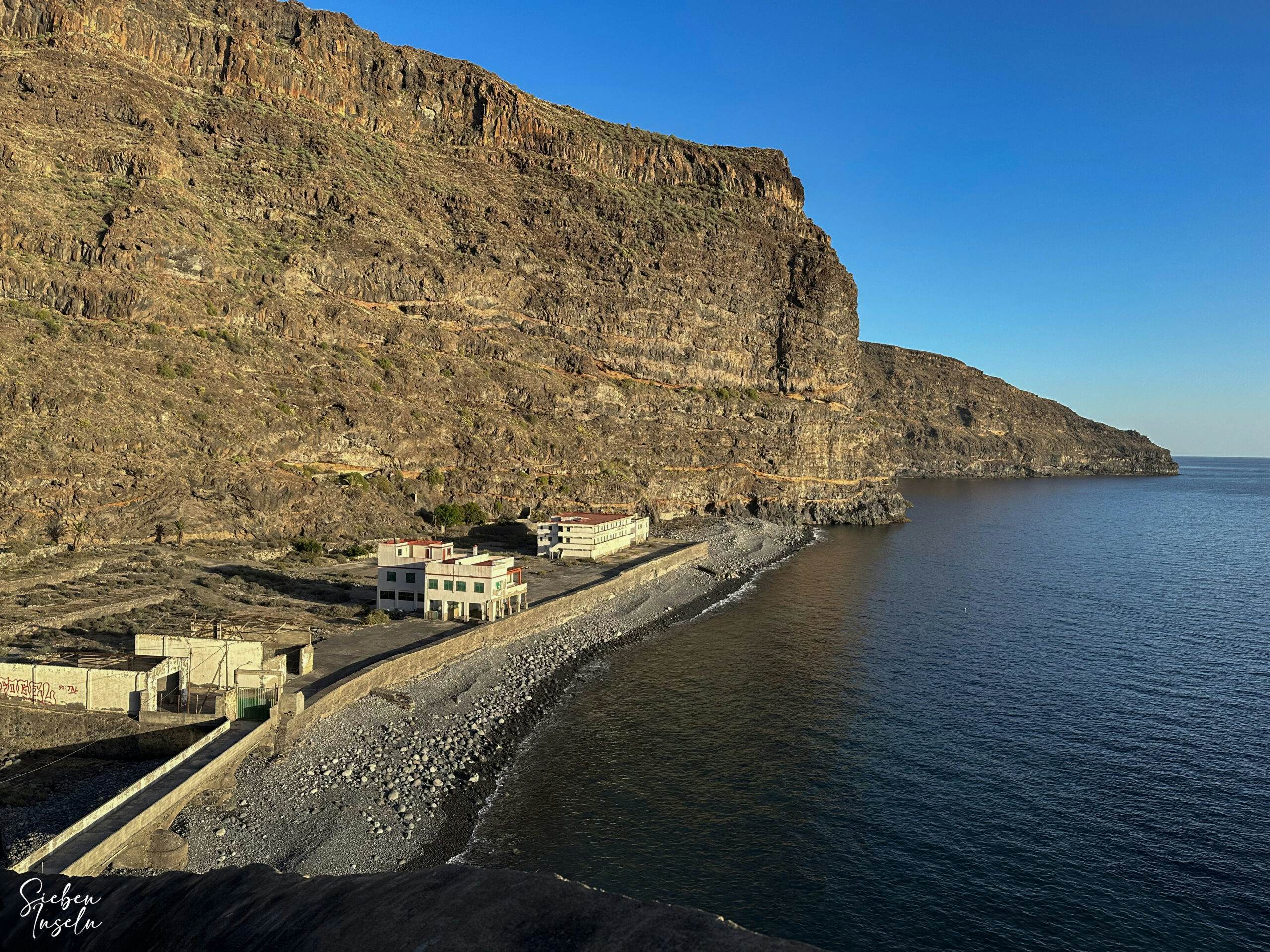
If you continue to follow the CV-17 through the village, you’ll reach the small church with a church square of La Dama. From here, you have a splendid view down to the beach of La Rajita with its abandoned buildings. These ruins are from a former fish processing factory that existed there from 1904 until the 1970s and provided employment for many people from the region. Walk a short distance down the road. After the hairpin bend, shortly after, turn right onto the hiking trail to Playa Rajita. In some steep, rocky switchbacks, this path takes you down to the beach of La Rajita. This is where Stage 5 of GR-132 ends.
View of Playa Rajita from the hiking trail
And finally
I hope you enjoyed the hike on GR-132 Stage 5. If you decide to do it, I wish you luck in finding accommodation in La Dama. Or I wish you good weather and such a wonderfully clear starry sky as I enjoyed on my night at Playa Rajita on Christmas Day. I wish you much joy on all your hikes,
Dagmar from SiebenInseln
Thank you for reading!
If you've found my hiking guides on SiebenInseln helpful for your Canary Islands adventures, please consider leaving a small tip. Your support is greatly appreciated and helps cover the costs of maintaining this blog.