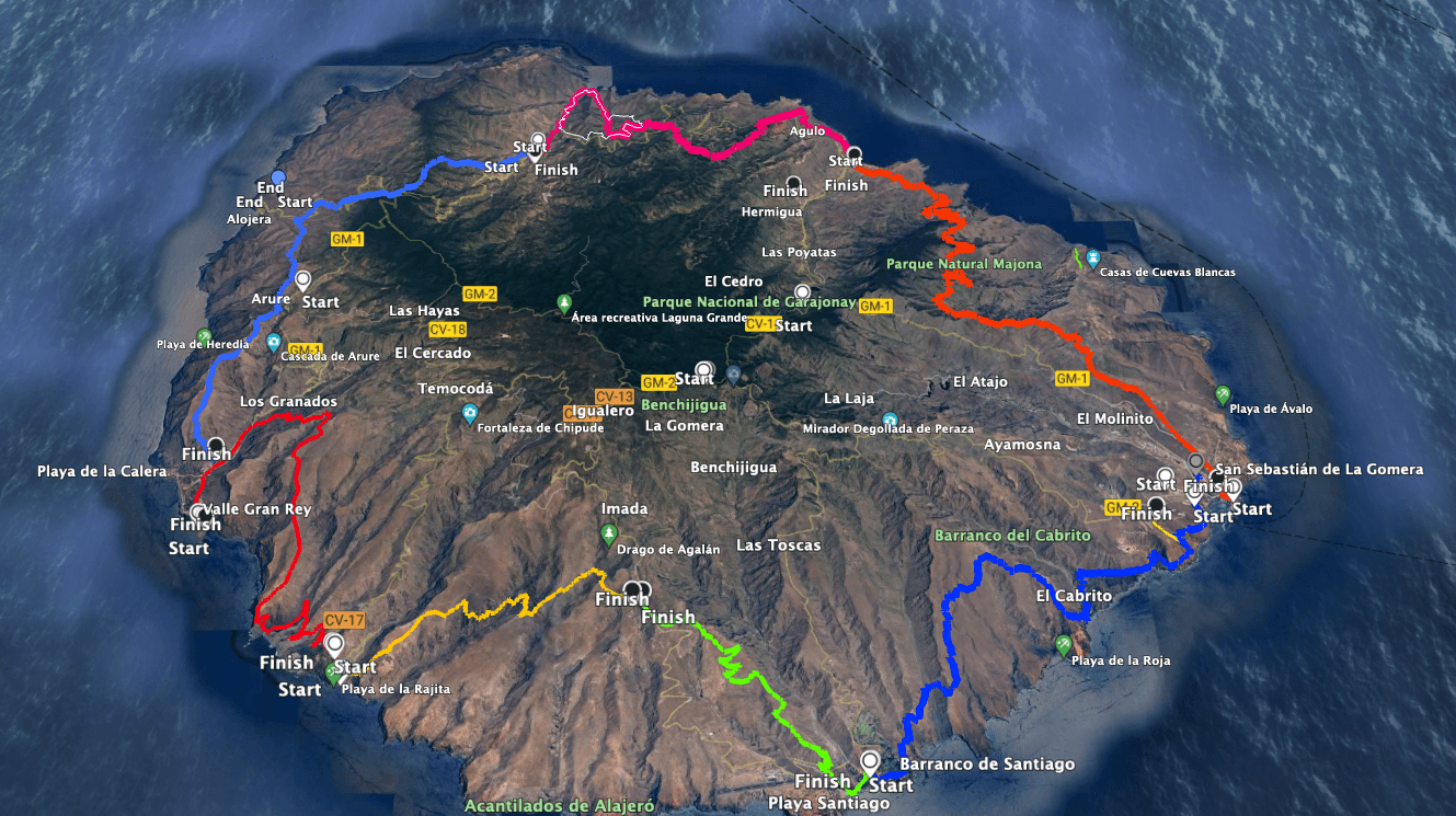
GR-132 with all stages - stage 3 and stage 4 blue on the left from Vallehermoso to Valle Gran Rey
You can find the 2nd stage from Hermigua to Vallehermoso here. And in this article, I will describe to you the 3rd stage from Vallehermoso to Alojera and the 4th stage from Alojera to Valle Gran Rey.
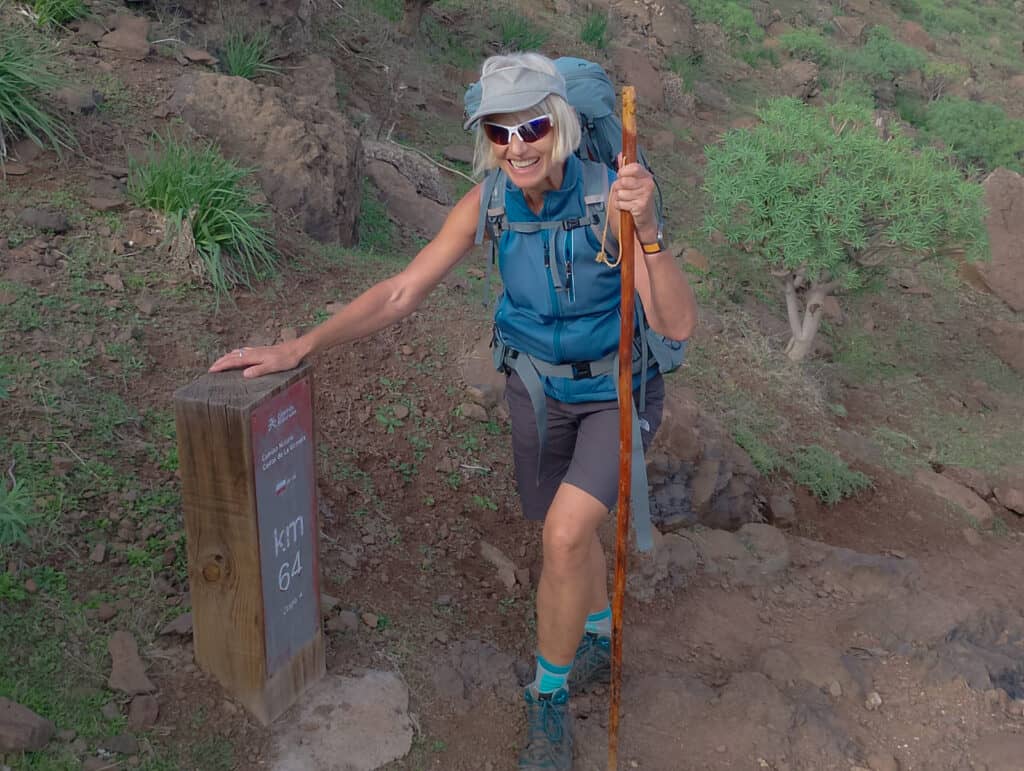
GR 132 - kilometre marker 64 reached
Here’s a reminder of all stages:
The long-distance hiking trail GR-132 is divided into the following officially signposted stages:
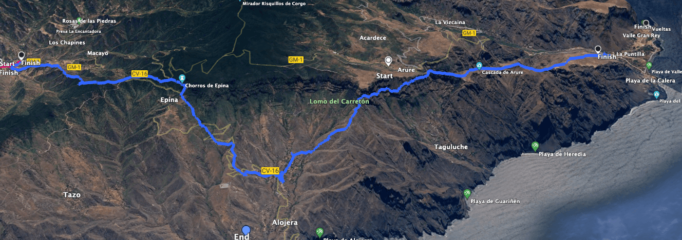
Track of the GR-132 stages 3 and 4 from Vallehermoso via Alojera to Valle Gran Rey
General Information on Hike GR 132, Stage 3, and Stage 4 – Vallehermoso to Valle Gran Rey
Starting Point and Access
You start your hike in the center of Vallehermoso at Plaza de la Constitución.
Access by car
You can reach Vallehermoso from both sides via the main island road GM-1. The GM-1 passes directly by Plaza de la Constitución in the center of Vallehermoso.
Access by bus
Bus line 2 runs between San Sebastian and Vallehermoso. For more detailed information about the exact times, you can visit the homepage.
Time
I prefer not to provide specific time estimates as they can vary greatly depending on individual factors. For GR 132, Stage 3, and Stage 4 from Vallehermoso to Alojera and into Valle Gran Rey, we took approximately 10.5 hours with long breaks and heavy luggage.
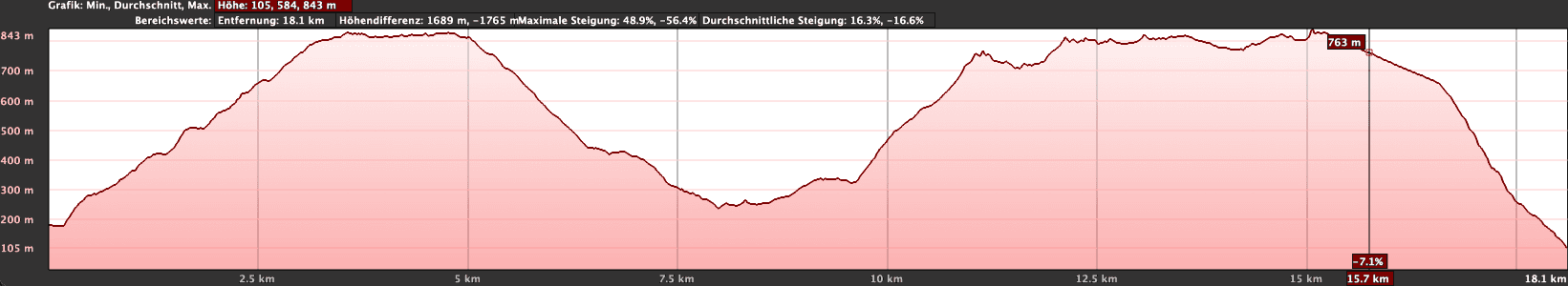
Elevation profile of hike GR-132 stages 3 and 4 from Vallehermoso via Alojera to Valle Gran Rey
Article summary and large selection of GPS hiking tracks
Sign up for my newsletter now and get exclusive access to my collected GPS tracks as well as all the brief information about my articles.
The elevation difference is approximately 1500 meters, and contrary to the information provided to me, the distance for us was 25.5 kilometers instead of the stated 22 kilometers (see above).
Difficulty
The hike follows the well-established long-distance hiking trail GR-132, Stage 3, and Stage 4, so generally, the trails are well maintained. However, there are a few spots where a head for heights and sure-footedness are necessary. Having excellent physical condition is essential for this long stretch. Even if you decide to split this section into two parts, you’ll still need to be in good shape.
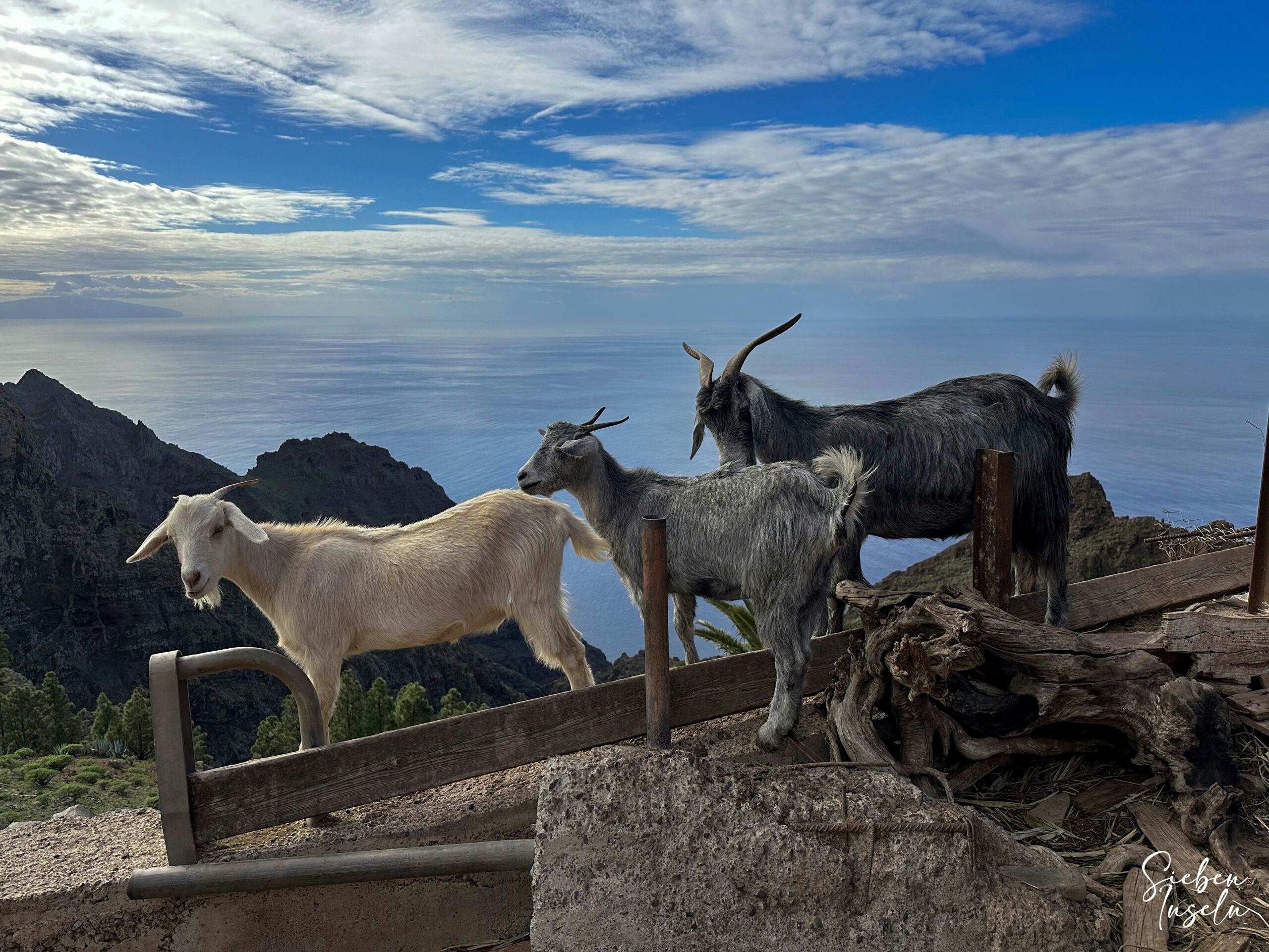
Goats by the wayside high above the Valle Gran Rey
Refreshment
You have options for refreshments at the beginning and end of GR 132, Stage 3, and Stage 4 in Vallehermoso and Valle Gran Rey, as well as in the middle at Chorus de Epina and in Alojera. A detour to Arure is also possible. However, it’s advisable to carry sufficient water and snacks for this long hike.
GR-132 stage 4 - View from the hiking trail down to Tagaluche
Variants
There aren’t many variations if you want to stick precisely to the GR-132, Stage 3, and Stage 4 hiking trail. However, for GR-132, Stage 3, there are actually two options to reach Epina. If you stop at the beach of Vallehermoso after Stage 2 (as I have already walked there, see hike Chijeré), then the first variant of Stage 3 begins there with the ascent. Since I have already walked there, this time we chose the longer route into Vallehermoso for Stage 2 and thus made the ascent from there.
Other tours you can find in this area on SiebenInseln:
View from the ascent path via Alojera to the neighbouring island of El Hierro
Hike GR 132, Stage 3, Stage 4 – Vallehermoso – Alojera – Valle Gran Rey
Route Section Vallehermoso to Chorros de Epina – Stage 3
You start your hike on GR 132, Stage 3, from Vallehermoso to Alojera at Plaza de la Constitución in the center of Vallehermoso. To the right of the large Central Bar, you walk up Calle Mayor. After a short while, a stairway marked as a hiking trail branches off to the left. This stairway takes you steeply uphill between the houses, signposted towards Epina. You cross the GM-1 and continue between the houses, initially still on a well-paved path, ascending steeply. Then the path turns into a hiking trail, quickly taking you up to the ridge high above Vallehermoso. You walk parallel to the GM-1, steadily climbing higher along the ridge trail into the valley. Ignore all branching paths along the way.
GR-132 stage 3 View back from the hiking trail to Vallehermoso
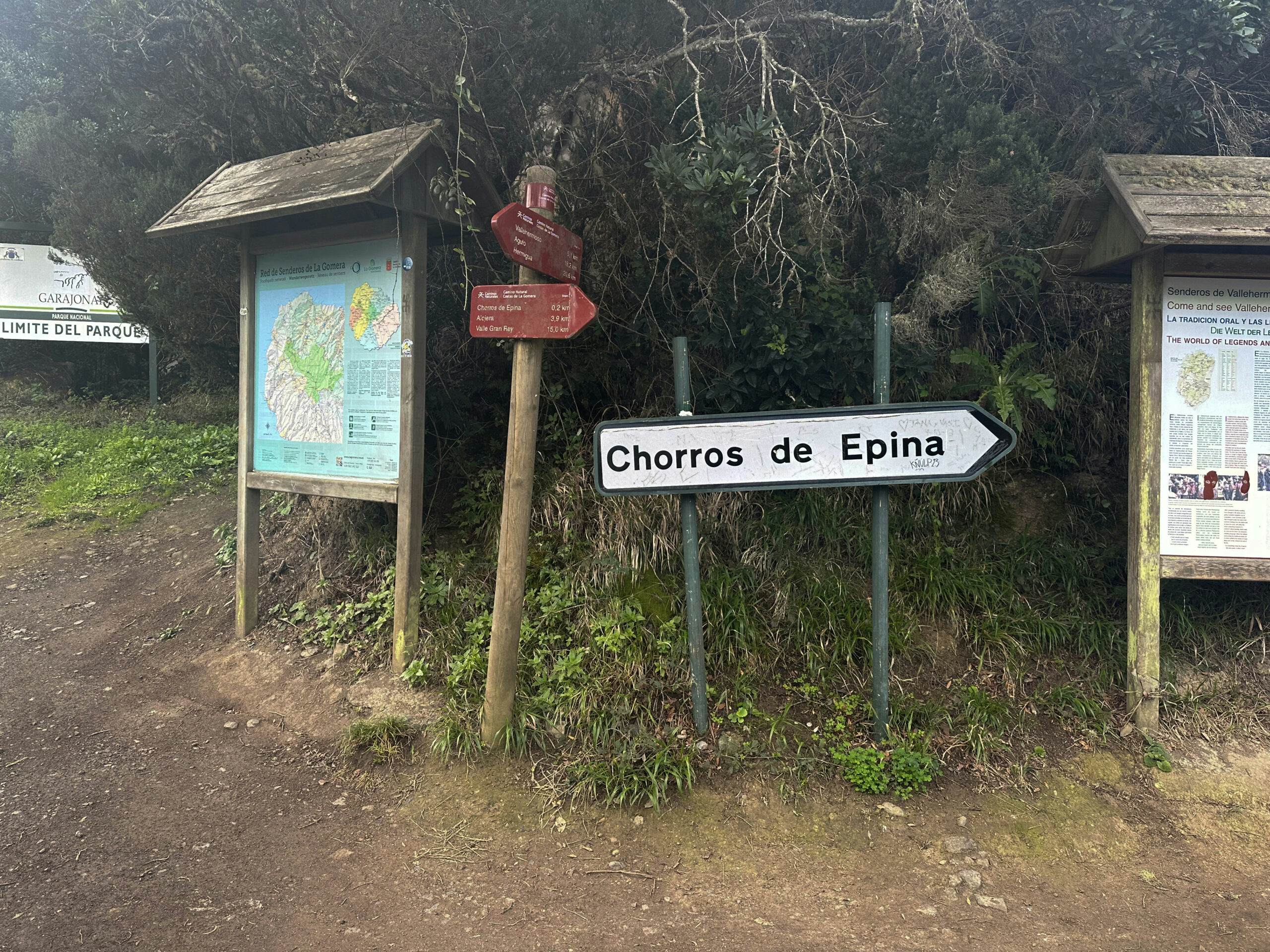
After a very long ascent, the path eventually turns slightly downhill along the left side of the slope. At Anillos de Liesegang, the hiking trail finally merges into CV-16 at a bend. Follow this for a while until it merges into GM-1 on the left. Stay to the right on GM-1, passing by the restaurant Los Chorros de Epina. Shortly after the restaurant, you’ll see many hiking signposts and a large sign labeled Chorros de Epina. Here, you turn right onto the hiking trail into the forest.
Hiking trail crossing at the GR-132 - Chorros de Epina
Route Section Chorros de Epina to Alojera – Stage 3
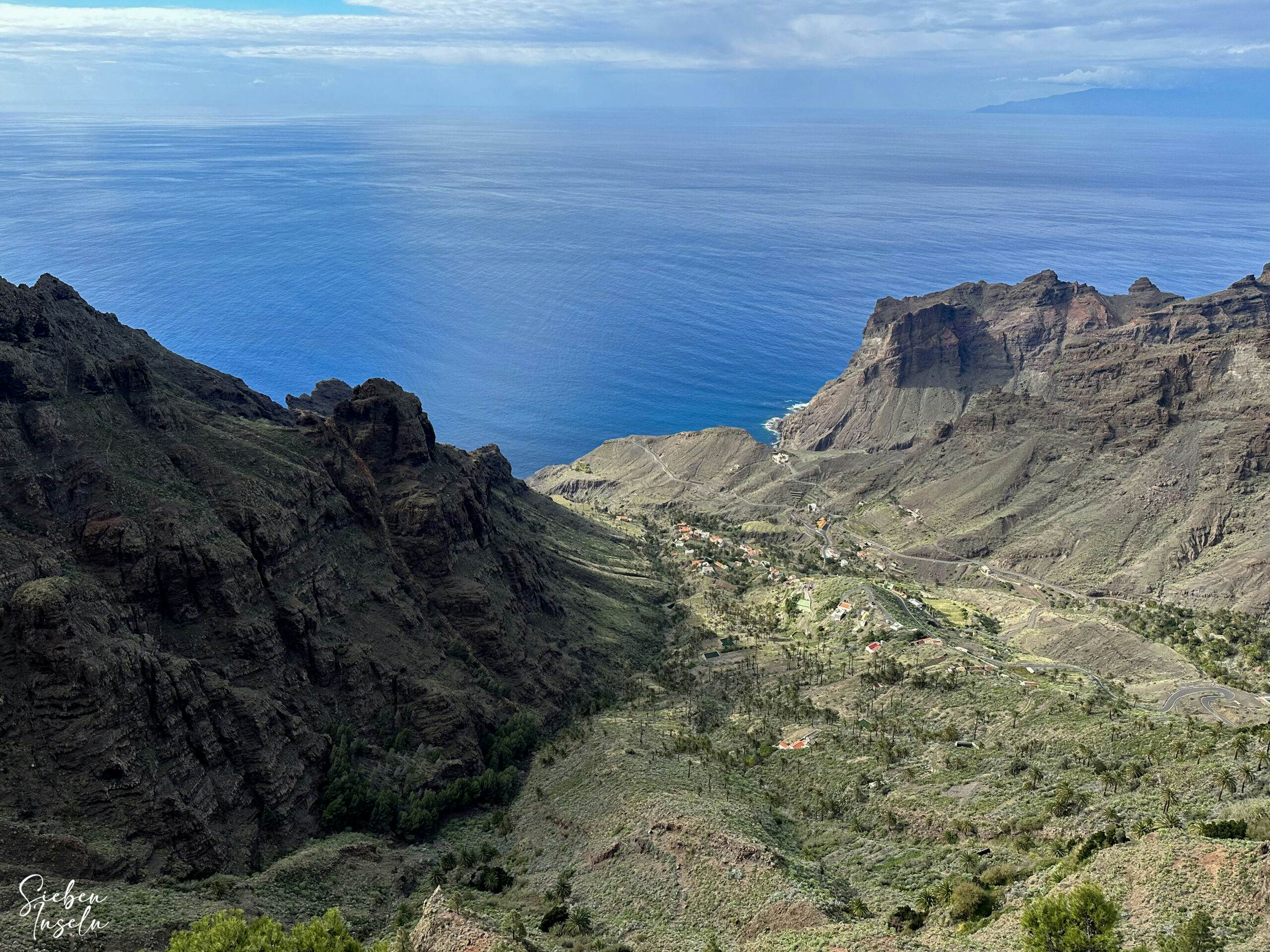
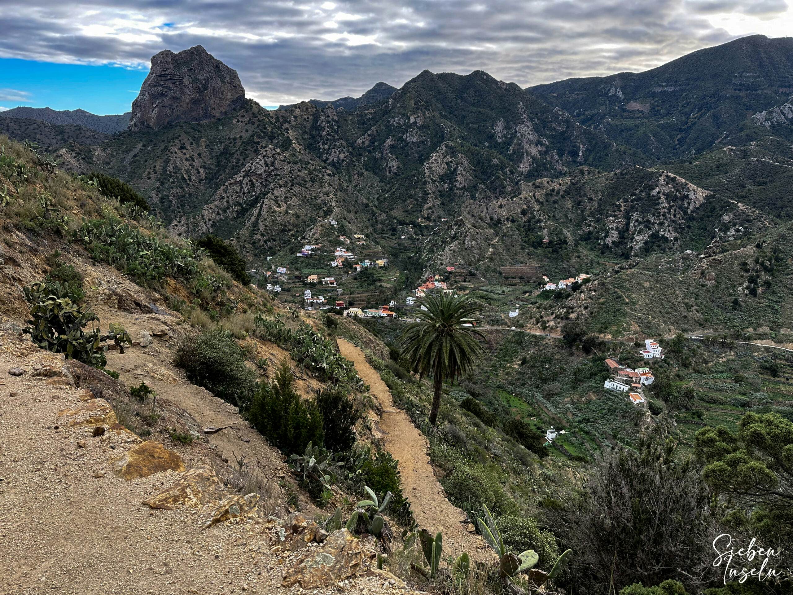
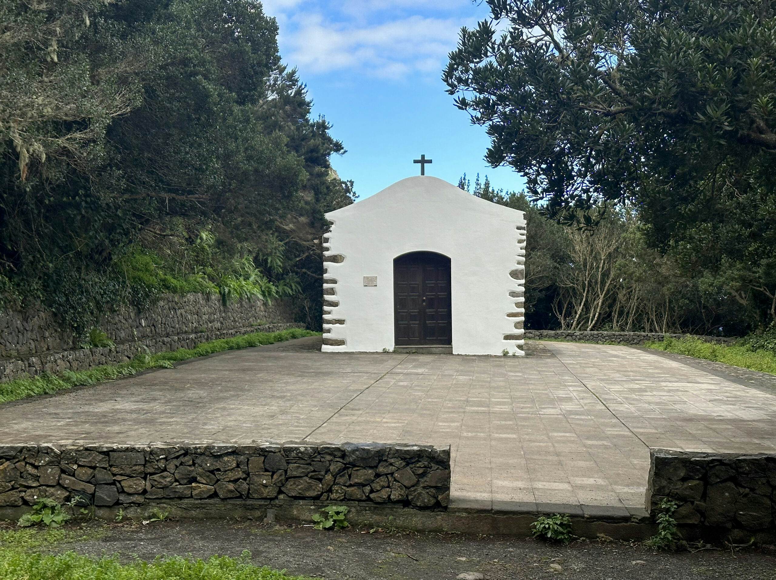
You enter the forest to the right towards Alojera. Initially, you pass by a small church. Then, the path continues downhill on a forest path. Eventually, you emerge from the forest at a large water reservoir onto a plain. From there, you have splendid views of the landscape around Alojera and to the neighboring island of El Hierro. Now begins a long descent, leading you down towards Alojera between fields and shrubbery on the hiking trail. You will cross the CV-16 several times along the way, with the hiking trail continuing on the other side of the road each time.
Article summary and large selection of GPS hiking tracks
Sign up for my newsletter now and get exclusive access to my collected GPS tracks as well as all the brief information about my articles.
Small chapel high above Epina on the edge of the path
Finally, you cross the CV-16 for the last time on this descent next to the cemetery of Alojera. Now, if you prefer, you can simply follow the CV-16 down into the village. However, we continued on the hiking trail, which initially leads you down on a wide track and then on narrow paths into a small ravine. From there, you ascend between the houses back to the road and eventually reach the CV-16. Follow the CV-16 to the right for a short while. At a larger square, you leave the CV-16 and follow the road Caserio Lomo del Balo uphill to the left. Be careful, as we initially got a bit lost here. In reality, you just need to continue along the road uphill for quite a while.
Hiker on the descent to Alojera
Route Section Alojera to Mirador de El Santo – Stage 4
Eventually, the road ends between large water reservoirs. Straight ahead, a concrete path continues. However, at this point, you turn right and follow the hiking trail uphill. You pass by some houses on the left and quickly reach terraced fields. Initially, the path gently ascends along the slope. You cross a small ravine (Barranco del Mono). Then, on the other side of the ravine, the long ascent begins. Initially, the path leads you steeply up over a ridge. Near Mirado Tejeleche alojera, you cross the Carretera General Taguluche.
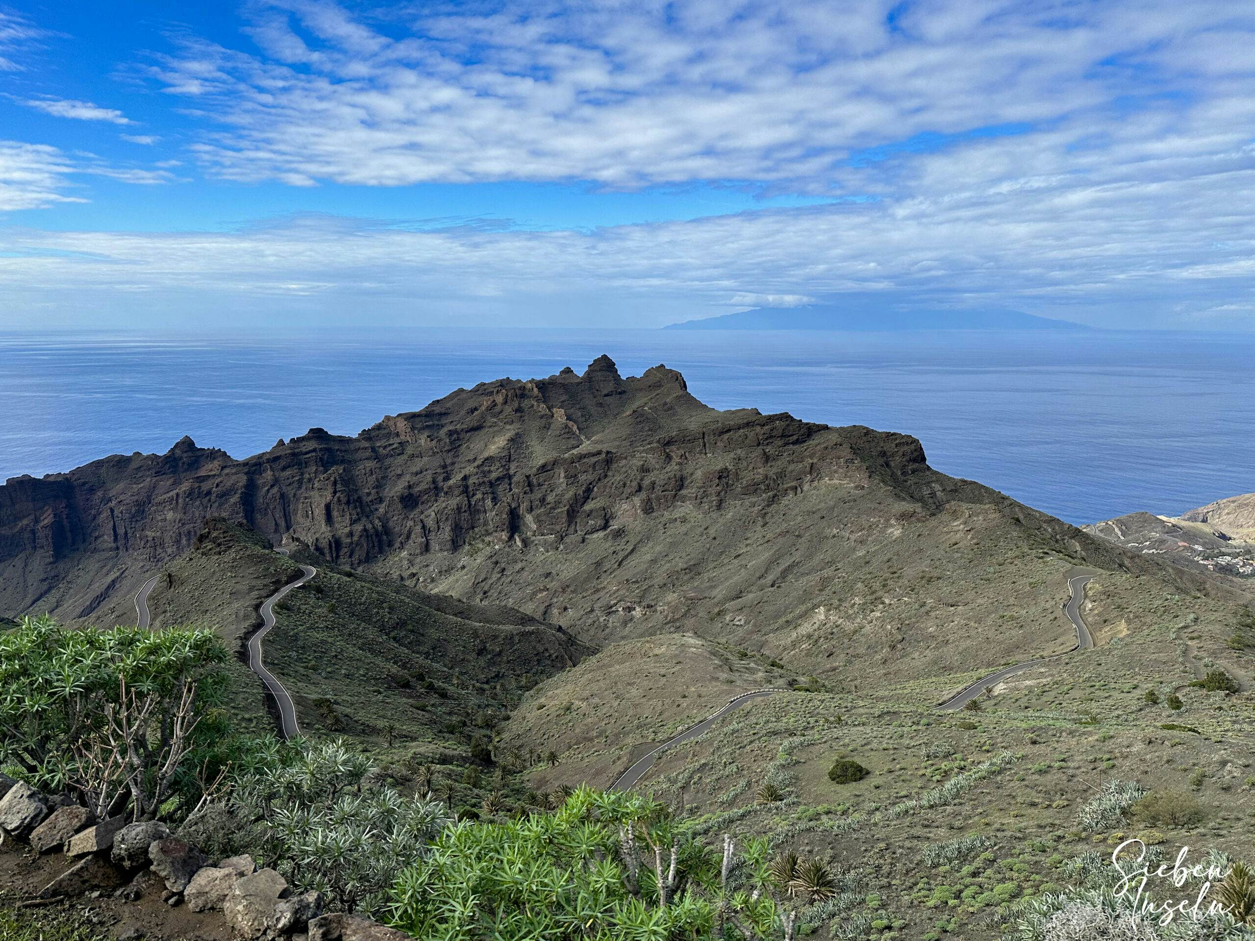
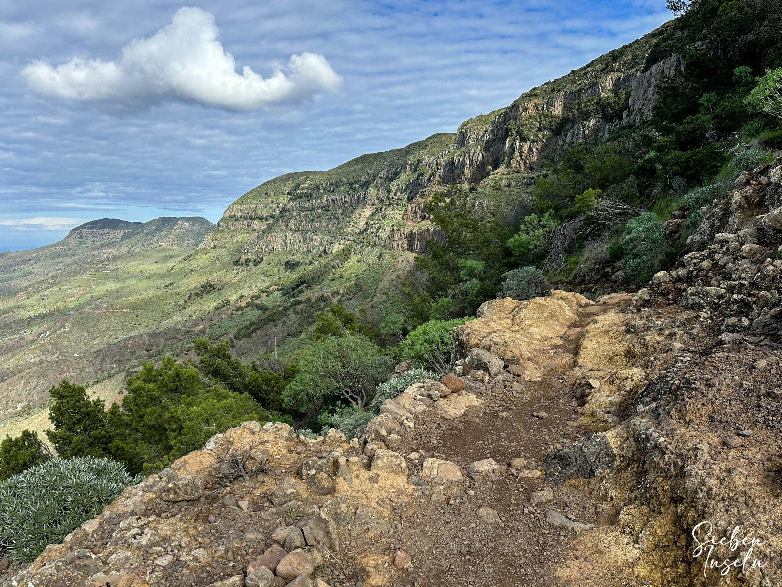
The steep ascent continues over a ridge in front of Lomo del Carretón on the other side of the road. You can enjoy magnificent views in all directions, including glimpses of the valley around Taguluche. Eventually, the ridge path leads you into wooded areas in front of the towering cliffs. From there, it continues steeply uphill in switchbacks. After reaching the base of the cliff, the path continues up and down along the cliff face for quite a while. You still have stunning views. Then, the path becomes steeper again and eventually brings you up to Mirador de El Santo.
View of the Lomo del Carretón from the hiking trail
Route Section Mirador de El Santo to La Mérica Plateau – Stage 4
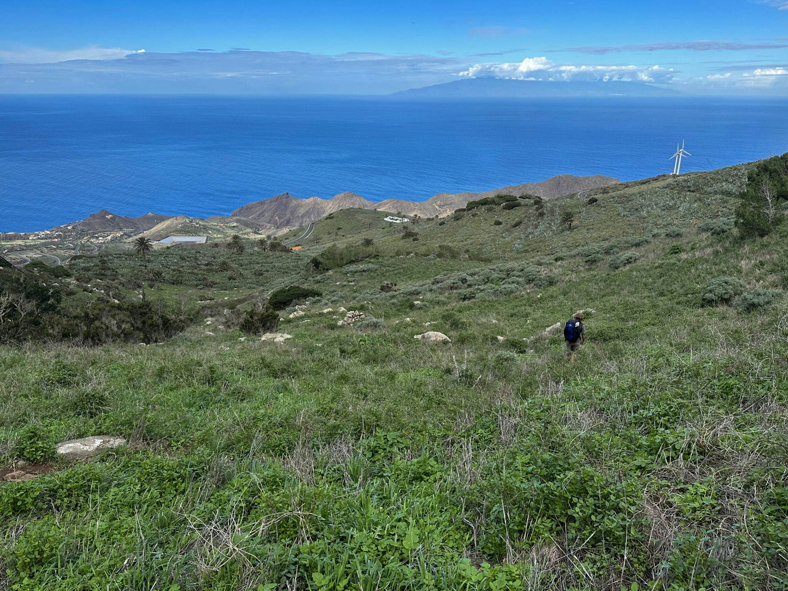
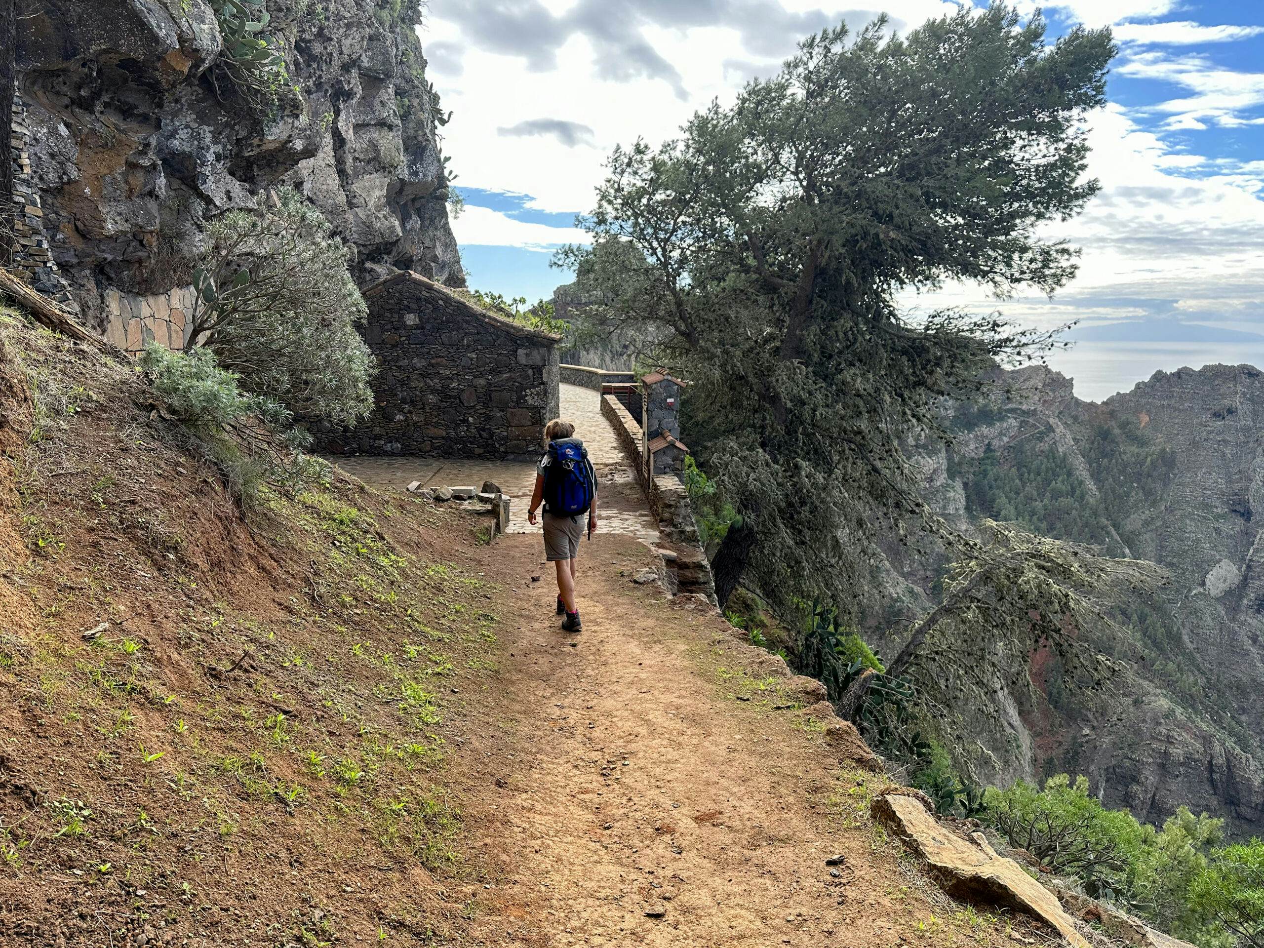
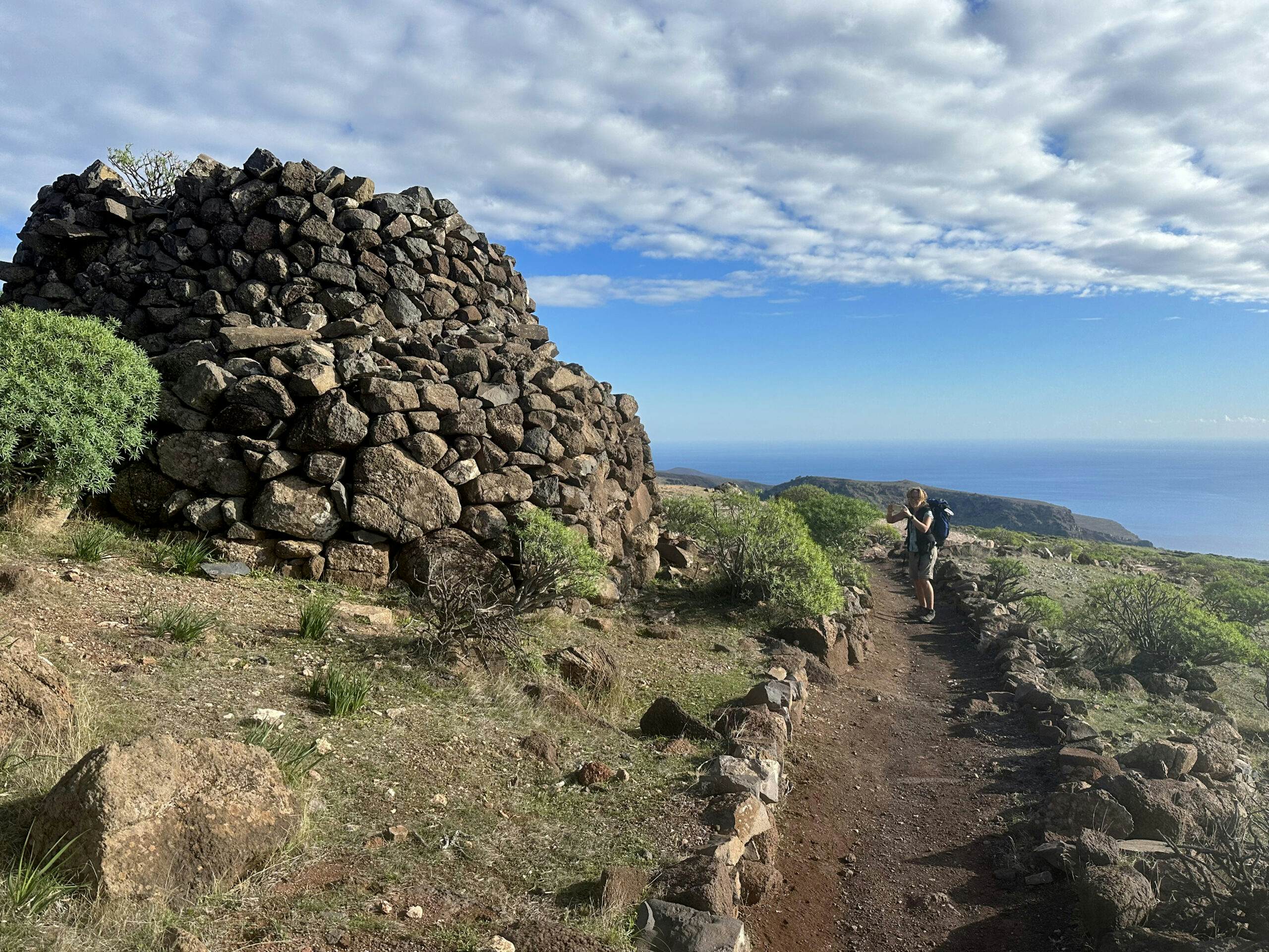
Mirador de El Santo is located above Arure, offering breathtaking views. When you leave, you can take a short left turn to Arure (time for a break?). However, on GR-132 Stage 4, you continue to the right along Camino El Santo. Initially, this wide path runs close to the edge of the cliff facing the sea. At Mirador La Merica, you pass by a goat farm and may even get close to the goats. You continue along the ridge path, which now offers good views of Valle Gran Rey to your left.
GR-132 stage 4 - Mirador de El Santo near Arure
For further route description on the section from Arure to Valle Gran Rey, you can find it in the article Great Valle Gran Rey Round. You leave Camino El Santo when it turns to the right and continue straight ahead along the ridge path. This path now ascends and then leads you along the left side of the cliff beneath large rocks. At the end of this path, you reach the vast La Mérica plateau.
Hiking trail GR-132 stage 4 down into the Valle Gran Rey in front of the old lime kiln
Route Section La Mérica Plateau to Valle Gran Rey (La Calera) – Stage 4
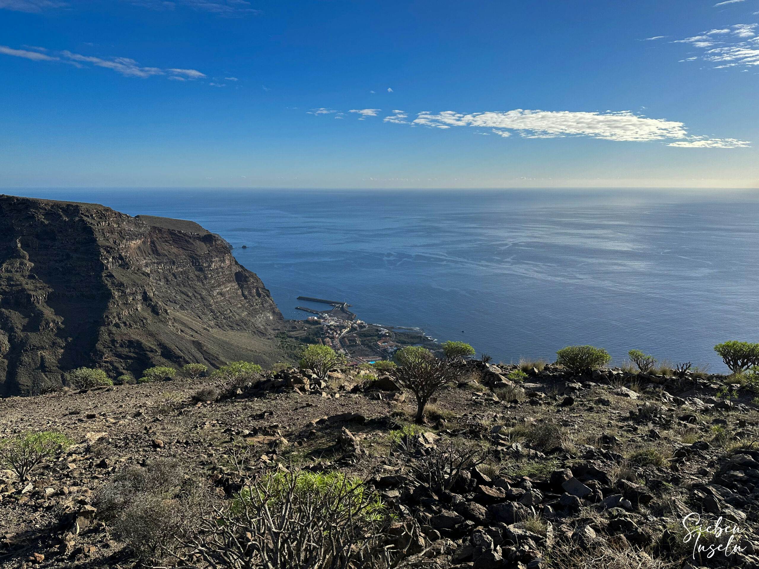
From La Mérica plateau at 857 meters altitude, you can also see the neighboring islands La Palma and El Hierro in the distance. On this wide green plateau, reminiscent of Irish pastureland, you can hike downhill at a leisurely pace on the well-laid-out path. The path across the plateau runs parallel to the cliff edge overlooking Valle Gran Rey, passing by old lime kilns and a large ruined house (El Pajar de La Mérica).
View from the hiking trail down into the Valle Gran Rey to Vueltas
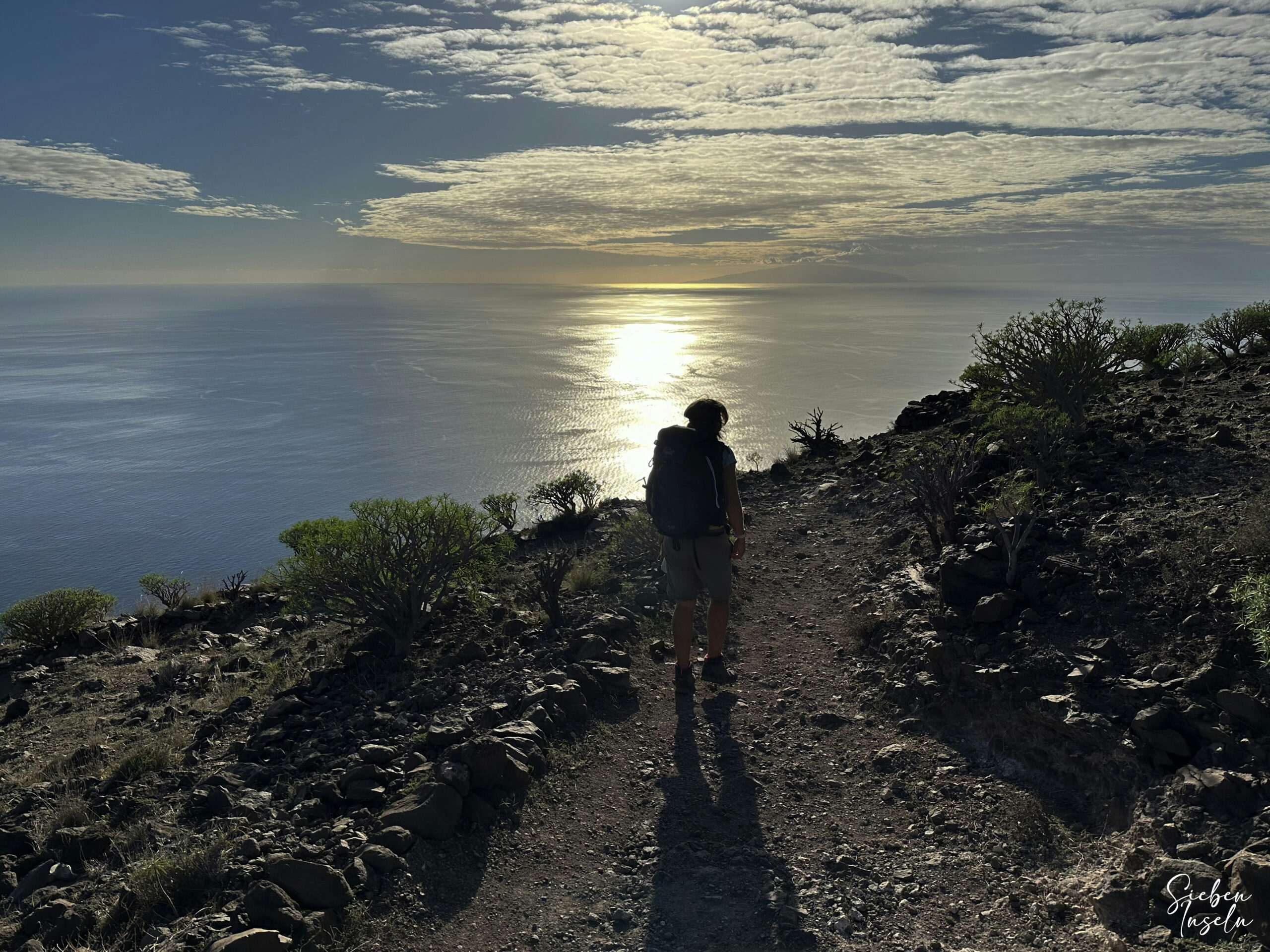
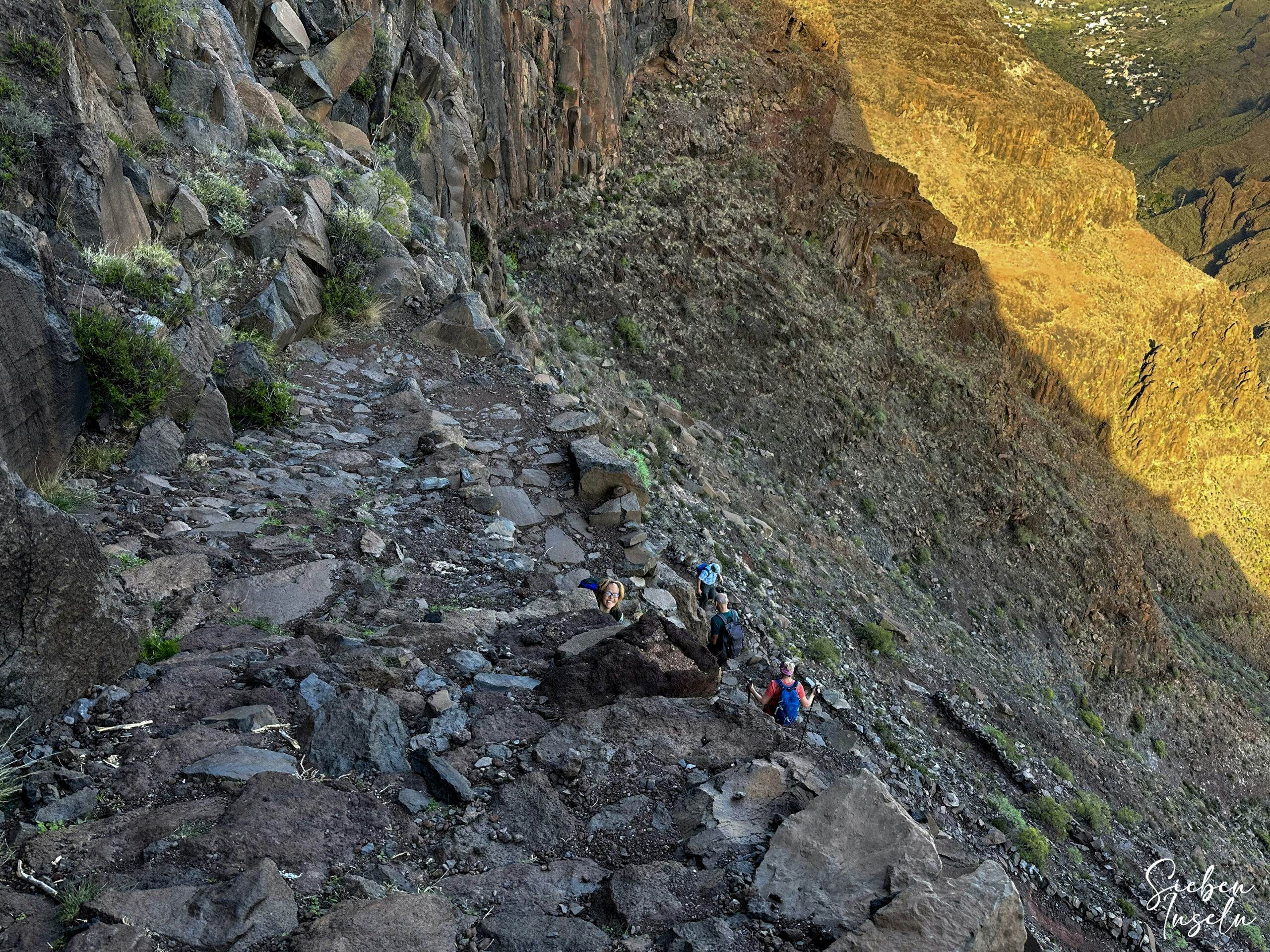
At the end of the plateau, you reach a viewpoint offering beautiful views of the entire Valle Gran Rey at your feet. Then, the descent continues on mostly paved path, steep and winding for quite a while. At the end of the descent, you arrive at a staircase in the district of La Calera. We completed this long section of stages 3 and 4 just before sunset. However, it was also December 24th, one of the shortest days of the year. But after this long journey with luggage, I knew what we had achieved. However, we had accommodation in the district of Vueltas and had to walk a little further. You will surely find your way from the staircase to the main road, bus, vehicle, or accommodation yourself.
Steep descent into the Valle Gran Rey
And finally
I hope you enjoyed the description of my hike on GR 132, Stage 3, and Stage 4, and that you’re still eager to accompany me. Further stages will be posted soon on SevenIslands. I wish you continued wonderful and safe hikes and always look forward to your comments.
Dagmar from SiebenInseln
Thank you for reading!
If you've found my hiking guides on SiebenInseln helpful for your Canary Islands adventures, please consider leaving a small tip. Your support is greatly appreciated and helps cover the costs of maintaining this blog.